Category:Polish-language SVG maps showing history
Jump to navigation
Jump to search
Media in category "Polish-language SVG maps showing history"
The following 54 files are in this category, out of 54 total.
-
 1263 Morze Śródziemne.svg 925 × 424; 703 KB
-
 Anaximander world map-pl.svg 1,063 × 1,063; 12 KB
-
 Ancient Egypt map pl.svg 1,320 × 1,500; 273 KB
-
 AncientGreekDialects (Woodard)-pl.svg 660 × 555; 793 KB
-
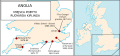
 Anglia w roku878.svg 874 × 1,142; 1.31 MB
-
 AreasOfHabiruActivityInAmarnaLetters-pl.svg 1,500 × 1,000; 664 KB
-
 Kampania Atlancka.svg 900 × 1,052; 138 KB
-
 Austria-Hungary map-pl.svg 783 × 605; 331 KB
-
 Battaglia Convoglio Espero PL.svg 1,599 × 1,202; 52 KB
-
 Battle of Kircholm.svg 1,052 × 710; 217 KB
-
 Bitwa o kretę.svg 1,156 × 880; 1.07 MB
-
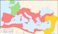
 Bizancjum 1180.svg 924 × 425; 806 KB
-
 Brytania 400-500.svg 700 × 794; 1.03 MB
-
 Cesarstwo Łacińskie1204.svg 2,444 × 1,351; 764 KB
-
 Christian states 495 AD (pl).svg 946 × 631; 122 KB
-
 Convoy PQ-17 map 1942-pl.svg 970 × 1,095; 227 KB
-
 Curzon line pl.svg 563 × 513; 69 KB
-
 Elam-map-PL.svg 555 × 480; 472 KB
-
 Falaise Pocket map pl.svg 672 × 1,007; 251 KB
-
 Frankish Empire 481 to 814-pl.svg 1,735 × 1,227; 314 KB
-
 Grunwald1.svg 744 × 524; 17 KB
-
 Grunwald2.svg 744 × 524; 19 KB
-
 Grunwald3.svg 744 × 524; 18 KB
-
 Grunwald4.svg 744 × 524; 17 KB
-
 Hammurabi's Babylonia PL.svg 655 × 570; 108 KB
-
 Herodotus world map-pl.svg 788 × 476; 277 KB
-
 Jugosławia podczas wojny 2006.svg 1,832 × 1,142; 142 KB
-
 Kassite Babylonia PL.svg 661 × 580; 116 KB
-
 Kryzys libański.svg 758 × 947; 27 KB
-
 Księstwo Kurlandii i Semigalii w 1740 roku 1740.svg 1,074 × 945; 482 KB
-
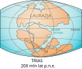 Laurasia-Gondwana-pl.svg 519 × 435; 25 KB
-
 LithuanianHistory-PL.svg 1,518 × 1,743; 104 KB
-
 Magellan's voyage PL.svg 2,488 × 1,378; 4.11 MB
-
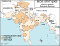 Map british india kipling PL.svg 1,200 × 926; 408 KB
-
 Map Byzantine Empire 1025-pl.svg 1,963 × 1,104; 87 KB
-
 Map Crusader states 1135-pl.svg 978 × 1,330; 570 KB
-
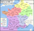 Map Gaul divisions 481-pl.svg 1,968 × 1,776; 1.09 MB
-
 Map great britain kipling PL.svg 2,047 × 950; 144 KB
-
 Map Israel Judea 926 BC-pl.svg 554 × 918; 1.01 MB
-
 Map of Ancient Rome 271 AD pl.svg 2,050 × 1,213; 374 KB
-
 Map Thirty Years War-pl.svg 715 × 927; 91 KB
-
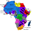 Mapa polityczna Afryki (1914).svg 704 × 599; 188 KB
-
 Mapa prus.svg 755 × 565; 166 KB
-
 Midland Map - 5 Boroughs 912 AD PL.svg 581 × 490; 866 KB
-
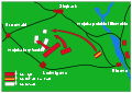
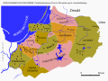
 Panstwo mieclawa.svg 700 × 567; 3.21 MB
-
 Peninsule acadienne (multilingue).svg 1,180 × 825; 1.21 MB
-
 Ptolemaic Alexandria - pl.svg 1,702 × 1,065; 48 KB
-
 Północno-wschodnie Niemcy ok 1000.svg 700 × 742; 3.96 MB
-
 Reino de los visigodos-pl.svg 653 × 670; 35 KB
-
 Roman Empire 460 pl.svg 1,220 × 1,385; 2.5 MB
-
 Seven Hills of Rome-pl.svg 654 × 624; 25 KB
-
 Subcarpathia Carpatho-Ukraine.svg 688 × 525; 105 KB
-
 Wołoszczyzna XII-XVI w.svg 900 × 400; 1.22 MB
-
 WWII in Europe 1939-1941-pl.svg 1,256 × 1,259; 176 KB


-pl.svg)


.svg)


.svg)


.svg)


