Category:Maps of 20th-century Africa
Jump to navigation
Jump to search
English: Modern maps showing the history of Africa. Not to be confused with old/contemporary 20th-century maps of Africa
Subcategories
This category has the following 8 subcategories, out of 8 total.
M
- Maps of French Morocco (60 F)
- Maps of French Tunisia (4 F)
Media in category "Maps of 20th-century Africa"
The following 36 files are in this category, out of 36 total.
-
 Africa1911.jpg 360 × 407; 51 KB
-
 Flag map of Colonial Africa (1913).png 2,000 × 2,050; 139 KB
-
 1913년 프랑스령 서아프리카 지도.png 440 × 363; 35 KB
-
 French Equatorial Africa in 1914.png 358 × 402; 14 KB
-
 1915 ww1 - Idrisid Asir, Gobroon, Kenadiid & Diiriye Guure kingdom.png 590 × 556; 346 KB
-
 Flag map of Colonial Africa (1945).png 2,000 × 2,050; 202 KB
-
 AfricaColdWar.png 585 × 600; 55 KB
-
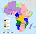
 Africa map 1914.svg 1,430 × 1,350; 1.73 MB
-
 Africa map 1935, colours 2.svg 1,430 × 1,350; 1.82 MB
-
 Africa map 1935, colours.svg 1,430 × 1,350; 1.87 MB
-
 Africa map 1935.svg 1,430 × 1,350; 1.87 MB
-
 Africa map 1939, colours.svg 1,430 × 1,350; 1.81 MB
-
 Africa1910sSmall.jpg 376 × 451; 93 KB
-
 Afrika Karte 1914.svg 1,430 × 1,350; 1.73 MB
-
 Carte de l'Afrique équatoriale française, 1914.svg 827 × 828; 1.7 MB
-
 Carte de l'Afrique équatoriale française, 1935.svg 991 × 871; 1.87 MB
-
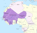 Carte de l'Afrique-Occidentale française, 1914.svg 868 × 787; 1.7 MB
-
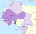 Carte de l'Afrique-Occidentale française, 1935.svg 839 × 794; 1.87 MB
-
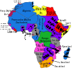
 Colonial Africa 1913, pre WWI-es.svg 1,000 × 929; 363 KB
-
 Colonial Africa 1913, pre WWI.svg 1,000 × 929; 505 KB
-
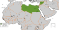 Federation of Arab Republics.GIF 821 × 419; 15 KB
-
 French West Africa 1913 map.png 440 × 363; 46 KB
-
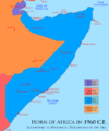
 Horn1936ad.png 1,110 × 1,327; 58 KB
-
 Horn1949ad.png 1,110 × 1,327; 60 KB
-
 Horn1960ad fin.png 1,110 × 1,327; 117 KB
-
 Horn1960ad.png 1,110 × 1,327; 59 KB
-
 Kolonie afryka 1914.PNG 704 × 599; 79 KB
-
 Kolonie Afryka 1947.PNG 704 × 599; 84 KB
-
 Map Affrica 1914-cy.svg 1,525 × 1,440; 1.73 MB
-
 Map of the life of sulemaana kante inventor of the n'ko alphabet.png 1,582 × 934; 316 KB
-
 Mapa polityczna Afryki (1914)-es.svg 704 × 599; 191 KB
-
 Mapa polityczna Afryki (1914).svg 704 × 599; 188 KB
-
 Nigèria - Colonizacion en 1914.png 716 × 411; 65 KB
-
 Nigèria - Colonizacion en 1919.png 891 × 523; 92 KB
-
 Scramble-for-Africa-1880-1913-ar.png 2,312 × 1,141; 410 KB
-
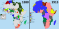 Scramble-for-Africa-1880-1913.png 2,311 × 1,142; 164 KB

.png)


.png)


-es.svg)
.svg)


