File:Laptev Sea map-el.svg
Jump to navigation
Jump to search

Size of this PNG preview of this SVG file: 800 × 448 pixels. Other resolutions: 320 × 179 pixels | 640 × 358 pixels | 1,024 × 574 pixels | 1,280 × 717 pixels | 2,560 × 1,434 pixels | 1,498 × 839 pixels.
Original file (SVG file, nominally 1,498 × 839 pixels, file size: 310 KB)
Captions
Captions
Add a one-line explanation of what this file represents
Summary
[edit]
| Description |
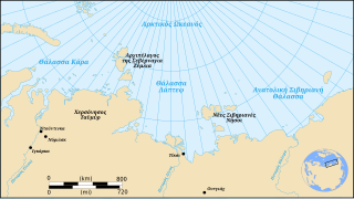
Ελληνικά: Χάρτης που δείχνει την θέση της Θάλασσας Λάπτεφ, τμήμα του Αρκτικού Οκεανού : Ελληνική Έκδοση |
||
| Date | |||
| Source | Own work based on: Laptev Sea map-fr.svg by Pinpin | ||
| Author | Egmontaz | ||
| Other versions |
  |
||
| SVG development |
|
Licensing
[edit]
I, the copyright holder of this work, hereby publish it under the following license:
I, the copyright holder of this work, hereby publish it under the following license:
This file is licensed under the Creative Commons Attribution-Share Alike 3.0 Unported, 2.5 Generic, 2.0 Generic and 1.0 Generic license.
- You are free:
- to share – to copy, distribute and transmit the work
- to remix – to adapt the work
- Under the following conditions:
- attribution – You must give appropriate credit, provide a link to the license, and indicate if changes were made. You may do so in any reasonable manner, but not in any way that suggests the licensor endorses you or your use.
- share alike – If you remix, transform, or build upon the material, you must distribute your contributions under the same or compatible license as the original.
Original upload log
[edit]
This image is a derivative work of the following images:
- Laptev Sea map-fr.svg licensed with Cc-by-sa-3.0,2.5,2.0,1.0, GFDL
- 2007-12-04T17:40:19Z Pinpin 1498x839 (312075 Bytes) {{Information |Description={{en|Map showing the location of the Laptev Sea, part of the Arctic Ocean : French Version}} {{fr|Carte donnant la localisation de la mer de Laptev, une partie de l'océan Arctique : version frança
Uploaded with derivativeFX
File history
Click on a date/time to view the file as it appeared at that time.
| Date/Time | Thumbnail | Dimensions | User | Comment | |
|---|---|---|---|---|---|
| current | 23:08, 24 February 2009 | | 1,498 × 839 (310 KB) | Egmontaz (talk | contribs) | {{Information |Description={{en|Map showing the location of the Laptev Sea, part of the Arctic Ocean : French Version}} {{el|Χάρτης που δείχνει την θέση της Θάλασσας Λάπτεφ, τμήμα του Αρκτικού Οκε |
You cannot overwrite this file.
File usage on Commons
There are no pages that use this file.
File usage on other wikis
The following other wikis use this file:
- Usage on el.wikipedia.org