Category:Maps of Severnaya Zemlya
Jump to navigation
Jump to search
Wikimedia category | |||||
| Upload media | |||||
| Instance of | |||||
|---|---|---|---|---|---|
| Category combines topics | |||||
| Nothern Zemlya | |||||
archipelago in the Russian high Arctic   | |||||
| Instance of | |||||
| Named after |
| ||||
| Location | Krasnoyarsk Krai, Russia | ||||
| Located in or next to body of water | |||||
| Has part(s) | |||||
| Time of discovery or invention |
| ||||
| Population |
| ||||
| Area |
| ||||
| Elevation above sea level |
| ||||
 | |||||
Subcategories
This category has the following 6 subcategories, out of 6 total.
B
- Maps of Bolshevik Island (7 F)
K
- Maps of Komsomolets Island (7 F)
O
P
- Maps of Pioneer Island (4 F)
S
- Maps of Schmidt Island (5 F)
- Maps of Sedov Archipelago (2 F)
Media in category "Maps of Severnaya Zemlya"
The following 39 files are in this category, out of 39 total.
-
 Arcipelago di Sedov-it.svg 778 × 488; 22 KB
-
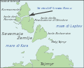
 Arctic Cape fr.svg 580 × 503; 23 KB
-
 Arctic Cape nl.svg 579 × 497; 13 KB
-
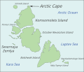 Arctic Cape.svg 579 × 497; 11 KB
-
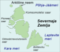 Arktiline neem.png 586 × 503; 64 KB
-
 Emperor Nicholas II Land 1913-map-arctic.png 1,286 × 724; 579 KB
-
 Emperor Nicholas II Land Russian Empire Map.jpg 1,328 × 925; 408 KB
-
 EPNZ 1-3 oil and gas areas.png 743 × 653; 237 KB
-
 Golfo Uzkij-it.svg 589 × 477; 17 KB
-
 Krasnoflotskie-it.svg 778 × 488; 22 KB
-
 Laptev Sea map-el.svg 1,498 × 839; 310 KB
-
 Najdenysh-it.svg 778 × 488; 22 KB
-
 Operational Navigation Chart A-2, 2nd edition.jpg 9,254 × 6,659; 13.7 MB
-
 Operational Navigation Chart B-3, 2nd edition.jpg 9,254 × 6,694; 16.37 MB
-
 Red Army Strait-nl.svg 529 × 478; 15 KB
-
 Relief Map of Severnaya Zemlya.png 600 × 591; 417 KB
-
 Russia - Severnaya Zemlya.PNG 768 × 467; 184 KB
-
 RussiaSevernayaZemlya.png 300 × 178; 33 KB
-
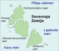 Severnaja Zemlja.png 586 × 503; 62 KB
-
 Severnaya Zemlya cs.svg 875 × 897; 69 KB
-
 Severnaya Zemlya fr.svg 580 × 503; 23 KB
-
 Severnaya Zemlya hr.svg 543 × 470; 91 KB
-
 Severnaya Zemlya rus.svg 875 × 897; 96 KB
-
 Severnaya Zemlya ukr.png 878 × 900; 122 KB
-
 Severnaya Zemlya-de.svg 580 × 503; 14 KB
-
 Severnaya Zemlya-es.svg 580 × 503; 15 KB
-
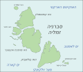 Severnaya Zemlya-he.svg 580 × 503; 14 KB
-
 Severnaya Zemlya-hu.png 580 × 503; 71 KB
-
 Severnaya Zemlya-lt.svg 580 × 503; 14 KB
-
 Severnaya Zemlya-nl.svg 580 × 503; 14 KB
-
 Severnaya Zemlya-sl.svg 580 × 503; 13 KB
-
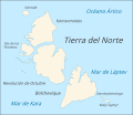
 Severnaya Zemlya.svg 580 × 503; 14 KB
-
 Shokalsky Strait-nl.svg 529 × 478; 15 KB
-
 Stretto dell'Armata Rossa-it.svg 589 × 477; 17 KB
-
 Stretto di Shokalskij-it.svg 589 × 478; 16 KB
-
 Vilkitsky Strait fr.svg 580 × 524; 33 KB
-
 Yevgenov Strait-nl.svg 529 × 478; 13 KB
-
 Yuny Strait-nl.svg 529 × 478; 15 KB
-
 Северная Земля.png 1,129 × 723; 110 KB


