Category:Maps of the Laptev Sea
Jump to navigation
Jump to search
Subcategories
This category has the following 3 subcategories, out of 3 total.
M
S
Media in category "Maps of the Laptev Sea"
The following 59 files are in this category, out of 59 total.
-
 1598 map of the Polar Regions by Willem Barentsz.jpg 13,719 × 10,160; 30.66 MB
-
 Barents third voyage.jpg 2,000 × 1,511; 965 KB
-
 Barentskartet, 1598 (12068020364).jpg 2,842 × 2,091; 3.85 MB
-
 Barentsz Full Map.jpg 1,000 × 742; 258 KB
-
 BrnBld LaptevTopo.pdf 760 × 754; 48 KB
-
 De Long Islands ru.svg 676 × 547; 842 KB
-
 Dunay1a RU.png 1,623 × 1,063; 201 KB
-
 Dunay1a.png 1,623 × 1,063; 228 KB
-
 Faddey.PNG 560 × 451; 14 KB
-
 Faddey2y.PNG 560 × 425; 15 KB
-
 Forminsket utgave av Barentskartet - no-nb krt 00487.jpg 4,418 × 3,449; 3.45 MB
-
 Jana laht.png 901 × 644; 64 KB
-
 Jeannette crew course map-fr.svg 1,443 × 1,167; 853 KB
-
 Jeannette crew course map.png 1,500 × 1,219; 500 KB
-

-

-
 Kara sea2BB.PNG 701 × 534; 19 KB
-
 Kara sea2ST.PNG 701 × 534; 19 KB
-
 Karte des Bolschoi Arktitscheski Sapowednik.svg 1,498 × 839; 297 KB
-
 Komsomolskoy3y.PNG 790 × 517; 30 KB
-
 Lage der Iswestija ZIK-Inseln.svg 1,498 × 839; 298 KB
-
 Laptev Sea map - Morze Łaptiewów polish version-pl.png 1,500 × 841; 492 KB
-
 Laptev Sea map he.svg 1,498 × 839; 298 KB
-
 Laptev Sea map hr.svg 1,004 × 563; 780 KB
-
 Laptev Sea map hu.svg 2,000 × 1,121; 615 KB
-
 Laptev Sea map pl.svg 1,498 × 839; 304 KB
-
 Laptev Sea map-de.svg 1,498 × 839; 296 KB
-
 Laptev Sea map-el.svg 1,498 × 839; 310 KB
-
 Laptev Sea map-es.svg 1,498 × 839; 270 KB
-
 Laptev Sea map-fr.svg 1,498 × 839; 305 KB
-
 Laptev Sea map-nl.svg 1,498 × 839; 305 KB
-
 Laptev Sea map-pl.svg 1,498 × 839; 305 KB
-
 Laptev Sea map-sv.png 1,500 × 841; 487 KB
-
 Laptev Sea map.png 1,500 × 841; 382 KB
-
 Laptev seaPBZ.PNG 701 × 534; 19 KB
-
 Laptevzee.PNG 857 × 506; 17 KB
-
 Lishny-Operational Navigation Chart B-3, 2nd edition.jpg 837 × 539; 185 KB
-
 Maly Taymyr-Operational Navigation Chart B-3, 2nd edition.jpg 779 × 471; 157 KB
-
 New Siberian Islands location map.svg 676 × 547; 805 KB
-
 Operational Navigation Chart A-2, 2nd edition.jpg 9,254 × 6,659; 13.7 MB
-
 Operational Navigation Chart B-3, 2nd edition.jpg 9,254 × 6,694; 16.37 MB
-
 Operational Navigation Chart B-4, 4th edition.jpg 9,254 × 6,667; 12.51 MB
-
 Operational Navigation Chart C-6, 3rd edition.jpg 9,069 × 6,618; 18.47 MB
-
 Ostrova sv petra2.PNG 863 × 671; 71 KB
-
 Peschanyy laptev.PNG 418 × 328; 53 KB
-
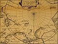 Pontanus 1611 Arctic Map.jpg 2,852 × 2,142; 802 KB
-
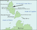
 Severnaya Zemlya cs.svg 875 × 897; 69 KB
-
 Siberia BHC.png 710 × 409; 13 KB
-
 Siberia omoloy.png 710 × 409; 13 KB
-
 Siberia SK.png 710 × 412; 13 KB
-
 Siberia yanabay.png 710 × 409; 13 KB
-
 Siberia YB.png 710 × 409; 13 KB
-
 Stretto dell'Armata Rossa-it.svg 589 × 477; 17 KB
-
 Tiksi - Siberia - Laptev Sea.png 514 × 675; 37 KB
-
 Yana bay1.png 901 × 644; 51 KB
-
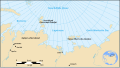
 Восточно-Сибирское Лаптевых море.png 910 × 545; 128 KB
-
 Песчаный.PNG 606 × 431; 9 KB
-
 Северная Земля.png 1,129 × 723; 110 KB
-
 NewSiberianIslands.png 300 × 178; 32 KB


.jpg)


_door_Willem_Barendsz_(titel_op_object),_NG-800.jpg)


