File:Herenigde Nederlanden.jpg
Jump to navigation
Jump to search
Size of this preview: 330 × 600 pixels. Other resolutions: 132 × 240 pixels | 264 × 480 pixels | 423 × 768 pixels | 563 × 1,024 pixels | 1,615 × 2,934 pixels.
Original file (1,615 × 2,934 pixels, file size: 198 KB, MIME type: image/jpeg)
Captions
Captions
Add a one-line explanation of what this file represents

|
This map, as well as other fictitious maps, is fictitious or too incorrect (i.e. due to anachronism) to be used in real-life contexts (contemporary or historic). It may have some visual elements that are similar to official maps such as colors or certain layout features, but they are NOT official and don't have any official recognition. |
[[Category:]]
Summary
[edit]
| Description |
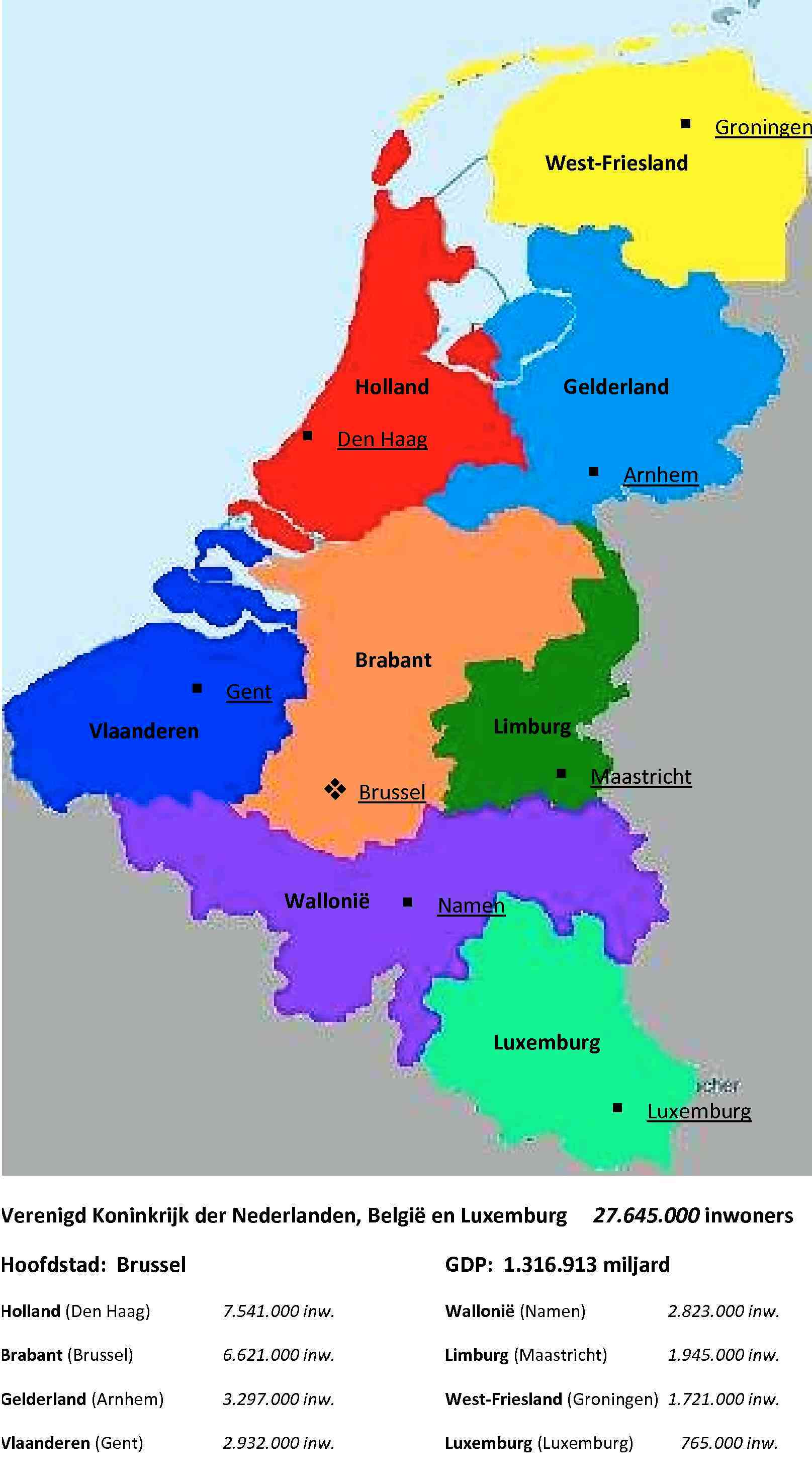
Nederlands: Regioindeling die rekening houdt met cultureelhistorische achtergrond en economische samenhang. |
| Date | |
| Source | Own work |
| Author | Golfo |
Licensing
[edit]
| I, the copyright holder of this work, release this work into the public domain. This applies worldwide. In some countries this may not be legally possible; if so: I grant anyone the right to use this work for any purpose, without any conditions, unless such conditions are required by law. |
File history
Click on a date/time to view the file as it appeared at that time.
| Date/Time | Thumbnail | Dimensions | User | Comment | |
|---|---|---|---|---|---|
| current | 22:16, 11 June 2010 | | 1,615 × 2,934 (198 KB) | Golfo~commonswiki (talk | contribs) | {{Information |Description={{nl|1=Regioindeling die rekening houdt met cultureelhistorische achtergrond en economische samenhang.}} |Source=own |Author=Golfo |Date=2010-06-12 |Permission= |other_versions= }} |
You cannot overwrite this file.
File usage on Commons
There are no pages that use this file.