Category:Maps of proposed subdivisions of the Netherlands
Jump to navigation
Jump to search
Media in category "Maps of proposed subdivisions of the Netherlands"
The following 8 files are in this category, out of 8 total.
-
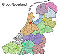
 Groot-Nederland.png 800 × 773; 268 KB
-
 Grootnederland.jpg 2,000 × 1,922; 495 KB
-
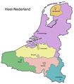 Heelnederland.png 1,212 × 1,385; 284 KB
-
 Herenigde Nederlanden.jpg 1,615 × 2,934; 198 KB
-
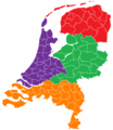
 Nederlandse provincies (gemeenten) herindeling.png 534 × 616; 59 KB
-
 Nederlandse provincies (gemeenten) herindeling2.png 534 × 616; 54 KB
-
 Nederlandse provincies (gemeenten) herindeling3.png 534 × 616; 53 KB
-
 Nederlandse provincies (gemeenten) herindeling4.png 534 × 616; 50 KB


_herindeling.png)
_herindeling2.png)
_herindeling3.png)
_herindeling4.png)