File:Dalmazia1560.png
Jump to navigation
Jump to search
No higher resolution available.
Dalmazia1560.png (516 × 424 pixels, file size: 586 KB, MIME type: image/png)
Captions
Captions
Add a one-line explanation of what this file represents

Summary
[edit]
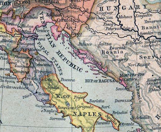
Italiano: Istria e Dalmazia nel 1560
Map from "Historical Atlas" by William R. Shepherd, 1923
Licensing
[edit]
|
This work is in the public domain in its country of origin and other countries and areas where the copyright term is the author's life plus 70 years or fewer. | |
| This file has been identified as being free of known restrictions under copyright law, including all related and neighboring rights. | |
File history
Click on a date/time to view the file as it appeared at that time.
| Date/Time | Thumbnail | Dimensions | User | Comment | |
|---|---|---|---|---|---|
| current | 21:14, 13 August 2011 | | 516 × 424 (586 KB) | DIREKTOR (talk | contribs) | Tone |
| 20:40, 15 February 2006 |  | 516 × 424 (549 KB) | Ilario (talk | contribs) | {{it|Istria e Dalmazia nel 1560}} Map from "Historical Atlas" by William R. Shepherd, 1923 Category:Maps of Dalmatia |
You cannot overwrite this file.
File usage on Commons
The following 4 pages use this file:
File usage on other wikis
The following other wikis use this file:
- Usage on ast.wikipedia.org
- Usage on cs.wikipedia.org
- Usage on de.wikipedia.org
- Usage on el.wikipedia.org
- Usage on es.wikipedia.org
- Usage on fa.wikipedia.org
- Usage on he.wikipedia.org
- Usage on hr.wikipedia.org
- Usage on hu.wikipedia.org
- Usage on hy.wikipedia.org
- Usage on incubator.wikimedia.org
- Usage on it.wikipedia.org
- Usage on ja.wikipedia.org
- Usage on lt.wikipedia.org
- Usage on ms.wikipedia.org
- Usage on nl.wikipedia.org
- Usage on pl.wikipedia.org
- Usage on pt.wikipedia.org
- Usage on ru.wikipedia.org
- Usage on simple.wikipedia.org
- Usage on sq.wikipedia.org
- Usage on uk.wikipedia.org
- Usage on vec.wikipedia.org