File:Crop type map gee.tif
Jump to navigation
Jump to search

Size of this PNG preview of this TIF file: 800 × 530 pixels. Other resolutions: 320 × 212 pixels | 640 × 424 pixels | 1,024 × 679 pixels | 1,280 × 849 pixels | 1,629 × 1,080 pixels.
Original file (1,629 × 1,080 pixels, file size: 6.76 MB, MIME type: image/tiff)
Captions
Captions
Add a one-line explanation of what this file represents
Summary
[edit]| Description |
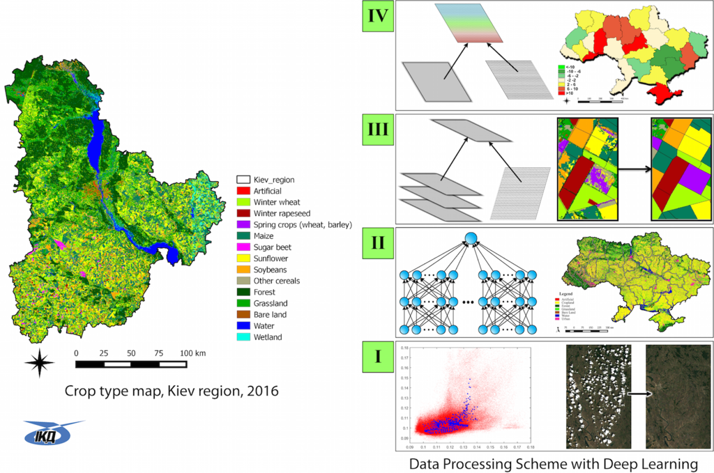
English: Satellite Land Cover map for Kiev region of Ukraine (2016) based on Machine Learning and Deep learning techniques and Google Earth Engine cloud platform to deal with "Big data" problem, 10 m resolution, Sentinel-2 data. Supported by Google Earth Research Awards.
Українська: Супутникова карта земного покриву для території Київської області України (2016 р.), побудована із використанням методів машинного та глибинного навчання та хмарної платформи Google Earth Engine для обробки "Великих даних", роздільна здатність - 10 м, дані супутника Sentinel-2. Карту побудовано за підтримки дослідницького гранту компанії Google |
| Date | |
| Source | Own work |
| Author | Інститут космічних досліджень НАН україни та ДКА України |
Licensing
[edit]I, the copyright holder of this work, hereby publish it under the following license:
This file is licensed under the Creative Commons Attribution-Share Alike 4.0 International license.
- You are free:
- to share – to copy, distribute and transmit the work
- to remix – to adapt the work
- Under the following conditions:
- attribution – You must give appropriate credit, provide a link to the license, and indicate if changes were made. You may do so in any reasonable manner, but not in any way that suggests the licensor endorses you or your use.
- share alike – If you remix, transform, or build upon the material, you must distribute your contributions under the same or compatible license as the original.
|
This image was uploaded as part of Science Photo Competition 2016 |
File history
Click on a date/time to view the file as it appeared at that time.
| Date/Time | Thumbnail | Dimensions | User | Comment | |
|---|---|---|---|---|---|
| current | 10:09, 28 October 2016 |  | 1,629 × 1,080 (6.76 MB) | Andrew.k.911 (talk | contribs) | User created page with UploadWizard |
You cannot overwrite this file.
File usage on Commons
There are no pages that use this file.