File:Carte administrative des Provinces Maritimes du Canada.svg
Jump to navigation
Jump to search

Size of this PNG preview of this SVG file: 800 × 575 pixels. Other resolutions: 320 × 230 pixels | 640 × 460 pixels | 1,024 × 737 pixels | 1,280 × 921 pixels | 2,560 × 1,841 pixels | 2,928 × 2,106 pixels.
Original file (SVG file, nominally 2,928 × 2,106 pixels, file size: 900 KB)
Captions
Captions
Add a one-line explanation of what this file represents
Summary
[edit]
| Description |
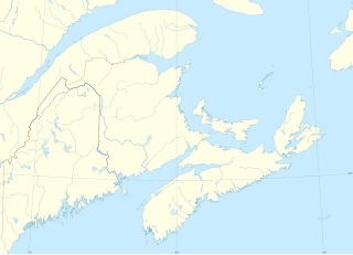
English: The Maritimes canadian provinces administrative map.
Lambert conformal conic projection; WGS84 datum
Geographic limits of the map:
Français : Carte administrative des Provinces Maritimes du Canada.
Projection conique conforme de Lambert ; système géodétique WGS84.
Limites géographiques de la carte :
|
| Date | (UTC) |
| Source |
English: Sources:
Français : Sources :
|
| Author | Sémhur (talk) |
| Attribution (required by the license) | © Sémhur / Wikimedia Commons / |
| SVG development |
| Object location | | View this and other nearby images on: OpenStreetMap |
|---|
Licensing
[edit]
I, the copyright holder of this work, hereby publish it under the following licenses:
| Copyleft: This work of art is free; you can redistribute it and/or modify it according to terms of the Free Art License. You will find a specimen of this license on the Copyleft Attitude site as well as on other sites. |
This file is licensed under the Creative Commons Attribution-Share Alike Attribution-Share Alike 4.0 International, 3.0 Unported, 2.5 Generic, 2.0 Generic and 1.0 Generic license.
- You are free:
- to share – to copy, distribute and transmit the work
- to remix – to adapt the work
- Under the following conditions:
- attribution – You must give appropriate credit, provide a link to the license, and indicate if changes were made. You may do so in any reasonable manner, but not in any way that suggests the licensor endorses you or your use.
- share alike – If you remix, transform, or build upon the material, you must distribute your contributions under the same or compatible license as the original.
You may select the license of your choice.
File history
Click on a date/time to view the file as it appeared at that time.
| Date/Time | Thumbnail | Dimensions | User | Comment | |
|---|---|---|---|---|---|
| current | 16:14, 14 April 2013 | | 2,928 × 2,106 (900 KB) | Sémhur (talk | contribs) | == {{int:filedesc}} == {{Information |Description={{Multilingual description |en= The Maritimes canadian provinces administrative map. Lambert conformal conic projection; WGS84 datum * Central meridian: 65° W * First standard pa... |
You cannot overwrite this file.
File usage on Commons
There are no pages that use this file.
File usage on other wikis
The following other wikis use this file: