Category:SVG maps of New Brunswick
Jump to navigation
Jump to search
Provinces and territories of Canada: Alberta · British Columbia · Manitoba · New Brunswick · Newfoundland and Labrador · Nova Scotia · Ontario · Prince Edward Island · Quebec · Northwest Territories · Nunavut · Yukon
Subcategories
This category has only the following subcategory.
Media in category "SVG maps of New Brunswick"
The following 68 files are in this category, out of 68 total.
-
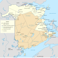
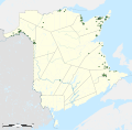
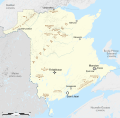
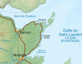
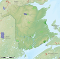
 Acadia New Brunswick general map-fr.svg 2,237 × 2,199; 3.9 MB
-
 Acadie Nouveau-Brunswick.svg 1,411 × 1,388; 794 KB
-
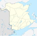
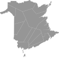
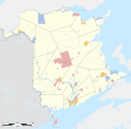
 Administrative areas of New Brunswick map-blank.svg 2,237 × 2,199; 1.47 MB
-
 Administrative areas of New Brunswick topographic map-blank.svg 2,237 × 2,199; 3.75 MB
-
 Administrative areas of New Brunswick with First Nations land topographic map-blank.svg 2,237 × 2,199; 3.83 MB
-
 Administrative areas of New Brunswick with First Nations lands map-7 sites -fr.svg 2,237 × 2,199; 1.61 MB
-
 Administrative areas of New Brunswick with First Nations lands map-blank.svg 2,237 × 2,199; 1.52 MB
-
 Blank Map of New Brunswick.svg 4,096 × 2,731; 5.81 MB
-
 Canada New Brunswick location map 2.svg 1,411 × 1,388; 453 KB
-
 Canada New Brunswick location map.svg 1,411 × 1,388; 500 KB
-
 Carte administrative des Provinces Maritimes du Canada.svg 2,928 × 2,106; 900 KB
-
 Carte Caisses populaires acadiennes.svg 2,237 × 2,199; 1.55 MB
-
 Carte topographique des Provinces Maritimes du Canada.svg 2,928 × 2,106; 973 KB
-
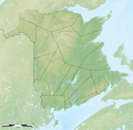
 Counties of New Brunswick topographic map-blank.svg 2,237 × 2,199; 3.8 MB
-
 First Nations lands of New Brunswick map-blank.svg 2,237 × 2,199; 647 KB
-
 Flag-map of New Brunswick.svg 1,068 × 1,030; 115 KB
-
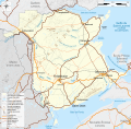
 Fundy National Park topographic map-fr.svg 1,043 × 1,076; 5.36 MB
-
 Gamaliel Smethurst topographic map-fr.svg 2,237 × 2,199; 3.15 MB
-
 King williams war.svg 638 × 455; 1.71 MB
-
 Map of New Brunswick highlighting Albert County.svg 4,096 × 2,731; 5.81 MB
-
 Map of New Brunswick highlighting Carleton County.svg 4,096 × 2,731; 5.81 MB
-
 Map of New Brunswick highlighting Charlotte County.svg 4,096 × 2,731; 5.81 MB
-
 Map of New Brunswick highlighting Gloucester County.svg 4,096 × 2,731; 5.81 MB
-
 Map of New Brunswick highlighting Kent County.svg 4,096 × 2,731; 5.81 MB
-
 Map of New Brunswick highlighting Kings County.svg 4,096 × 2,731; 5.81 MB
-
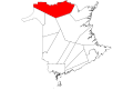
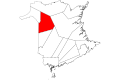
 Map of New Brunswick highlighting Madawaska County.svg 4,096 × 2,731; 5.81 MB
-
 Map of New Brunswick highlighting Northumberland County.svg 4,096 × 2,731; 5.81 MB
-
 Map of New Brunswick highlighting Queens County.svg 4,096 × 2,731; 5.81 MB
-
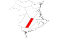
 Map of New Brunswick highlighting Restigouche County.svg 4,096 × 2,731; 5.81 MB
-
 Map of New Brunswick highlighting Saint John County.svg 4,096 × 2,731; 5.81 MB
-
 Map of New Brunswick highlighting Sunbury County.svg 4,096 × 2,731; 5.81 MB
-
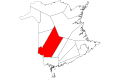
 Map of New Brunswick highlighting Victoria County.svg 4,096 × 2,731; 5.81 MB
-
 Map of New Brunswick highlighting Westmorland County.svg 4,096 × 2,731; 5.81 MB
-
 Map of New Brunswick highlighting York County.svg 4,096 × 2,731; 5.81 MB
-
 Mountains of New Brunswick map-fr.svg 2,237 × 2,199; 2.96 MB
-
 Mountains of New Brunswick topographic map-fr.svg 2,237 × 2,199; 3.2 MB
-
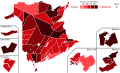
 New Brunswick 2014 Election Results.svg 1,011 × 842; 3.82 MB
-
 New Brunswick 2018 Election Results.svg 1,329 × 1,095; 926 KB
-
 New Brunswick counties.svg 334 × 332; 3.13 MB
-
 New Brunswick general election 1978 - Results by Riding.svg 2,000 × 1,215; 315 KB
-
 New Brunswick general election 1987 - Results by Riding.svg 2,000 × 1,215; 294 KB
-
 New Brunswick general election 2006 - Results By Riding.svg 1,585 × 1,000; 313 KB
-
 New Brunswick general election 2010 - Results By Riding.svg 1,585 × 1,000; 312 KB
-
 New Brunswick general election 2018 - Results by Riding.svg 1,011 × 842; 3.82 MB
-
 New Brunswick general election 2020 - Results by Riding.svg 512 × 422; 591 KB
-
 New Brunswick general election, 1974 results by riding.svg 3,092 × 1,871; 244 KB
-
 New Brunswick general election, 1982 results by riding.svg 3,092 × 1,871; 255 KB
-
 New Brunswick general election, 1991 results by riding.svg 512 × 310; 243 KB
-
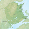
 New Brunswick general map-fr.svg 2,237 × 2,199; 3.07 MB
-
 New Brunswick Köppen.svg 900 × 1,170; 426 KB
-
 New Brunswick topographic map-fr.svg 2,237 × 2,199; 3.31 MB
-
 New Brunswick topographic map-fr1.svg 1,012 × 779; 3.32 MB
-
 New Brunswick with the proposal for an acadian province map-blank.svg 2,237 × 2,199; 670 KB
-
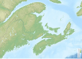
 New England and South-East of Canada topographic map-blank.svg 1,455 × 1,040; 528 KB
-
 Nouveau-Brunswick Köppen.svg 900 × 1,170; 488 KB
-
 Official languagues of New Brunswick municipalities map-blank.svg 2,237 × 2,199; 1.52 MB
-
 Paroisse Beresford 1966.svg 1,150 × 1,306; 34 KB
-
 Paroisse Caraquet 1966.svg 1,400 × 784; 37 KB
-
 Paroisse Dorchester 1966.svg 1,662 × 2,100; 23 KB
-
 Paroisse Dundas 1966.svg 1,270 × 738; 28 KB
-
 Paroisse Shédiac 1966.svg 1,610 × 906; 53 KB
-
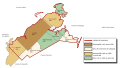
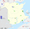 Protected areas of New Brunswick map-blank.svg 2,237 × 2,199; 2.77 MB
-
 Protected areas of New Brunswick topographic map-blank.svg 2,237 × 2,199; 3.01 MB
-
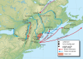
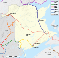 Railways of New Brunswick map-fr.svg 2,237 × 2,199; 2.72 MB
-
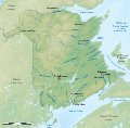
 Rivers of New Brunswick map-fr.svg 2,237 × 2,199; 3.18 MB
-
 Rivers of New Brunswick topographic map-fr.svg 2,237 × 2,199; 3.41 MB
-
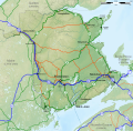
 Roads of New Brunswick map-fr.svg 2,237 × 2,199; 3.03 MB
-
 Roads of New Brunswick topographic map-fr.svg 2,237 × 2,199; 3.27 MB


