Category:SVG blank maps of Canada
Jump to navigation
Jump to search
Media in category "SVG blank maps of Canada"
The following 24 files are in this category, out of 24 total.
-
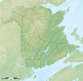
 Administrative areas of New Brunswick map-blank.svg 2,237 × 2,199; 1.47 MB
-
 Administrative areas of New Brunswick topographic map-blank.svg 2,237 × 2,199; 3.75 MB
-
 Administrative areas of New Brunswick with First Nations land topographic map-blank.svg 2,237 × 2,199; 3.83 MB
-
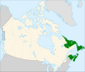 Atlantic Canada.svg 1,084 × 920; 93 KB
-
 Blank map of Canada.svg 1,085 × 921; 82 KB
-
 Blank Map of New Brunswick.svg 4,096 × 2,731; 5.81 MB
-
 BlankMap-USA-states-Canada-provinces, HI closer.svg 512 × 512; 104 KB
-
 BlankMap-USA-states-Canada-provinces.svg 2,289 × 1,744; 211 KB
-
 CAN locator map.svg 614 × 281; 172 KB
-
 Canada (geolocalisation).svg 1,084 × 920; 94 KB
-
 Canada blank map.svg 1,114 × 942; 205 KB
-
 Canada location map.svg 1,084 × 920; 155 KB
-
 Canada provinces-blank CSS-map green.svg 978 × 950; 64 KB
-
 Canada provinces-blank-map XMLcomments-CSSclasses-SVGids green.svg 978 × 950; 68 KB
-
 Carte administrative des Provinces Maritimes du Canada.svg 2,928 × 2,106; 900 KB
-
 Central Canada.svg 1,084 × 920; 93 KB
-
 Counties of New Brunswick topographic map-blank.svg 2,237 × 2,199; 3.8 MB
-
 First Nations lands of New Brunswick map-blank.svg 2,237 × 2,199; 647 KB
-
 Map Canada.svg 1,007 × 483; 66 KB
-
 New Brunswick with the proposal for an acadian province map-blank.svg 2,237 × 2,199; 670 KB
-
 New England and South-East of Canada topographic map-blank.svg 1,455 × 1,040; 528 KB
-
 Région métropolitaine de Saguenay-blank.svg 1,459 × 1,138; 515 KB
-
 Région métropolitaine de Shawinigan-blank.svg 1,529 × 2,138; 213 KB
-
 Région métropolitaine de Sherbrooke-blank.svg 1,104 × 1,407; 291 KB


.svg)


