File:California US Congressional District 28 (since 2013).tif
Jump to navigation
Jump to search

Size of this PNG preview of this TIF file: 800 × 395 pixels. Other resolutions: 320 × 158 pixels | 640 × 316 pixels | 1,024 × 506 pixels | 2,016 × 996 pixels.
Original file (2,016 × 996 pixels, file size: 3.04 MB, MIME type: image/tiff)
Captions
Captions
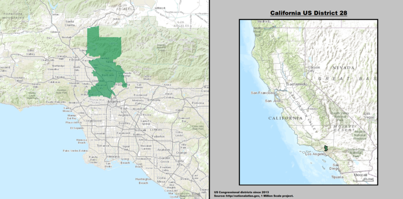
Map of Political District of California's 28th Congressional District, 2019.
Summary
[edit]| Description |
English: Boundaries for California's 28th congressional district in the U.S. House of Representatives — located in Los Angeles County, California.
Español: Mapa del 28.º distrito congresional de California — Condado de Los Ángeles, California. |
| Date | |
| Source | GIS shapefile data created by the United States Department of the Interior, as part of the "1 Million Scale" geospatial data project. Retrieved from: http://nationalatlas.gov/atlasftp-1m.html?openChapters=#chpbound |
| Author | 1: GIS (congressional districts, 2013) shapefile data was created by the United States Department of the Interior. 2: Data was rendered using ArcGIS® software by Esri. 3: File developed for use on Wikipedia and elsewhere by 7partparadigm. |
Licensing
[edit]This map was obtained from an edition of the National Atlas of the United States. Like almost all works of the U.S. federal government, works from the National Atlas are in the public domain in the United States.
Online access: NationalAtlas.gov | 1970 print edition: Library of Congress, Perry-Castañeda Library
|
en:California's 28th congressional district es:28.º distrito congresional de California
File history
Click on a date/time to view the file as it appeared at that time.
| Date/Time | Thumbnail | Dimensions | User | Comment | |
|---|---|---|---|---|---|
| current | 03:18, 22 March 2014 |  | 2,016 × 996 (3.04 MB) | 7partparadigm (talk | contribs) | User created page with UploadWizard |
You cannot overwrite this file.
File usage on Commons
The following page uses this file:
File usage on other wikis
The following other wikis use this file:
- Usage on en.wikipedia.org
- Usage on fr.wikipedia.org
- Usage on hu.wikipedia.org
- Usage on nl.wikipedia.org
- Usage on tr.wikipedia.org
- Usage on www.wikidata.org
- Usage on zh.wikipedia.org
Metadata
Categories:
- Congressional district maps of California
- Maps of Los Angeles County, California
- Maps of Los Angeles
- Maps of the San Fernando Valley
- Burbank, California
- Echo Park, Los Angeles
- East Hollywood
- Glendale, California
- Hollywood, California
- La Cañada Flintridge, California
- Los Feliz, Los Angeles
- North Hollywood, Los Angeles
- Silverlake, Los Angeles
- West Hollywood, California
- San Fernando Valley
- San Gabriel Mountains
- Santa Monica Mountains in Los Angeles
- Verdugo Mountains