File:Asia Menor y Estados Cruzados - 1140.jpg
Jump to navigation
Jump to search
Size of this preview: 555 × 600 pixels. Other resolutions: 222 × 240 pixels | 444 × 480 pixels | 711 × 768 pixels | 1,097 × 1,185 pixels.
Original file (1,097 × 1,185 pixels, file size: 441 KB, MIME type: image/jpeg)
Captions
Captions
Add a one-line explanation of what this file represents

|
File:Asia Minor and the States of the Crusaders.svg is a vector version of this file. It should be used in place of this JPG file when not inferior.
File:Asia Menor y Estados Cruzados - 1140.jpg → File:Asia Minor and the States of the Crusaders.svg
For more information, see Help:SVG. |
 |
Summary
[edit]
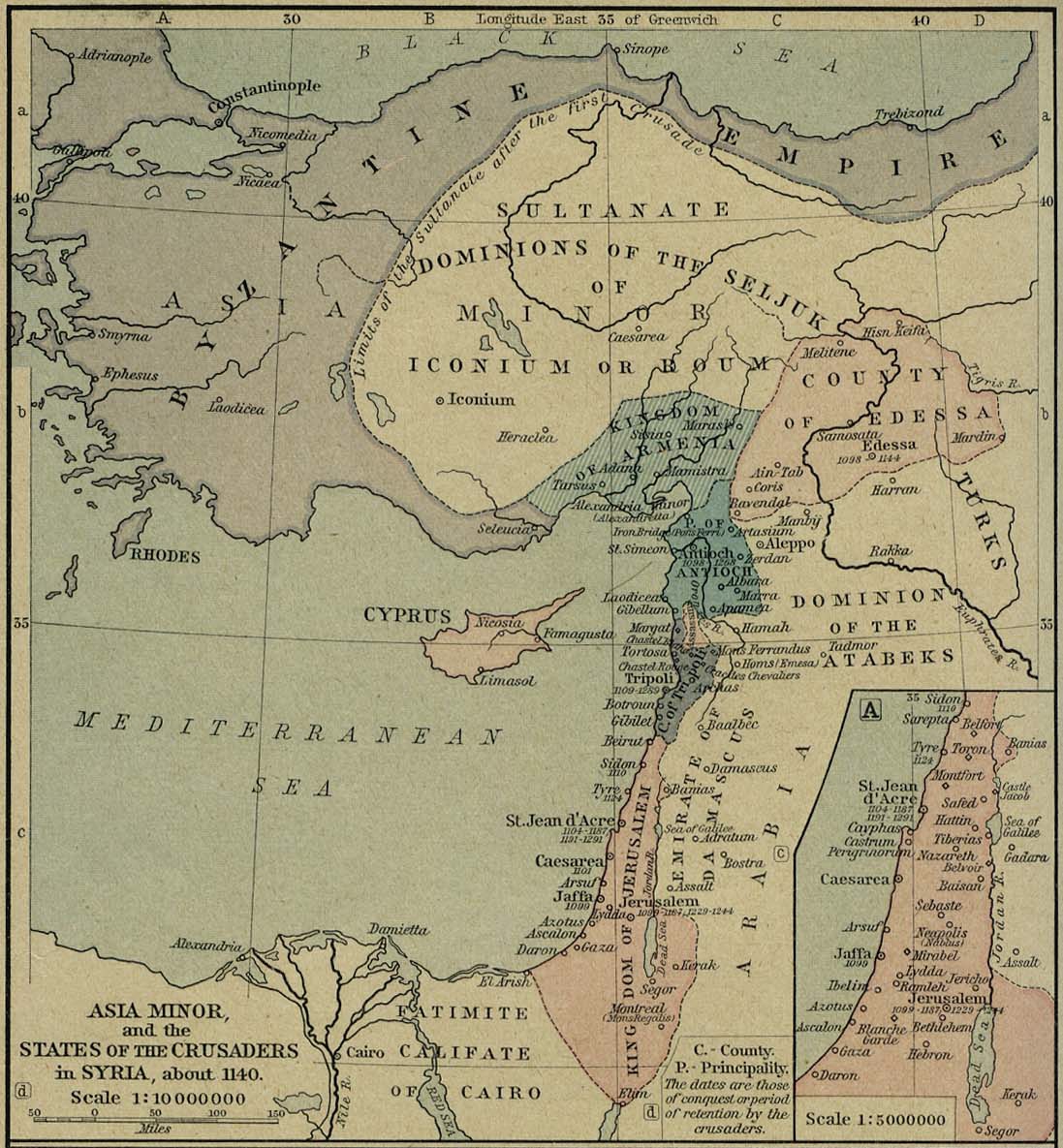
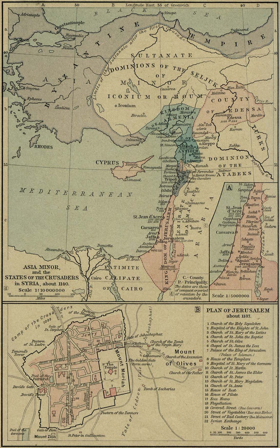
| Description | Asia Minor at the time of the First Mithridatical War. |
| Date | |
| Source |
The Historical Atlas, by William R. Shepherd, 1911. Original image at the Perry-Castañeda Library Map Collection at the University of Texas at Austin website: http://www.lib.utexas.edu/maps/historical/shepherd/asia_minor_1140.jpg
|
| Author |
William Robert Shepherd |
Licensing
[edit]
|
This work is in the public domain in its country of origin and other countries and areas where the copyright term is the author's life plus 70 years or fewer. | |
| This file has been identified as being free of known restrictions under copyright law, including all related and neighboring rights. | |
File history
Click on a date/time to view the file as it appeared at that time.
| Date/Time | Thumbnail | Dimensions | User | Comment | |
|---|---|---|---|---|---|
| current | 23:33, 7 November 2006 | | 1,097 × 1,185 (441 KB) | Bertie Wooster (talk | contribs) | Mapa de Asia Menor y los Estados cruzados en 1140 - Historical Atlas by William R. Shepherd, 1923. |
You cannot overwrite this file.
File usage on Commons
There are no pages that use this file.
File usage on other wikis
The following other wikis use this file:
- Usage on ca.wikipedia.org
- Usage on tr.wikipedia.org