File:Arabian Peninsula arabic.png
Jump to navigation
Jump to search
Size of this preview: 757 × 599 pixels. Other resolutions: 303 × 240 pixels | 606 × 480 pixels | 1,018 × 806 pixels.
Original file (1,018 × 806 pixels, file size: 394 KB, MIME type: image/png)
Captions
Captions
Add a one-line explanation of what this file represents
Summary
[edit]
| Description |
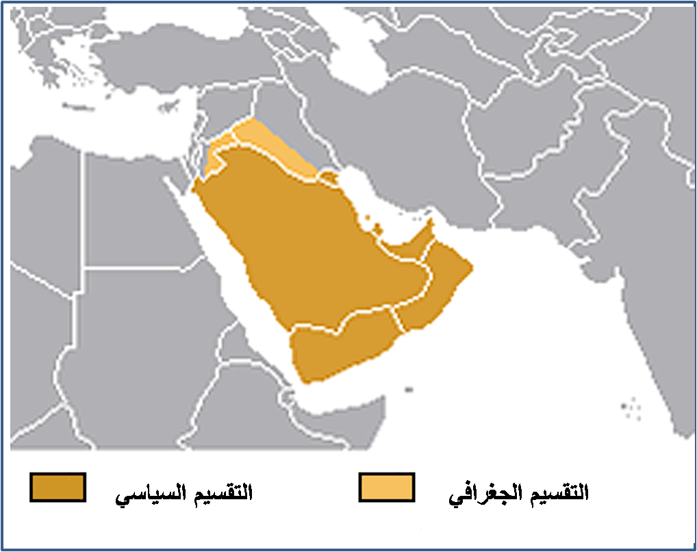
English: Translated as "the Arabian Peninsula Map" from arabic, where the map shows portions of Iraq and Syria that are colorized to inscribed within. (see note below.) This appears to be consistent with the tranlated title and this excerpt from Arabian pennisula:
"Its northern limit is defined by the w:Iranian and w:Iraqi mountain range of w:Zagros collision zone, a mountainous uplift where a w:continental collision between the w:Arabian Plate and Asia is occurring. It merges with the w:Syrian Desert with no clear line of demarcation. |
| Date | 21 November |
| Source | Own work |
| Author | إبن البيطار |
| Permission (Reusing this file) |
Look Bellow |
- note
English:
Previously erroneously categorized as "GCC countries" which has the meaning:
"Politically, the Arabian Peninsula consists of Saudi Arabia, Kuwait, Bahrain, Qatar, the United Arab Emirates, the Sultanate of Oman, and the Republic of Yemen. Together, these countries (excluding the Republic of Yemen located in the south-western corner of the pennisula) constitute the Gulf Cooperation Council (GCC), the subject of this map. Founded on 26 May 1981, the aim of this collective is to promote coordination between member states in all fields in order to achieve unity.— quote with minor annotation/links from GCC website.
- 2008-07-17 ... removed from that category as clearly off target. Yemen is same coloring, and portions of other geopolitical entities are indicated by other countries.
Licensing
[edit]
| I, the copyright holder of this work, release this work into the public domain. This applies worldwide. In some countries this may not be legally possible; if so: I grant anyone the right to use this work for any purpose, without any conditions, unless such conditions are required by law. |
File history
Click on a date/time to view the file as it appeared at that time.
| Date/Time | Thumbnail | Dimensions | User | Comment | |
|---|---|---|---|---|---|
| current | 09:19, 21 November 2007 | | 1,018 × 806 (394 KB) | Producer (talk | contribs) | {{Information |Description=Translated the Arabian Peninsula Map in arabic |Source=self-made |Date=21 November |Author= إبن البيطار |Permission=Look Bellow |other_versions= }} |
You cannot overwrite this file.
File usage on Commons
The following 16 pages use this file:
- Category:Maps of 10th-century Arabia
- Category:Maps of 11th-century Arabia
- Category:Maps of 12th-century Arabia
- Category:Maps of 14th-century Arabia
- Category:Maps of 15th-century Arabia
- Category:Maps of 16th-century Arabia
- Category:Maps of 17th-century Arabia
- Category:Maps of 18th-century Arabia
- Category:Maps of 19th-century Arabia
- Category:Maps of 20th-century Arabia
- Category:Maps of 6th-century Arabia
- Category:Maps of 7th-century Arabia
- Category:Maps of 8th-century Arabia
- Category:Maps of 9th-century Arabia
- Category:Maps of pre-Islamic Arabia
- Category:Maps of the history of Arabia