Category:Maps of the Arabian Peninsula
Jump to navigation
Jump to search
English: Maps of the Arabian Peninsula
See also:
Subcategories
This category has the following 12 subcategories, out of 12 total.
A
- Afrotropical realm maps (1 P, 8 F)
K
M
- Maps of Arab tribes (20 F)
O
Q
S
T
- Topographical maps of Arabia (1 F)
U
Y
Media in category "Maps of the Arabian Peninsula"
The following 71 files are in this category, out of 71 total.
-
 Arabian peninsula definition-Berkay.png 250 × 162; 5 KB
-
 Afrotropic-Arabian Peninsula.svg 2,487 × 2,770; 387 KB
-
 Afrotropic-Ecozone-Arabian Peninsula.svg 773 × 555; 36 KB
-
 20200211 NP EMASoH Brief map 2 cleaned - Copy.jpg 3,000 × 1,916; 1.86 MB
-
 Anak Benua Arab.jpg 3,284 × 4,096; 1.1 MB
-
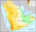
 Arabia Saudi physical.jpg 1,010 × 1,196; 945 KB
-
 Arabia Saudi political.jpg 1,010 × 1,179; 550 KB
-
 Arabia-peninsula-political-czech.png 1,200 × 1,176; 127 KB
-
 Arabia. NYPL1503440.tiff 4,792 × 2,739; 37.57 MB
-
 Arabian Desert.jpg 500 × 428; 116 KB
-
 Arabian endorheic basins.png 1,357 × 1,321; 62 KB
-
 Arabian Peninsula (no borders).svg 600 × 600; 302 KB
-
 Arabian Peninsula (orthographic projection).png 2,000 × 2,000; 666 KB
-
 Arabian Peninsula - Drainage.png 7,013 × 6,231; 51.26 MB
-
 Arabian Peninsula - Lithology.png 6,891 × 6,125; 55.75 MB
-
 Arabian Peninsula - Soils.png 6,891 × 6,125; 56.59 MB
-
 Arabian Peninsula arabic.png 1,018 × 806; 394 KB
-
 Arabian peninsula definition (cropped).PNG 460 × 311; 17 KB
-
 Arabian peninsula definition AR2.png 460 × 375; 36 KB
-
 Arabian peninsula definition hu.svg 460 × 375; 56 KB
-
 Arabian peninsula definition.PNG 460 × 375; 34 KB
-
 Arabian Peninsula.PNG 461 × 394; 13 KB
-
 Arabian Peninsula.svg 600 × 600; 628 KB
-
 Arabian Sea map-A.png 800 × 757; 126 KB
-
 Arabian-peninsula-definition-cz.png 250 × 196; 4 KB
-
 ArabianpeninsulaAL.PNG 250 × 115; 5 KB
-
 Arap Yarımadası Çalışma Alanı.png 250 × 162; 5 KB
-
 Central Asia- Afghanistan and Her Relation to British and Russian Territories WDL11751.png 1,556 × 1,024; 3.18 MB
-
 AT1302 map.png 1,037 × 822; 33 KB
-
 AT1320 map.png 1,053 × 844; 37 KB
-
 Empty quarter Arabia.PNG 990 × 651; 345 KB
-
 Empty quarter Arabic.png 328 × 352; 51 KB
-
 Empty quarter german.png 328 × 352; 26 KB
-
 Ersian Gulf Arab States armenian.png 623 × 599; 83 KB
-
 General Map of Central Asia- II WDL11775.png 1,403 × 1,024; 2.37 MB
-
 General Map of Central Asia- Schematic View WDL11786.png 1,255 × 1,024; 2.09 MB
-
 Golf Persic - Idrocarburs.png 635 × 711; 125 KB
-
 IMCMEX 2012 areas of operations OpenStreetMap.png 1,206 × 877; 241 KB
-
 Israel Iran conflict 2024 map.jpg 1,080 × 1,438; 114 KB
-
-
 James Silk Buckingham's General Map of Persia.jpg 3,000 × 2,135; 1.16 MB
-
 Karte Arabische Halbinsel.png 2,104 × 1,875; 253 KB
-
 LocationMap mod.jpg 595 × 547; 74 KB
-
 Map of Jabrid Emirate (3).png 2,160 × 1,216; 258 KB
-
 Map of Middle East(pt).png 1,000 × 966; 323 KB
-
 Map-crop-1.png 1,214 × 1,214; 103 KB
-
 Map-crop-11.png 1,214 × 659; 88 KB
-
 Map-crop-2.png 1,500 × 1,500; 118 KB
-
 Nahd Map.png 1,912 × 869; 292 KB
-
 Outline map of GCC countries.png 466 × 394; 31 KB
-
 Peninsula Aràbia - Clima segon la classificacion de Köppen.png 2,911 × 2,653; 410 KB
-
 Peninsula Aràbia - Religions.png 2,911 × 2,653; 608 KB
-
 Peninsula Aràbia - Topografia.png 2,913 × 2,654; 967 KB
-
 Peninsular Arabic.svg 501 × 519; 301 KB
-
 Persian Gulf States Defined Arias .png 1,202 × 1,156; 52 KB
-
 Range map of the Socotra Buzzard.png 1,080 × 1,158; 74 KB
-
 Rub-al-Ĥalo.png 328 × 352; 31 KB
-
 Saudi Arabia transport map.jpg 1,010 × 1,194; 936 KB
-
 Semitic-map-urdu.png 1,255 × 2,000; 990 KB
-
 The Eastern Question in Europe and Asia WDL11691.png 2,121 × 1,551; 4.42 MB
-
 Tihamah.png 1,514 × 1,107; 970 KB
-
 Şamar Dağları.jpg 753 × 572; 34 KB
-
 آل رشيد2.png 612 × 600; 294 KB
-
 اقاليم الجزيرة العربية.png 1,142 × 771; 74 KB
-
 خريطة أهم دول و سلاطين الجزيرة العربية و قبائل قبل 100سنه.jpg 1,571 × 1,606; 512 KB
-
 خريطة قبائل منطقة شبة الجزيرة العربية و اليمن.png 1,024 × 1,024; 690 KB
-
 خريطة من الأرشيف العربي القديم للمنطقة.jpg 1,024 × 947; 204 KB
-
 خريطه للملكة العربية السعودية.jpg 220 × 229; 11 KB
-
 وادي سرحان واطلس المملكة العربية السعودية والعالم2.jpg 808 × 1,024; 118 KB
-
 وادي سرحان والشرارات بخريطة اردنية1.jpg 495 × 508; 33 KB
-
 阿拉伯半岛以及以色列和西奈.png 1,690 × 1,224; 30 KB


.svg)
.png)


.PNG)


.png)
.png)


