Category:Maps of 10th-century Arabia
Jump to navigation
Jump to search

English: Category for maps showing the history of the Arabian Peninsula in the 10th century AD (roughly AH 288-AH 392).
Not to be confused with genuinely old maps (Old maps of...).
Not to be confused with genuinely old maps (Old maps of...).
Media in category "Maps of 10th-century Arabia"
The following 7 files are in this category, out of 7 total.
-
 Eastern & Central Arabia 9th–10th Centuries.svg 1,370 × 685; 1.41 MB
-
 Mouvement des Tribus Souliem et hilal-ar.png 1,196 × 825; 244 KB
-
 Mouvement des Tribus Souliem et hilal.png 1,196 × 825; 652 KB
-
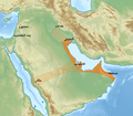 Qarmatian Republic-ar.png 876 × 765; 938 KB
-
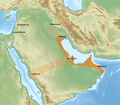 Qarmatian Republic.png 876 × 765; 938 KB
-
 The Caliphate (632 - 945).jpg 4,415 × 2,847; 3.47 MB
-
 النشاط البحري للمسلمين 750 - 960.jpg 1,311 × 965; 542 KB


.jpg)
