File:A map of North America, LOC 74694149.jpg
Jump to navigation
Jump to search
Size of this preview: 720 × 599 pixels. Other resolutions: 288 × 240 pixels | 577 × 480 pixels | 923 × 768 pixels | 1,230 × 1,024 pixels | 2,460 × 2,048 pixels | 7,129 × 5,935 pixels.
Original file (7,129 × 5,935 pixels, file size: 6.51 MB, MIME type: image/jpeg)
Captions
Captions
Add a one-line explanation of what this file represents
Summary
[edit]| Description |
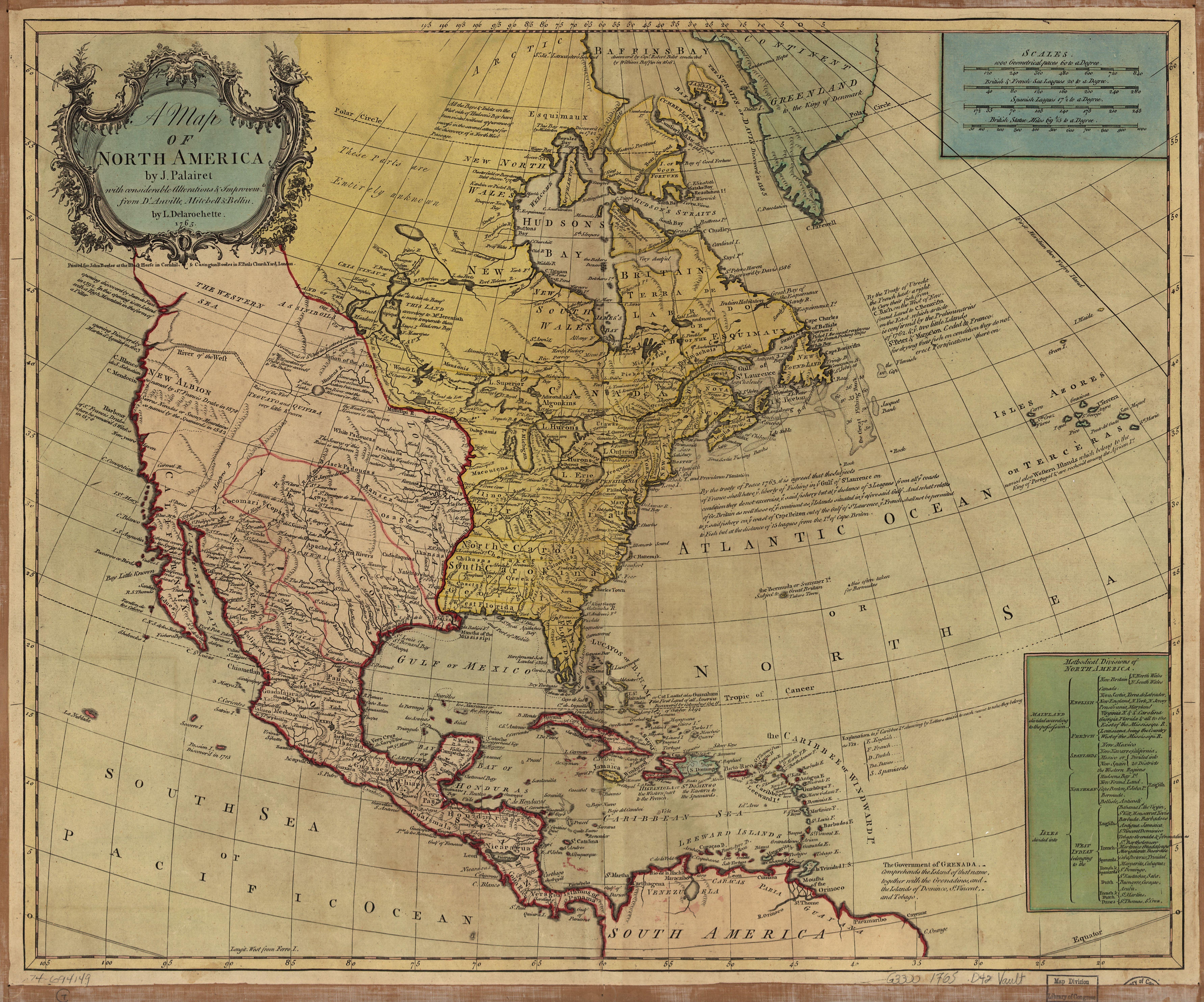
English: Scale ca. 1:15,000,000. Relief shown pictorially. Hand colored. "Longit. west from Ferro I." Differs from other copy in coloration. Map is colored in to show the extent of British America, and the Spanish and French territory. "Printed for John Bowles at the Black Horse in Cornhil, & Carington Bowles in St. Pauls Church Yard, London." Includes historical notes and table of "Methodical divisions of North America." LC Maps of North America, 1750-1789, 115 Available also through the Library of Congress Web site as a raster image. Vault AACR2: 651/1; 650/2; 700/1; 700/2; 700/3 |
||
| Title | A map of North America, | ||
| Shelf ID | G3300 1765 .D42 | ||
| Date | |||
| Source | https://www.loc.gov/item/74694149/ | ||
| Author | Delarochette, L. (Louis); Palairet, Jean; Bowles, Carington; Bowles, John; Delarochette, L. | ||
| Permission (Reusing this file) |
|
||
| Location | North America · America | ||
| Part of | Military Battles And Campaigns · American Memory · Catalog · Geography And Map Division · American Revolution And Its Era: Maps And Charts Of North America And The West Indies, 1750-1789 | ||
| Subject | North America · Maps · Early Works To 1800 · America · British |

Licensing
[edit]
|
This is a faithful photographic reproduction of a two-dimensional, public domain work of art. The work of art itself is in the public domain for the following reason:
The official position taken by the Wikimedia Foundation is that "faithful reproductions of two-dimensional public domain works of art are public domain".
This photographic reproduction is therefore also considered to be in the public domain in the United States. In other jurisdictions, re-use of this content may be restricted; see Reuse of PD-Art photographs for details. | ||||
File history
Click on a date/time to view the file as it appeared at that time.
| Date/Time | Thumbnail | Dimensions | User | Comment | |
|---|---|---|---|---|---|
| current | 20:55, 18 June 2018 | | 7,129 × 5,935 (6.51 MB) | Fæ (talk | contribs) | LOC Maps https://www.loc.gov/item/74694149/ #19984 |
You cannot overwrite this file.
File usage on Commons
There are no pages that use this file.