Category:1765 maps of North America
Jump to navigation
Jump to search
Temperate regions: North America · South America · Africa · Europe · – Polar regions: – Other regions:
English: 1765 maps of North America
Subcategories
This category has only the following subcategory.
U
Media in category "1765 maps of North America"
The following 8 files are in this category, out of 8 total.
-
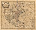 A map of North America, LOC 74694148.jpg 7,434 × 6,167; 6.67 MB
-
 A map of North America, LOC 74694148.tif 7,434 × 6,167; 131.17 MB
-
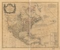
 A map of North America, LOC 74694149.jpg 7,129 × 5,935; 6.51 MB
-
 Cantonment of the forces in North America 11th. Octr. 1765. LOC gm72002043.jpg 7,360 × 6,181; 4.82 MB
-
 Cantonment of the forces in North America 11th. Octr. 1765. LOC gm72002043.tif 7,360 × 6,181; 130.15 MB
-
 Descripcion de las costas, islas placeres, i bajos delas, Indias Occidentales, LOC 75695815.jpg 11,202 × 7,274; 14.93 MB
-
 Descripcion de las costas, islas placeres, i bajos delas, Indias Occidentales, LOC 75695815.tif 11,202 × 7,274; 233.13 MB
-
 North america 1765globe.jpg 1,504 × 1,000; 587 KB


