File:2009 Yukon Quest map.svg
Jump to navigation
Jump to search

Size of this PNG preview of this SVG file: 464 × 399 pixels. Other resolutions: 279 × 240 pixels | 558 × 480 pixels | 893 × 768 pixels | 1,191 × 1,024 pixels | 2,382 × 2,048 pixels.
Original file (SVG file, nominally 464 × 399 pixels, file size: 61 KB)
Captions
Captions
Add a one-line explanation of what this file represents
Summary
[edit]
| Description |
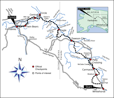
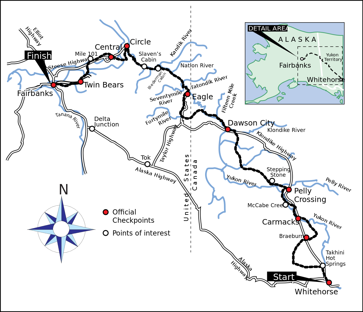
English: A map of the trail for the Yukon Quest International Sled Dog race, including checkpoints and points of interest. |
| Date | |
| Source |
Own work using:
|
| Author | JKBrooks85 |
Licensing
[edit]
| I, the copyright holder of this work, release this work into the public domain. This applies worldwide. In some countries this may not be legally possible; if so: I grant anyone the right to use this work for any purpose, without any conditions, unless such conditions are required by law. |
File history
Click on a date/time to view the file as it appeared at that time.
| Date/Time | Thumbnail | Dimensions | User | Comment | |
|---|---|---|---|---|---|
| current | 00:25, 26 August 2009 | | 464 × 399 (61 KB) | JKBrooks85 (talk | contribs) | {{Information |Description={{en|1=A map of the route of the 2009 Yukon Quest}} |Source=Own work by uploader |Author=JKBrooks85 |Date=2009-08-25 |Permission= |other_versions= }} Category:Yukon Quest |
You cannot overwrite this file.
File usage on Commons
There are no pages that use this file.
File usage on other wikis
The following other wikis use this file:
- Usage on de.wikipedia.org
- Usage on en.wikipedia.org
- Usage on fr.wikipedia.org
- Usage on pl.wikipedia.org
- Usage on ru.wikipedia.org
- Usage on sv.wikipedia.org