Category:Maps of Yukon
Jump to navigation
Jump to search
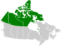
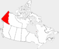
Provinces and territories of Canada: Alberta · British Columbia · Manitoba · New Brunswick · Newfoundland and Labrador · Nova Scotia · Ontario · Prince Edward Island · Quebec · Saskatchewan · Northwest Territories · Nunavut · Yukon
Wikimedia category | |||||
| Upload media | |||||
| Instance of | |||||
|---|---|---|---|---|---|
| Category combines topics | |||||
| Yukon | |||||
territory of Canada .jpg) someja dfa satełite in łujo     | |||||
| Instance of | |||||
| Part of | |||||
| Named after | |||||
| Location | Canada | ||||
| Capital | |||||
| Basic form of government |
| ||||
| Legislative body |
| ||||
| Executive body |
| ||||
| Official language | |||||
| Head of government |
| ||||
| Inception |
| ||||
| Highest point |
| ||||
| Population |
| ||||
| Area |
| ||||
| Replaces |
| ||||
| Different from | |||||
| Minimum temperature record |
| ||||
| official website | |||||
 | |||||
Subcategories
This category has the following 8 subcategories, out of 8 total.
E
- Election maps of Yukon (19 F)
F
- Flag maps of Yukon (2 F)
L
- Location maps of Yukon (3 F)
- Locator maps of Yukon (30 F)
S
- SVG maps of Yukon (15 F)
T
- Topographic maps of Yukon (8 F)
Media in category "Maps of Yukon"
The following 85 files are in this category, out of 85 total.
-
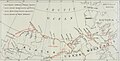
 PIKE(1896) Map of the Pelly Lakes and Surrounding Districts.jpg 2,675 × 2,437; 3.13 MB
-
 (1898) YUKON & MACKENZIE RIVERS.jpg 2,331 × 2,217; 2.46 MB
-
 (1898) YUKON GOLDFIELDS.jpg 539 × 963; 360 KB
-

-
 1967 Yukon Flotilla Log Book Color Cover.jpg 682 × 1,016; 113 KB
-
 1967 Yukon River Flotilla Watershed Map.jpg 423 × 679; 99 KB
-
 2009 Yukon Quest map.svg 464 × 399; 61 KB
-
 Alaska Highway1.png 2,083 × 2,028; 58 KB
-
 Alaska Panhandle-relief Cassiar Mountains.png 1,176 × 731; 1.49 MB
-
 Alaska Panhandle-relief Interior Mountains.png 1,176 × 731; 1.48 MB
-
 Alaska Panhandle-relief Logan Mountains.png 1,176 × 731; 1.49 MB
-
 Alaska Panhandle-relief Mackenzie Mountains.png 1,176 × 731; 1.47 MB
-
 Alaska Panhandle-relief Ogilvie Mountains.png 1,176 × 731; 1.49 MB
-
 Alaska Panhandle-relief Wrangell Mountains.png 1,176 × 731; 1.49 MB
-
 Alaska Panhandle-relief Yukon Plateau.png 1,176 × 731; 1.47 MB
-
 AlaskaHWY canadaMap.png 287 × 337; 32 KB
-
 An expedition through the Yukon district (microform) (1892) (19995044764).jpg 1,690 × 2,244; 841 KB
-
 An expedition through the Yukon district (microform) (1892) (19995048194).jpg 1,980 × 1,828; 681 KB
-
 An expedition through the Yukon district (microform) (1892) (20617595805).jpg 1,942 × 2,636; 793 KB
-
 Canada territories map.png 262 × 212; 4 KB
-
 Canada territories map.svg 403 × 306; 32 KB
-
 CentennialRangeNRCmap cropped.jpg 1,444 × 973; 2.21 MB
-
 CentennialRangeNRCmap.jpg 4,563 × 5,151; 3.57 MB
-
 Discovery Claim - map - 01.png 742 × 589; 198 KB
-
 Haines Junction highlighted in Yukon.svg 464 × 534; 136 KB
-
 Highway 1 map-YT.png 1,650 × 1,842; 77 KB
-
 Highway 10 map-YT.png 1,650 × 1,842; 78 KB
-
 Highway 11 map-YT.png 1,650 × 1,842; 75 KB
-
 Highway 2 map-YT.png 1,650 × 1,842; 79 KB
-
 Highway 3 map-YT.png 1,650 × 1,842; 77 KB
-
 Highway 37 map-YT.png 1,650 × 1,842; 78 KB
-
 Highway 4 map-YT.png 1,650 × 1,842; 78 KB
-
 Highway 5 map-YT.png 1,650 × 1,842; 79 KB
-
 Highway 6 map-YT.png 1,650 × 1,842; 80 KB
-
 Highway 7 map-YT.png 1,650 × 1,842; 77 KB
-
 Highway 8 map-YT.png 1,650 × 1,842; 79 KB
-
 Highway 9 map-YT.png 1,650 × 1,842; 79 KB
-
 Klondike Gold Rush map.jpg 944 × 602; 100 KB
-
 Klondike Gold Rush map.png 854 × 660; 859 KB
-
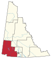
 Klondike(electoraldistrict).jpg 912 × 784; 41 KB
-
 Location map Yukon 2.png 599 × 800; 79 KB
-
 Location map Yukon.png 599 × 800; 50 KB
-
 Location of Dawson City in Yukon - 01.png 434 × 584; 111 KB
-
 Map of Klondike gold fields, 1898 (AL+CA 785).jpg 768 × 630; 95 KB
-
 Map of proposed combined Alaska-Yukon territory.png 814 × 540; 40 KB
-

-
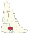
 Mayo-Tatchun.jpg 912 × 784; 41 KB
-
 N 60, W 135.1 - W 70.8, W 120 slope map.png 8,320 × 13,874; 35.98 MB
-
 Northwest-relief.2 BoundaryRanges.png 500 × 500; 514 KB
-
 Porter Creek Centre.jpg 512 × 384; 13 KB
-
 Porter Creek North.jpg 512 × 384; 13 KB
-
 Porter Creek South.jpg 512 × 384; 13 KB
-
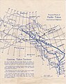 Proposed Route of Pacific-Yukon International Highways.jpg 1,184 × 1,496; 910 KB
-
 Provmap-yk.png 250 × 210; 8 KB
-
 Riverdale South map.jpg 512 × 384; 13 KB
-
 Territories region.png 281 × 230; 22 KB
-
 The American Museum journal (1912) (18156717002).jpg 2,754 × 1,408; 629 KB
-
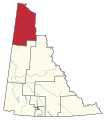
 Vuntut-Gwitchin.jpg 912 × 784; 41 KB
-
 YT Elections Klondike.svg 237 × 273; 209 KB
-
 YT Elections Kluane.svg 237 × 273; 229 KB
-
 YT Elections Lake Laberge.svg 237 × 273; 218 KB
-
 YT Elections Mayo-Tatchun.svg 237 × 273; 222 KB
-
 YT Elections Mount Lorne-Southern Lakes.svg 237 × 273; 212 KB
-
 YT Elections Pelly-Nisutlin.svg 237 × 273; 218 KB
-
 YT Elections Vuntut Gwitchin.svg 237 × 273; 213 KB
-
 YT Elections Watson Lake.svg 237 × 273; 218 KB
-
 YU-Canada-territory.png 852 × 698; 160 KB
-
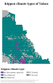 Yukon Köppen.svg 765 × 1,197; 1 MB
-
 Yukon Map-Blank.png 1,650 × 1,842; 71 KB
-
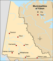 Yukon municipalities.png 2,079 × 2,400; 142 KB
-
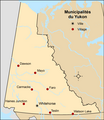 Yukon municipalités.png 2,079 × 2,400; 148 KB
-
 Yukon outline.svg 512 × 581; 214 KB
-
 LGBT Flag map of Yukon.png 2,000 × 3,422; 71 KB
-
 Yukon-CSD-ru.png 2,427 × 3,208; 126 KB
-
 Yukon-ethnic-21cent-rus.png 2,428 × 3,211; 157 KB
-
 Yukon-First-Nations-rus.png 2,430 × 3,211; 194 KB
-
 Yukon-G.gif 100 × 141; 1 KB
-
 Yukon-L.gif 100 × 141; 1 KB
-
 Yukon-NDP.gif 100 × 141; 2 KB
-
 Yukon-tribes19c-rus.png 2,820 × 3,372; 137 KB
-
 Yukon-Y.gif 100 × 141; 1 KB
-
 Yukon-YP.gif 100 × 141; 2 KB
-
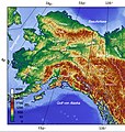 Yukon.jpg 774 × 816; 502 KB
-
 YukonWhitePassRailmap.png 396 × 481; 11 KB
-
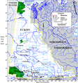 Yukonwikimap.PNG 863 × 926; 96 KB
_Map_of_the_Pelly_Lakes_and_Surrounding_Districts.jpg)
_YUKON_%26_MACKENZIE_RIVERS.jpg)
_YUKON_GOLDFIELDS.jpg)


_(1892)_(19995044764).jpg)
_(1892)_(19995048194).jpg)
_(1892)_(20617595805).jpg)


.jpg)


.jpg)

.jpg)


_(18156717002).jpg)


