Commons:Wiki Loves Monuments in Switzerland/Bern/P-T
Jump to navigation
Jump to search
Péry
| Location | Upload | Photo | Object | Cat. | Coordinates | KGS-Nr | |
|---|---|---|---|---|---|---|---|
| Péry | 
|
Vigier Cement AG, Firmenarchiv | B | 47°10′23″N 7°14′55″E / 47.173168304°N 7.248553057°E | 8819 | ||
Péry-La Heutte
| Location | Upload | Photo | Object | Cat. | Coordinates | KGS-Nr | |
|---|---|---|---|---|---|---|---|
| Péry-La Heutte | 
|
Taubenlochschlucht | ISOS | 47°09′28″N 7°15′53″E / 47.1578°N 7.26472°E | |||
Petit-Val
| Location | Upload | Photo | Object | Cat. | Coordinates | KGS-Nr | |
|---|---|---|---|---|---|---|---|
| Petit-Val | 
|
Châtelat | ISOS | 47°16′00″N 7°12′00″E / 47.266666666°N 7.2°E | |||
| Petit-Val | 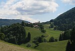
|
Souboz | ISOS | 47°16′32″N 7°14′40″E / 47.275555555°N 7.244444444°E | |||
Pieterlen
| Location | Upload | Photo | Object | Cat. | Coordinates | KGS-Nr | |
|---|---|---|---|---|---|---|---|
| Pieterlen | 
|
Himmelhaus | B | 47°10′33″N 7°20′12″E / 47.17587°N 7.336663°E | 1157 | ||
| Pieterlen | 
|
r. Kirche | B | 47°10′35″N 7°20′09″E / 47.176499392°N 7.335936652°E | 1158 | ||
Plateau de Diesse
| Location | Upload | Photo | Object | Cat. | Coordinates | KGS-Nr | |
|---|---|---|---|---|---|---|---|
| Plateau de Diesse | 
|
Diesse | ISOS | 47°06′55″N 7°07′05″E / 47.115277777°N 7.118055555°E | |||
| Plateau de Diesse | 
|
Diesse | ISOS | 47°06′55″N 7°07′05″E / 47.115277777°N 7.118055555°E | |||
| Plateau de Diesse | 
|
Temple | B | 47°06′44″N 7°07′02″E / 47.112277°N 7.117341°E | 873 | ||
Pohlern
| Location | Upload | Photo | Object | Cat. | Coordinates | KGS-Nr | |
|---|---|---|---|---|---|---|---|
| Pohlern | 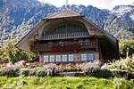
|
Bauernhaus Mätteli | A | 46°43′27″N 7°32′18″E / 46.724194444°N 7.538469444°E | 9772 | ||
| Pohlern | 
|
Bauernhaus, Rohrmoos | A | 46°43′10″N 7°32′33″E / 46.719430555°N 7.542622222°E | 1160 | ||
Radelfingen
| Location | Upload | Photo | Object | Cat. | Coordinates | KGS-Nr | |
|---|---|---|---|---|---|---|---|
| Radelfingen | 
|
r. Kirche mit Pfarrhaus | B | 47°01′18″N 7°16′27″E / 47.021577881°N 7.274149568°E | 1162 | ||
Rapperswil
| Location | Upload | Photo | Object | Cat. | Coordinates | KGS-Nr | |
|---|---|---|---|---|---|---|---|
| Rapperswil | 
|
Bangerten | ISOS | 47°03′20″N 7°26′59″E / 47.055555555°N 7.449722222°E | |||
| Rapperswil | 
|
Moosaffoltern | ISOS | 47°02′36″N 7°26′21″E / 47.043314°N 7.439056°E | |||
| Rapperswil | 
|
r. Kirche | B | 47°03′47″N 7°24′36″E / 47.063114577°N 7.409936063°E | 1163 | ||
| Rapperswil | 
|
Seewil | ISOS | 47°02′52″N 7°24′35″E / 47.0477°N 7.4096°E | |||
| Rapperswil | 
|
Zimlisberg | ISOS | 47°04′30″N 7°25′02″E / 47.074962°N 7.417221°E | |||
Reconvilier
| Location | Upload | Photo | Object | Cat. | Coordinates | KGS-Nr | |
|---|---|---|---|---|---|---|---|
| Reconvilier | 
|
Reconvilier | ISOS | 47°14′10″N 7°13′20″E / 47.236111111°N 7.222222222°E | |||
Reichenbach im Kandertal
| Location | Upload | Photo | Object | Cat. | Coordinates | KGS-Nr | |
|---|---|---|---|---|---|---|---|
| Reichenbach im Kandertal | 
|
Gasthof Bären | A | 46°37′32″N 7°41′40″E / 46.625602777°N 7.694358333°E | 1165 | ||
| Reichenbach im Kandertal | Letzi Mülenen, Talsperre | Letzi Mülenen, Talsperre | A | 46°38′16″N 7°41′31″E / 46.637761111°N 7.692°E | 10424 | ||
| Reichenbach im Kandertal | 
|
Notar-Sieber-Haus | A | 46°37′31″N 7°41′38″E / 46.625152777°N 7.693872222°E | 9233 | ||
| Reichenbach im Kandertal | 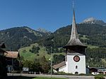
|
reformierte Kirche | B | 46°37′34″N 7°41′39″E / 46.62610752°N 7.694100114°E | 1166 | ||
| Reichenbach im Kandertal | 
|
Reudlen, alte Kaplanei (Heidenhaus) | B | 46°37′19″N 7°40′47″E / 46.621820868°N 7.679848468°E | 1167 | ||
| Reichenbach im Kandertal | 
|
Schwandi, Haus Wittwer | B | 46°36′15″N 7°40′16″E / 46.604099758°N 7.67108985°E | 1168 | ||
Renan
| Location | Upload | Photo | Object | Cat. | Coordinates | KGS-Nr | |
|---|---|---|---|---|---|---|---|
| Renan | 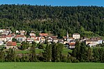
|
Renan | ISOS | 47°07′34″N 6°55′33″E / 47.1261°N 6.9259°E | |||
| Renan | 
|
Temple | B | 47°07′38″N 6°55′45″E / 47.12722°N 6.92917°E | 1169 | ||
Reutigen
| Location | Upload | Photo | Object | Cat. | Coordinates | KGS-Nr | |
|---|---|---|---|---|---|---|---|
| Reutigen | 
|
r. Kirche | B | 46°41′35″N 7°37′10″E / 46.693176892°N 7.619570815°E | 1170 | ||
Riggisberg
| Location | Upload | Photo | Object | Cat. | Coordinates | KGS-Nr | |
|---|---|---|---|---|---|---|---|
| Riggisberg | 
|
Abegg-Stiftung | B | 46°48′55″N 7°29′40″E / 46.815416°N 7.494546°E | 1171 | ||
| Riggisberg | 
|
Abegg-Stiftung | A | 46°48′56″N 7°29′41″E / 46.815555555°N 7.494722222°E | 8547 | ||
| Riggisberg | 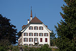
|
Schloss Riggisberg | B | 46°48′31″N 7°28′18″E / 46.808637911°N 7.471781248°E | 1172 | ||
| Riggisberg | 
|
Speicherstöckli, Grund Nr. 15 (111A) | A | 46°46′32″N 7°29′01″E / 46.775455555°N 7.483561111°E | 1196 | ||
Ringgenberg
| Location | Upload | Photo | Object | Cat. | Coordinates | KGS-Nr | |
|---|---|---|---|---|---|---|---|
| Ringgenberg | 
|
Goldswil, Kirchenruine | B | 46°41′48″N 7°52′49″E / 46.696559593°N 7.8802868°E | 1174 | ||
| Ringgenberg | 
|
Kirche und Burgruine | A | 46°42′04″N 7°53′49″E / 46.700988888°N 7.897055555°E | 1175 | ||
| Ringgenberg | 
|
Ringgenberg | ISOS | 46°42′10″N 7°53′42″E / 46.7029°N 7.8951°E | |||
Roggwil
| Location | Upload | Photo | Object | Cat. | Coordinates | KGS-Nr | |
|---|---|---|---|---|---|---|---|
| Roggwil | 
|
Gasthof Bären | B | 47°14′26″N 7°49′30″E / 47.240616064°N 7.824884032°E | 1176 | ||
| Roggwil | 
|
r. Kirche | B | 47°14′24″N 7°49′18″E / 47.239907313°N 7.821643108°E | 1177 | ||
Rohrbach
| Location | Upload | Photo | Object | Cat. | Coordinates | KGS-Nr | |
|---|---|---|---|---|---|---|---|
| Rohrbach | 
|
Rohrbach BE | ISOS | 47°08′14″N 7°48′50″E / 47.137222222°N 7.813888888°E | |||
Röthenbach im Emmental
| Location | Upload | Photo | Object | Cat. | Coordinates | KGS-Nr | |
|---|---|---|---|---|---|---|---|
| Röthenbach im Emmental | 
|
Alp Gabelspitz | A | 46°49′47″N 7°47′19″E / 46.829730555°N 7.788516666°E | 9237 | ||
| Röthenbach im Emmental | 
|
Kirche Würzbrunnen | A | 46°51′49″N 7°44′13″E / 46.863516666°N 7.737058333°E | 1178 | ||
Rubigen
| Location | Upload | Photo | Object | Cat. | Coordinates | KGS-Nr | |
|---|---|---|---|---|---|---|---|
| Rubigen | 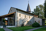
|
Kirche Kleinhöchstetten | B | 46°54′12″N 7°31′53″E / 46.903325975°N 7.531358526°E | 1179 | ||
| Rubigen | 
|
Kleinhöchstetten | ISOS | 46°38′42″N 7°25′11″E / 46.6451°N 7.4198°E | |||
| Rubigen | 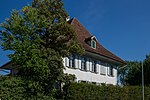
|
Schloss | B | 46°53′48″N 7°32′45″E / 46.896656692°N 7.545913606°E | 1180 | ||
Rüderswil
| Location | Upload | Photo | Object | Cat. | Coordinates | KGS-Nr | |
|---|---|---|---|---|---|---|---|
| Rüderswil | 
|
Ried | ISOS | 47°01′47″N 7°52′42″E / 47.02983°N 7.87833°E | |||
| Rüderswil | 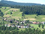
|
Rüderswil | ISOS | 46°59′04″N 7°43′26″E / 46.984444444°N 7.723888888°E | |||
Rüdtligen-Alchenflüh
| Location | Upload | Photo | Object | Cat. | Coordinates | KGS-Nr | |
|---|---|---|---|---|---|---|---|
| Rüdtligen-Alchenflüh | 
|
Alchenflüh, Alte Mühle | B | 47°04′55″N 7°34′48″E / 47.08186°N 7.57997°E | 1183 | ||
| Rüdtligen-Alchenflüh | 
|
Alchenflüh, Gasthof Bären | B | 47°04′56″N 7°34′52″E / 47.082145678°N 7.581246224°E | 1184 | ||
Rüeggisberg
| Location | Upload | Photo | Object | Cat. | Coordinates | KGS-Nr | |
|---|---|---|---|---|---|---|---|
| Rüeggisberg | 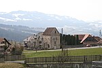
|
Kloster Rüeggisberg | A | 46°49′11″N 7°26′14″E / 46.819722222°N 7.437222222°E | 1186 | ||
| Rüeggisberg | 
|
Oberbütschel | ISOS | 46°50′17″N 7°27′48″E / 46.8381°N 7.4633°E | |||
| Rüeggisberg | 
|
reformierte Kirche | B | 46°49′16″N 7°26′19″E / 46.8212°N 7.438699°E | 1188 | ||
| Rüeggisberg | 
|
Rüeggisberg | ISOS | 46°49′18″N 7°26′22″E / 46.8218°N 7.4394°E | |||
| Rüeggisberg | 
|
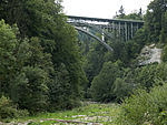
Schwandbachbrücke | A | 46°49′46″N 7°24′09″E / 46.829333333°N 7.402411111°E | 1185 | ||
| Rüeggisberg | 
|
Schwanden | ISOS | 46°48′51″N 7°24′46″E / 46.81424°N 7.4129°E | |||
Rüegsau
| Location | Upload | Photo | Object | Cat. | Coordinates | KGS-Nr | |
|---|---|---|---|---|---|---|---|
| Rüegsau | 
|
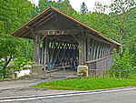
Holzbrücke (vgl. Rüegsau/BE) | A | 47°01′15″N 7°38′56″E / 47.020916666°N 7.648825°E | 10492 | ||
| Rüegsau | 
|
Holzbrücke (vgl. Rüegsau/BE) | A | 47°01′15″N 7°38′56″E / 47.020916666°N 7.648825°E | 930 | ||
| Rüegsau | 
|
r. Kirche mit Pfarrhaus | B | 47°01′29″N 7°40′28″E / 47.024782521°N 7.674516294°E | 1189 | ||
| Rüegsau | 
|
Rüegsbach, r. Kirche | B | 47°02′02″N 7°41′30″E / 47.033920964°N 7.691765159°E | 1190 | ||
Rumendingen
| Location | Upload | Photo | Object | Cat. | Coordinates | KGS-Nr | |
|---|---|---|---|---|---|---|---|
| Rumendingen | 
|
Rumendingen | ISOS | 47°06′19″N 7°38′39″E / 47.105277777°N 7.644166666°E | |||
Rümligen
| Location | Upload | Photo | Object | Cat. | Coordinates | KGS-Nr | |
|---|---|---|---|---|---|---|---|
| Rümligen | 
|
Schloss Rümligen | A | 46°49′45″N 7°29′24″E / 46.829283°N 7.489897°E | 1192 | ||
Rüti bei Büren
| Location | Upload | Photo | Object | Cat. | Coordinates | KGS-Nr | |
|---|---|---|---|---|---|---|---|
| Rüti bei Büren | 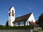
|
r. Kirche mit Pfarrhaus | B | 47°09′07″N 7°24′14″E / 47.152029284°N 7.403757548°E | 1194 | ||
| Rüti bei Büren | 
|
Rüti bei Büren | ISOS | 47°09′10″N 7°24′20″E / 47.152777777°N 7.405555555°E | |||
| Rüti bei Büren | 
|
Teufelsburg, Wallanlage | B | 47°08′51″N 7°25′36″E / 47.147446729°N 7.426635529°E | 1195 | ||
Saanen
| Location | Upload | Photo | Object | Cat. | Coordinates | KGS-Nr | |
|---|---|---|---|---|---|---|---|
| Saanen | 
|
Alte Kastlanei | A | 46°29′22″N 7°16′06″E / 46.489469°N 7.268398°E | 1198 | ||
| Saanen | 
|
Gstaad Palace | B | 46°28′23″N 7°17′22″E / 46.47314°N 7.28944°E | 1197 | ||
| Saanen | 
|
Kirche Saanen | A | 46°29′25″N 7°15′30″E / 46.490236111°N 7.258313888°E | 1200 | ||
| Saanen | 
|
reformierte St. Anna-Kapelle und Pfarrhaus | B | 46°29′25″N 7°15′32″E / 46.490283652°N 7.258834657°E | 1201 | ||
| Saanen | 
|
Saanen | ISOS | 46°28′59″N 7°15′59″E / 46.483055555°N 7.266388888°E | |||
Saicourt
| Location | Upload | Photo | Object | Cat. | Coordinates | KGS-Nr | |
|---|---|---|---|---|---|---|---|
| Saicourt | 
|
Bellelay, ancienne abbatiale | B | 47°15′51″N 7°10′07″E / 47.264105699°N 7.168553688°E | 1202 | ||
| Saicourt | 
|
Kloster Bellelay | A+ISOS | 47°15′50″N 7°10′07″E / 47.263888888°N 7.168611111°E | 1203 | ||
Saint-Imier
| Location | Upload | Photo | Object | Cat. | Coordinates | KGS-Nr | |
|---|---|---|---|---|---|---|---|
| Saint-Imier | 
|
Centre jurassien d'archives et de recherches (CEJARE) et Mémoires d'ici. Centre de recherche et de documentation du Jura bernois | B | 47°09′10″N 6°59′45″E / 47.152683°N 6.995815°E | 10584 | ||
| Saint-Imier | 
|
Collégiale | A | 47°09′09″N 6°59′48″E / 47.152575°N 6.996630555°E | 1245 | ||
| Saint-Imier | 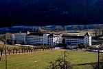
|
Fabrique de montres Longines | A | 47°08′57″N 7°00′13″E / 47.149291666°N 7.003513888°E | 9282 | ||
| Saint-Imier | 
|
Saint-Imier | ISOS | 47°09′10″N 7°00′00″E / 47.152777777°N 7.0°E | |||
| Saint-Imier | 
|
Tour de la Reine Berthe (St-Martin) | B | 47°09′07″N 6°59′47″E / 47.151903°N 6.99652°E | 1246 | ||
Sankt Stephan
| Location | Upload | Photo | Object | Cat. | Coordinates | KGS-Nr | |
|---|---|---|---|---|---|---|---|
| Sankt Stephan | 
|
Grodey, Haus Perren-Gobeli Nr. 311 | B | 46°30′35″N 7°23′56″E / 46.509850064°N 7.398897992°E | 1240 | ||
| Sankt Stephan | 
|
Ried, r. Kirche | B | 46°31′09″N 7°23′03″E / 46.51929017°N 7.384230341°E | 1241 | ||
Sauge
| Location | Upload | Photo | Object | Cat. | Coordinates | KGS-Nr | |
|---|---|---|---|---|---|---|---|
| Sauge | 
|
Taubenlochschlucht | ISOS | 47°09′28″N 7°15′53″E / 47.1578°N 7.26472°E | |||
Schangnau
| Location | Upload | Photo | Object | Cat. | Coordinates | KGS-Nr | |
|---|---|---|---|---|---|---|---|
| Schangnau | 
|
Altes Schulhaus (bei der Kirche) | B | 46°49′42″N 7°51′49″E / 46.82841°N 7.863478°E | 1204 | ||
| Schangnau | 
|
Gasthof Löwen | B | 46°49′40″N 7°51′40″E / 46.82779°N 7.860982°E | 1205 | ||
| Schangnau | 
|
Kemmeribodenbad | B | 46°48′08″N 7°56′07″E / 46.802259°N 7.935257°E | 1206 | ||
| Schangnau | 
|
Krämerhaus | A | 46°49′39″N 7°51′38″E / 46.827391666°N 7.860597222°E | 9238 | ||
| Schangnau | 
|
reformierte Kirche | B | 46°49′41″N 7°51′49″E / 46.828184°N 7.863738°E | 1207 | ||
Schattenhalb
| Location | Upload | Photo | Object | Cat. | Coordinates | KGS-Nr | |
|---|---|---|---|---|---|---|---|
| Schattenhalb | 
|
Reichenbachfall-Bahn | A | 46°43′10″N 8°11′16″E / 46.7195°N 8.1877°E | 9921 | ||
Schlosswil
| Location | Upload | Photo | Object | Cat. | Coordinates | KGS-Nr | |
|---|---|---|---|---|---|---|---|
| Schlosswil | 
|
Pfarrhaus | B | 46°54′32″N 7°36′24″E / 46.908997567°N 7.606750754°E | 1209 | ||
| Schlosswil | 
|
reformierte Kirche | B | 46°54′33″N 7°36′20″E / 46.909044269°N 7.605569565°E | 1210 | ||
| Schlosswil | 
|
Schloss Wil | A | 46°54′29″N 7°36′29″E / 46.908067°N 7.607996°E | 1211 | ||
Schüpfen
| Location | Upload | Photo | Object | Cat. | Coordinates | KGS-Nr | |
|---|---|---|---|---|---|---|---|
| Schüpfen | 
|
Müngerstock mit Nebengebäuden | B | 47°02′12″N 7°22′34″E / 47.036790588°N 7.376005107°E | 1212 | ||
| Schüpfen | 
|
Schwanden | ISOS | 47°02′11″N 7°24′07″E / 47.0363°N 7.40198°E | |||
| Schüpfen | 
|
Winterswil | ISOS | 47°01′30″N 7°21′24″E / 47.025°N 7.3568°E | |||
Schwarzenburg
Seeberg
| Location | Upload | Photo | Object | Cat. | Coordinates | KGS-Nr | |
|---|---|---|---|---|---|---|---|
| Seeberg | 
|
Aeschi SO–Burgäschisee Ost | ISOS | 47°10′07″N 7°40′20″E / 47.1687°N 7.67236°E | |||
| Seeberg | 
|
Aeschi SO–Burgäschisee Ost | UNESCO | 47°10′07″N 7°40′20″E / 47.1687°N 7.67236°E | |||
| Seeberg | 
|
Fürsteiner, mittelsteinzeitliche Freilandsiedlung | B | 47°09′58″N 7°39′35″E / 47.166214307°N 7.659813108°E | 1213 | ||
| Seeberg | 
|
r. Kirche mit Pfarrhaus | B | 47°09′32″N 7°40′12″E / 47.158863308°N 7.670068783°E | 1214 | ||
| Seeberg | 
|
Riedtwil | ISOS | 47°08′21″N 7°41′42″E / 47.13919°N 7.69505°E | |||
Seedorf
| Location | Upload | Photo | Object | Cat. | Coordinates | KGS-Nr | |
|---|---|---|---|---|---|---|---|
| Seedorf | 
|
Kloster Frienisberg | B | 47°01′37″N 7°19′54″E / 47.027030555°N 7.331655555°E | 1216 | ||
| Seedorf | 
|
r. Kirche | B | 47°02′03″N 7°18′41″E / 47.034257°N 7.3112897°E | 1217 | ||
Seftigen
| Location | Upload | Photo | Object | Cat. | Coordinates | KGS-Nr | |
|---|---|---|---|---|---|---|---|
| Seftigen | 
|
Bauernhaus | B | 46°47′18″N 7°32′24″E / 46.788313489°N 7.539870221°E | 1218 | ||
Signau
| Location | Upload | Photo | Object | Cat. | Coordinates | KGS-Nr | |
|---|---|---|---|---|---|---|---|
| Signau | 
|
Krämerhaus (Haus Beck) | B | 46°55′15″N 7°43′34″E / 46.920769639°N 7.726221323°E | 1221 | ||
| Signau | 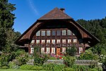
|
Liechtgut, Hofgruppe | B | 46°55′13″N 7°43′28″E / 46.920144728°N 7.724314305°E | 1222 | ||
| Signau | 
|
Moserhaus (ehem. Färberei) | B | 46°54′53″N 7°43′01″E / 46.914855767°N 7.716869119°E | 1223 | ||
| Signau | 
|
r. Kirche, Pfarrhaus und gedeckte Verbindungsbrücke | B | 46°55′14″N 7°43′28″E / 46.920593835°N 7.724579276°E | 1224 | ||
| Signau | 
|
Schüpbach, gedeckte Holzbrücke über die Emme | B | 46°55′47″N 7°44′15″E / 46.929691534°N 7.737364953°E | 1225 | ||
| Signau | 
|
Signau | ISOS | 46°55′18″N 7°43′36″E / 46.921666666°N 7.726666666°E | |||
Sigriswil
| Location | Upload | Photo | Object | Cat. | Coordinates | KGS-Nr | |
|---|---|---|---|---|---|---|---|
| Sigriswil | 
|
Merligen, Kalkofen | B | 46°41′31″N 7°44′38″E / 46.691878016°N 7.743893543°E | 1226 | ||
| Sigriswil | 
|
r. Kirche mit Pfarrhaus und Pfarrstöckli | B | 46°43′01″N 7°42′40″E / 46.717031697°N 7.711206087°E | 1227 | ||
| Sigriswil | Schloss Ralligen | Schloss Ralligen | B | 46°42′26″N 7°43′34″E / 46.707141°N 7.726036°E | 1228 | ||
| Sigriswil | 
|
Wiler | ISOS | 46°42′50″N 7°43′48″E / 46.71382°N 7.73012°E | |||
Siselen
| Location | Upload | Photo | Object | Cat. | Coordinates | KGS-Nr | |
|---|---|---|---|---|---|---|---|
| Siselen | 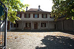
|
Pfarrhaus | A | 47°01′53″N 7°11′20″E / 47.031486111°N 7.188980555°E | 1229 | ||
| Siselen | 
|
Siselen | ISOS | 47°01′57″N 7°11′46″E / 47.03258°N 7.19602°E | |||
Sonvilier
| Location | Upload | Photo | Object | Cat. | Coordinates | KGS-Nr | |
|---|---|---|---|---|---|---|---|
| Sonvilier | 
|
Ferme de la Grande Coronelle | A | 47°09′44″N 6°56′41″E / 47.162302777°N 6.944627777°E | 1230 | ||
| Sonvilier | 
|
Ruines du Château d'Erguël | B | 47°08′09″N 6°58′40″E / 47.135818°N 6.977803°E | 1231 | ||
Sornetan
| Location | Upload | Photo | Object | Cat. | Coordinates | KGS-Nr | |
|---|---|---|---|---|---|---|---|
| Sornetan | 
|
Eglise réformée | A | 47°16′27″N 7°12′50″E / 47.274047222°N 7.213972222°E | 1233 | ||
Souboz
| Location | Upload | Photo | Object | Cat. | Coordinates | KGS-Nr | |
|---|---|---|---|---|---|---|---|
| Souboz | 
|
Souboz | ISOS | 47°16′32″N 7°14′40″E / 47.275555555°N 7.244444444°E | |||
Spiez
| Location | Upload | Photo | Object | Cat. | Coordinates | KGS-Nr | |
|---|---|---|---|---|---|---|---|
| Spiez | 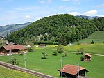
|
Bürg, prähistorische / mittelalterliche Höhensiedlung | A | 46°40′51″N 7°41′43″E / 46.680930555°N 7.695208333°E | 9578 | ||
| Spiez | 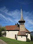
|
Einigen, reformierte Kirche | B | 46°42′34″N 7°38′46″E / 46.709413874°N 7.646237731°E | 1235 | ||
| Spiez | 
|
Lattigen, ehemaliges Jagdschlösschen | B | 46°41′28″N 7°39′05″E / 46.691233305°N 7.651331756°E | 1238 | ||
| Spiez | 
|
Neue protestantische Kirche | B | 46°41′27″N 7°40′37″E / 46.690867683°N 7.677045097°E | 9922 | ||
| Spiez | Reformierte Schlosskirche | Reformierte Schlosskirche | A | 46°41′21″N 7°41′18″E / 46.689033333°N 7.68845°E | 1236 | ||
| Spiez | 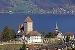
|
Schloss Spiez | A | 46°41′22″N 7°41′15″E / 46.689416666°N 7.687416666°E | 1237 | ||
| Spiez | 
|
Weinbauernhof, Spiezbergstrasse | A | 46°41′27″N 7°41′02″E / 46.690805555°N 7.684013888°E | 9239 | ||
Steffisburg
| Location | Upload | Photo | Object | Cat. | Coordinates | KGS-Nr | |
|---|---|---|---|---|---|---|---|
| Steffisburg | 
|
Ehemalige Regie Steffisburg | A | 46°45′46″N 7°36′58″E / 46.762869444°N 7.616141666°E | 9089 | ||
| Steffisburg | 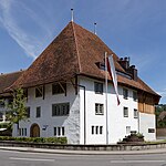
|
Höchhäuser | B | 46°46′40″N 7°38′14″E / 46.777751231°N 7.637269634°E | 1242 | ||
| Steffisburg | 
|
Landsitz Ortbühl, mit Oekonomiegebäude | B | 46°46′52″N 7°37′33″E / 46.781188703°N 7.625889744°E | 1243 | ||
| Steffisburg | 
|
reformierte Kirche mit Pfarrhaus | B | 46°46′54″N 7°38′02″E / 46.781805051°N 7.633879838°E | 1244 | ||
Stettlen
| Location | Upload | Photo | Object | Cat. | Coordinates | KGS-Nr | |
|---|---|---|---|---|---|---|---|
| Stettlen | 
|
Worblental | ISOS | 46°57′22″N 7°32′16″E / 46.9561°N 7.53782°E | |||
Stocken-Höfen
| Location | Upload | Photo | Object | Cat. | Coordinates | KGS-Nr | |
|---|---|---|---|---|---|---|---|
| Stocken-Höfen | 
|
Burgruine Jagdburg | B | 46°42′54″N 7°34′47″E / 46.714867596°N 7.57962216°E | 944 | ||
Studen
| Location | Upload | Photo | Object | Cat. | Coordinates | KGS-Nr | |
|---|---|---|---|---|---|---|---|
| Studen | 
|
Studenberg, keltisches Oppidum und gallo-römischer Tempelbezirk | B | 47°06′31″N 7°16′58″E / 47.108545°N 7.282807°E | 1248 | ||
| Studen | 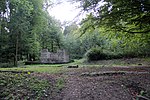
|
Vicus Petinesca | A | 47°06′42″N 7°17′27″E / 47.111783333°N 7.290808333°E | 1247 | ||
Sumiswald
| Location | Upload | Photo | Object | Cat. | Coordinates | KGS-Nr | |
|---|---|---|---|---|---|---|---|
| Sumiswald | 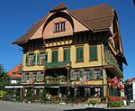
|
Gasthof Bären | A | 47°01′39″N 7°44′45″E / 47.027561111°N 7.745841666°E | 9240 | ||
| Sumiswald | 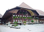
|
Gasthof Kreuz | B | 47°01′22″N 7°44′28″E / 47.022647797°N 7.741170739°E | 9923 | ||
| Sumiswald | 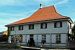
|
Pfarrhaus | A | 47°01′41″N 7°44′46″E / 47.027938888°N 7.745975°E | 9241 | ||
| Sumiswald | 
|
Reformierte Kirche | A | 47°01′40″N 7°44′42″E / 47.027761111°N 7.745013888°E | 1250 | ||
| Sumiswald | 
|
Schloss Spittel | B | 47°01′55″N 7°45′46″E / 47.032033597°N 7.762865577°E | 1251 | ||
| Sumiswald | 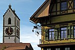
|
Sumiswald | ISOS | 47°01′39″N 7°44′43″E / 47.027469444°N 7.745261111°E | |||
Sutz-Lattrigen
| Location | Upload | Photo | Object | Cat. | Coordinates | KGS-Nr | |
|---|---|---|---|---|---|---|---|
| Sutz-Lattrigen | 
|
reformierte Kirche mit Pfarrhaus | B | 47°06′14″N 7°13′01″E / 47.103967008°N 7.216919626°E | 1252 | ||
| Sutz-Lattrigen | 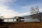
|
Rütte, neolithische /bronzezeitliche Seeufersiedlungen | A | 47°06′20″N 7°12′53″E / 47.105577777°N 7.214680555°E | 9579 | ||
| Sutz-Lattrigen | 
|
Von Rütte-Gut | A | 47°06′10″N 7°12′50″E / 47.102672222°N 7.213969444°E | 9127 | ||
Tavannes
| Location | Upload | Photo | Object | Cat. | Coordinates | KGS-Nr | |
|---|---|---|---|---|---|---|---|
| Tavannes | 
|
Col de Pierre Pertuis | A | 47°12′36″N 7°11′39″E / 47.210102°N 7.194166°E | 9580 | ||
| Tavannes | 
|
Eglise Du Christ-Roi | A | 47°13′18″N 7°11′51″E / 47.221569444°N 7.197427777°E | 9765 | ||
| Tavannes | 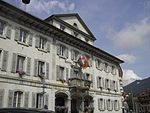
|
Hôtel de Ville | B | 47°13′13″N 7°11′56″E / 47.220191°N 7.198808°E | 1254 | ||
| Tavannes | 
|
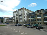
Quartier industriel (Ebauches Tavannes SA, Tavannes Machines SA, Zampa SA) | B | 1255 | |||
| Tavannes | 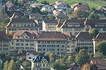
|
Tavannes | ISOS | 47°13′15″N 7°12′05″E / 47.220833333°N 7.201388888°E | |||
Thierachern
| Location | Upload | Photo | Object | Cat. | Coordinates | KGS-Nr | |
|---|---|---|---|---|---|---|---|
| Thierachern | 
|
r. Kirche mit Pfarrhaus | B | 46°45′15″N 7°34′24″E / 46.754185857°N 7.573443033°E | 1257 | ||
Thun
Thunstetten
| Location | Upload | Photo | Object | Cat. | Coordinates | KGS-Nr | |
|---|---|---|---|---|---|---|---|
| Thunstetten | 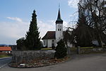
|
reformierte Kirche mit Pfarrhaus | B | 47°12′14″N 7°45′14″E / 47.203772909°N 7.754006978°E | 1278 | ||
| Thunstetten | 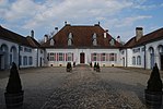
|
Schloss Thunstetten | A | 47°12′19″N 7°45′13″E / 47.205277777°N 7.753611111°E | 1277 | ||
Toffen
| Location | Upload | Photo | Object | Cat. | Coordinates | KGS-Nr | |
|---|---|---|---|---|---|---|---|
| Toffen | 
|
Schloss Toffen | A | 46°51′48″N 7°29′21″E / 46.863447222°N 7.489036111°E | 1279 | ||
Trachselwald
| Location | Upload | Photo | Object | Cat. | Coordinates | KGS-Nr | |
|---|---|---|---|---|---|---|---|
| Trachselwald | 
|
Gasthof Tanne | B | 47°01′01″N 7°44′18″E / 47.016817009°N 7.738415313°E | 9226 | ||
| Trachselwald | 
|
Kirche Trachselwald | A | 47°01′00″N 7°44′15″E / 47.0166°N 7.73763°E | 1281 | ||
| Trachselwald | 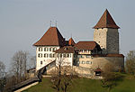
|
Schloss Trachselwald | A | 47°01′03″N 7°44′31″E / 47.017513888°N 7.741877777°E | 1283 | ||
| Trachselwald | 
|
Trachselwald | ISOS | 47°01′01″N 7°44′16″E / 47.016888888°N 7.737872222°E | |||
Tramelan
| Location | Upload | Photo | Object | Cat. | Coordinates | KGS-Nr | |
|---|---|---|---|---|---|---|---|
| Tramelan | 
|
La Chaux de Tramelan | ISOS | 47°13′33″N 7°04′00″E / 47.22572°N 7.06658°E | |||
| Tramelan | 
|
Le Cernil | ISOS | 47°13′56″N 7°04′34″E / 47.2322°N 7.076°E | |||
Trub
| Location | Upload | Photo | Object | Cat. | Coordinates | KGS-Nr | |
|---|---|---|---|---|---|---|---|
| Trub | 
|
Bauernhaus Hinter Hütten | A | 46°58′42″N 7°52′21″E / 46.978405555°N 7.872469444°E | 9767 | ||
| Trub | 
|
Bauernhaus Ober-Brandösch | A | 46°58′22″N 7°53′41″E / 46.972905555°N 7.894816666°E | 9227 | ||
| Trub | 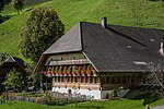
|
Bauernhaus Schmittenhof | A | 46°55′52″N 7°51′23″E / 46.931097222°N 7.856461111°E | 9228 | ||
| Trub | 
|
Gedeckte Fuhrenbrücke (versetzt) über die Trueb | B | 46°56′16″N 7°52′28″E / 46.937663741°N 7.874388025°E | 1286 | ||
| Trub | 
|
reformierte Kirche mit Pfarrhaus und Ofenhaus | B | 46°56′35″N 7°52′39″E / 46.94313925°N 7.877453383°E | 1287 | ||
Trubschachen
| Location | Upload | Photo | Object | Cat. | Coordinates | KGS-Nr | |
|---|---|---|---|---|---|---|---|
| Trubschachen | 
|
Gasthof Bären | B | 46°55′24″N 7°50′41″E / 46.923470304°N 7.844599772°E | 1288 | ||
| Trubschachen | Hasenlehn (Baugruppe, Heimatmuseum) | Hasenlehn (Baugruppe, Heimatmuseum) | B | 46°55′20″N 7°50′32″E / 46.922308807°N 7.842358996°E | 1289 | ||
| Trubschachen | 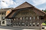
|
Himmelhus | B | 46°55′21″N 7°50′35″E / 46.922396679°N 7.842950481°E | 1290 | ||
Tschugg
| Location | Upload | Photo | Object | Cat. | Coordinates | KGS-Nr | |
|---|---|---|---|---|---|---|---|
| Tschugg | 
|
Landgut Steiger | A | 47°01′35″N 7°04′26″E / 47.0265°N 7.07378°E | 1291 | ||
Twann-Tüscherz
| Location | Upload | Photo | Object | Cat. | Coordinates | KGS-Nr | |
|---|---|---|---|---|---|---|---|
| Twann-Tüscherz | 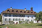
|
Ehemaliges Cluniazenserpriorat | A | 47°04′11″N 7°08′34″E / 47.069705555°N 7.142644444°E | 1294 | ||
| Twann-Tüscherz | 
|
Fraubrunnenhaus | A | 47°05′42″N 7°09′29″E / 47.095127777°N 7.157994444°E | 9229 | ||
| Twann-Tüscherz | 
|
reformierte Kirche | B | 47°05′43″N 7°09′36″E / 47.09534235°N 7.159921927°E | 1295 | ||
| Twann-Tüscherz | 
|
St. Petersinsel | ISOS | 47°04′15″N 7°08′33″E / 47.070833333°N 7.1425°E | |||
| Twann-Tüscherz | 
|
St. Petersinsel, sogenanntes Rousseau-Pavillon | B | 47°04′16″N 7°08′27″E / 47.071142157°N 7.14076°E | 1296 | ||
| Twann-Tüscherz | 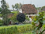
|
Thormanngut (Wingreis) | A | 47°06′06″N 7°10′32″E / 47.1018°N 7.17549°E | 1297 | ||
| Twann-Tüscherz | 
|
Tüscherz | ISOS | 47°06′47″N 7°11′47″E / 47.113°N 7.1965°E | |||
| Twann-Tüscherz | 
|
Twann | ISOS | 47°05′34″N 7°09′39″E / 47.0927°N 7.1609°E | |||
| Twann-Tüscherz | 
|
Wingreis | ISOS | 47°06′07″N 7°11′03″E / 47.102°N 7.1841°E | |||


