Category:Petinesca
Jump to navigation
Jump to search
| Object location | | View all coordinates using: OpenStreetMap |
|---|
archaeological site in Studen in the canton of Bern, Switzerland  | |||||
| Upload media | |||||
| Instance of |
| ||||
|---|---|---|---|---|---|
| Part of | |||||
| Location | Studen, Seeland administrative district, Seeland administrative region, Bern, Switzerland | ||||
| Street address |
| ||||
| Heritage designation | |||||
 | |||||
Media in category "Petinesca"
The following 8 files are in this category, out of 8 total.
-
 ETH-BIB-Petinesca-Tempelbezirk-Dia 247-13181.tif 3,649 × 2,847; 29.83 MB
-
 ETH-BIB-Petinesca-Torturm-Dia 247-13180.tif 3,641 × 2,847; 29.77 MB
-
 Historische Karte CH Rome 1 2016.png 2,500 × 1,594; 542 KB
-
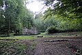
 Petinesca grundsteine.JPG 640 × 480; 193 KB
-
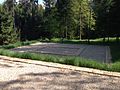
 Petinesca Tempelbezirk Studen.jpg 5,184 × 3,456; 13.46 MB
-
 Tempel Nahaufnahme.JPG 640 × 480; 127 KB
-
 Tempelanlage mit Dach.jpg 548 × 438; 72 KB
-
 Toranlage Petinesca.jpg 548 × 438; 60 KB


