Category:Wisconsin Highway 19
Jump to navigation
Jump to search
 | number: | (nineteen) |
|---|---|---|
| State highways in Wisconsin: | 11 · 12 · 13 · 14 · 15 · 16 · 17 · 19 · 20 · 21 · 22 · 23 · 24 · 25 · 26 · 27 · 28 · 29 · 30 · 31 · 32 · 33 · 34 · 35 · 36 · 37 · 38 · 39 |
state highway in Dane, Dodge, and Jefferson counties in Wisconsin, United States   | |||||
| Upload media | |||||
| Instance of | |||||
|---|---|---|---|---|---|
| Location |
| ||||
| Transport network | |||||
| Owned by | |||||
| Maintained by | |||||
| Length |
| ||||
| Terminus | |||||
| |||||
English: Media related to Wisconsin Highway 19, a 59.37-mile (95.55 km) state highway in Dane, Dodge, and Jefferson counties in Wisconsin, United States.
Subcategories
This category has only the following subcategory.
Media in category "Wisconsin Highway 19"
The following 14 files are in this category, out of 14 total.
-
 Main Street Commercial Historic District Watertown Wisconsin.jpg 1,920 × 1,257; 899 KB
-
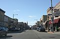
 MarshallWisconsinDowntown.jpg 2,304 × 1,728; 703 KB
-
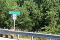 Maunesha River sign.JPG 1,024 × 681; 212 KB
-
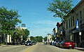
 SunPrairieWisconsin1.jpg 2,304 × 1,728; 726 KB
-
 SunPrairieWisconsin2.jpg 2,299 × 1,581; 1.52 MB
-
 SunPrairieWisconsinDowntown.jpg 2,304 × 1,415; 1.67 MB
-
 Token Creek WI Sign WIS19 looking east.jpg 1,920 × 1,280; 990 KB
-
 WaterlooWisconsinDowntown2WIS89WIS19.jpg 2,304 × 1,347; 1.75 MB
-
 WaunakeeWisconsinDowntown1.jpg 2,304 × 1,667; 1.69 MB
-
 WaunakeeWisconsinDowntown2.jpg 2,304 × 1,728; 747 KB
-
 WaunakeeWisconsinSign.jpg 2,304 × 1,728; 803 KB
-
 WIS 19.svg 384 × 384; 2 KB
-
 Wis-19-map.png 960 × 569; 215 KB
-
 Wisconsin State Highway 19 - panoramio (2).jpg 5,184 × 3,888; 4.85 MB


.jpg)