Category:Wheeldale Gill, North Yorkshire
Jump to navigation
Jump to search
English: Wheedale Gill is a stream and valley, flows into West Beck, then Murk Esk, then River Esk. Valley divides Wheeldale and Egton High Moors
Media in category "Wheeldale Gill, North Yorkshire"
The following 18 files are in this category, out of 18 total.
-
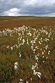 Cottongrass Wheeldale Gill - geograph.org.uk - 1392190.jpg 427 × 640; 73 KB
-
 Ford across Wheeldale Gill - geograph.org.uk - 2630994.jpg 640 × 415; 245 KB
-
 Ford at Wheeldale Gill - geograph.org.uk - 2596279.jpg 640 × 426; 95 KB
-
 Gate Post, Wheeldale Gill - geograph.org.uk - 1393111.jpg 640 × 427; 63 KB
-

-
 Looking Across Wheeldale Gill. - geograph.org.uk - 577896.jpg 640 × 388; 243 KB
-
 Sheepfold, Wheeldale Gill - geograph.org.uk - 1392231.jpg 640 × 427; 68 KB
-
 Shooting Butt, Wheeldale Gill - geograph.org.uk - 1392319.jpg 640 × 427; 65 KB
-
 Wheeldale Ford - geograph.org.uk - 832441.jpg 640 × 427; 79 KB
-
 Wheeldale Gill - geograph.org.uk - 1392196.jpg 427 × 640; 87 KB
-
 Wheeldale Gill - geograph.org.uk - 1392263.jpg 427 × 640; 83 KB
-

-
 Dropping Down to Wheeldale Gill. - geograph.org.uk - 194434.jpg 640 × 480; 95 KB
-
 Footbridge, Wheeldale Gill - geograph.org.uk - 397469.jpg 640 × 480; 182 KB
-
 Scar End Wood. - geograph.org.uk - 194781.jpg 640 × 480; 104 KB
-
 Stream, Egton High Moor - geograph.org.uk - 193458.jpg 640 × 384; 104 KB
-

-
 Wheeldale - geograph.org.uk - 376129.jpg 640 × 426; 95 KB


