Category:Egton High Moor
Jump to navigation
Jump to search
Subcategories
This category has the following 5 subcategories, out of 5 total.
M
W
- Wheeldale Gill, North Yorkshire (18 F)
- Wintergill, North Yorkshire (8 F)
Media in category "Egton High Moor"
The following 30 files are in this category, out of 30 total.
-
 Birchwath Slack - geograph.org.uk - 193465.jpg 640 × 384; 98 KB
-
 Collier Gill - geograph.org.uk - 192679.jpg 640 × 384; 110 KB
-
 Egton High Moor - geograph.org.uk - 2629555.jpg 640 × 427; 202 KB
-
 Egton High Moor - geograph.org.uk - 2629562.jpg 640 × 429; 254 KB
-
 Egton High Moor - geograph.org.uk - 2629569.jpg 640 × 438; 253 KB
-
 Egton High Moor - geograph.org.uk - 2630686.jpg 640 × 428; 226 KB
-

-
 Lone tree on Egton High Moor - geograph.org.uk - 2629613.jpg 640 × 413; 252 KB
-
 Lonely Pine on Park Rigg. - geograph.org.uk - 397450.jpg 480 × 640; 109 KB
-
 Marked Footpath - geograph.org.uk - 1330144.jpg 640 × 480; 90 KB
-
 Moorland Fire - geograph.org.uk - 686238.jpg 640 × 384; 38 KB
-
 Moorland Stone - geograph.org.uk - 220730.jpg 640 × 480; 63 KB
-
 Multicoloured Heather - geograph.org.uk - 222068.jpg 640 × 480; 211 KB
-
 Nearing the lone tree, Egton High Moor - geograph.org.uk - 1860704.jpg 640 × 426; 257 KB
-
 On Egton High Moor - geograph.org.uk - 2629625.jpg 640 × 410; 247 KB
-
 On Egton High Moor - geograph.org.uk - 2629630.jpg 640 × 428; 245 KB
-
 On Egton High Moor - geograph.org.uk - 2629634.jpg 640 × 427; 207 KB
-
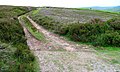
 Path across Egton High Moor - geograph.org.uk - 2629606.jpg 640 × 427; 189 KB
-
 Public Bridleway to Beck Hole - geograph.org.uk - 193100.jpg 640 × 384; 61 KB
-
 Track to Hazel Head - geograph.org.uk - 193107.jpg 640 × 384; 95 KB
-
 Weak Road to Stape - geograph.org.uk - 451018.jpg 640 × 428; 86 KB
-
 Above Middle Heads, Egton High Moor - geograph.org.uk - 192659.jpg 640 × 384; 40 KB
-
 Boulder, Egton High Moor - geograph.org.uk - 193462.jpg 640 × 384; 58 KB
-
 Cattle grid, Egton High Moor - geograph.org.uk - 38653.jpg 640 × 428; 46 KB
-
 Disused workings on Hamer Moor - geograph.org.uk - 100397.jpg 640 × 397; 19 KB
-
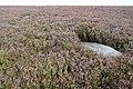
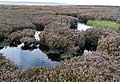
 Pond, Egton High Moor - geograph.org.uk - 192644.jpg 640 × 480; 63 KB
-
 Shooting Butt, Egton High Moor - geograph.org.uk - 192646.jpg 640 × 384; 109 KB
-
 Standing Stone on Wheeldale Moor - geograph.org.uk - 19847.jpg 480 × 640; 87 KB
-
 Stream, Egton High Moor - geograph.org.uk - 193458.jpg 640 × 384; 104 KB
-
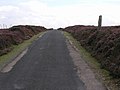
 Track on Egton High Moor - geograph.org.uk - 368055.jpg 640 × 480; 94 KB


