Category:West Langdon
Jump to navigation
Jump to search
English: West Langdon is a village in the Langdon civil parish and Dover district of Kent, England; and five miles north of Dover town.
village in United Kingdom  | |||||
| Upload media | |||||
| Instance of | |||||
|---|---|---|---|---|---|
| Location | Dover, Kent, South East England, England | ||||
 | |||||
Subcategories
This category has the following 2 subcategories, out of 2 total.
W
- West Langdon Abbey (3 F)
Media in category "West Langdon"
The following 64 files are in this category, out of 64 total.
-
 A church in West Langdon.jpg 640 × 395; 55 KB
-
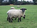
 Black face sheep on Vicarage Farm - geograph.org.uk - 346601.jpg 640 × 480; 131 KB
-
 Blocked gateway to field - geograph.org.uk - 949224.jpg 640 × 480; 185 KB
-
 Forge Lane, Sutton Downs - geograph.org.uk - 634921.jpg 640 × 480; 234 KB
-
 Inquisitive sheep - geograph.org.uk - 347610.jpg 640 × 480; 150 KB
-
 Looking N along the Sandwich Road - geograph.org.uk - 949219.jpg 640 × 480; 165 KB
-
 Looking NE along Forge Lane near Sutton - geograph.org.uk - 634900.jpg 640 × 480; 255 KB
-
-
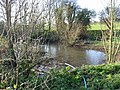 Pond at bottom of Church Hill - geograph.org.uk - 634897.jpg 640 × 480; 383 KB
-
 Private road to The Firs, Sutton Downs - geograph.org.uk - 634927.jpg 640 × 480; 344 KB
-
 Sheep grazing on Sutton Downs - geograph.org.uk - 634918.jpg 640 × 480; 308 KB
-
 Sheep near St Peters - geograph.org.uk - 99815.jpg 640 × 480; 55 KB
-
 Southern end of Roman Road - geograph.org.uk - 1141922.jpg 640 × 480; 209 KB
-

-
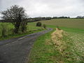 View along road to West Langdon - geograph.org.uk - 660214.jpg 640 × 480; 172 KB
-
 View along the Sandwich Road - geograph.org.uk - 948101.jpg 640 × 480; 179 KB
-
 West Langdon - Book shop - panoramio.jpg 1,000 × 750; 466 KB
-
 Chapel Lane, Ashley - geograph.org.uk - 424005.jpg 640 × 480; 69 KB
-
 Church Lane, West Langdon - geograph.org.uk - 334492.jpg 640 × 480; 252 KB
-
 Crossroads on Forge Lane - geograph.org.uk - 660537.jpg 640 × 480; 140 KB
-

-
 Entering West Langdon from the west - geograph.org.uk - 334488.jpg 640 × 480; 248 KB
-
 Farm road of Homestead Lane - geograph.org.uk - 424081.jpg 640 × 480; 70 KB
-
 Field boundary on Sutton Down - geograph.org.uk - 702226.jpg 640 × 480; 179 KB
-
 Field boundary, Sutton Down - geograph.org.uk - 634909.jpg 640 × 480; 264 KB
-
 Field margin, Sutton Downs - geograph.org.uk - 634903.jpg 640 × 480; 331 KB
-
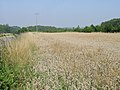
 Fields near West Langdon - geograph.org.uk - 123776.jpg 640 × 480; 58 KB
-
 Footpath across Sutton Down - geograph.org.uk - 702219.jpg 640 × 480; 189 KB
-
 Footpath crossroads on Sutton Down - geograph.org.uk - 702222.jpg 640 × 480; 225 KB
-
 Footpath to Ashley - geograph.org.uk - 656934.jpg 640 × 480; 207 KB
-

-
 Footpath towards Eastling Road - geograph.org.uk - 744049.jpg 640 × 480; 186 KB
-
 Gated track to Enifer Downs Farm - geograph.org.uk - 334510.jpg 640 × 480; 187 KB
-

-
 Houses on Chapel Lane - geograph.org.uk - 703223.jpg 640 × 480; 238 KB
-

-
 Looking NE along Chapel Lane - geograph.org.uk - 703234.jpg 640 × 480; 214 KB
-
 Looking NE along footpath to Sutton - geograph.org.uk - 660532.jpg 640 × 480; 191 KB
-

-

-
 Looking SE along Waldershare Lane - geograph.org.uk - 334506.jpg 640 × 480; 208 KB
-
 Looking SW along Chapel Lane - geograph.org.uk - 703229.jpg 640 × 480; 156 KB
-
 No through road - geograph.org.uk - 334550.jpg 640 × 480; 281 KB
-
 North Downs Way - geograph.org.uk - 660164.jpg 640 × 480; 224 KB
-
 Road through Eastling Wood - geograph.org.uk - 660181.jpg 640 × 480; 252 KB
-
 Road to Great Napchester Farm - geograph.org.uk - 425726.jpg 640 × 480; 49 KB
-
 Route of the Roman Road - geograph.org.uk - 426255.jpg 640 × 480; 62 KB
-

-
 St Margaret's Farm, Napchester Road - geograph.org.uk - 425751.jpg 640 × 480; 57 KB
-
 Studdale House Farm on Homestead Lane - geograph.org.uk - 704461.jpg 640 × 480; 191 KB
-
 Studdale House Farm, Studdal - geograph.org.uk - 425711.jpg 640 × 480; 77 KB
-
 The Firs, private road - geograph.org.uk - 634929.jpg 640 × 480; 217 KB
-
 The road heading SE from West Langdon - geograph.org.uk - 334498.jpg 640 × 480; 281 KB
-
 The road through West Langdon, in May - geograph.org.uk - 426278.jpg 640 × 480; 68 KB
-
 The road to Ashley - geograph.org.uk - 423975.jpg 640 × 480; 25 KB
-
 The Roman Rd, Stone Street - geograph.org.uk - 319945.jpg 480 × 640; 117 KB
-

-

-

-
 View NW across Sutton Downs - geograph.org.uk - 702225.jpg 640 × 480; 170 KB
-
 View S along Roman Road - geograph.org.uk - 425717.jpg 640 × 480; 39 KB
-
 View SW along Waldershare Road - geograph.org.uk - 423990.jpg 640 × 480; 61 KB
-
 View SW towards Whitfield - geograph.org.uk - 426345.jpg 640 × 480; 32 KB
-
 Whitfield (North) - geograph.org.uk - 99813.jpg 640 × 480; 53 KB


_-_geograph.org.uk_-_99813.jpg)