Category:Langdon, Kent
Jump to navigation
Jump to search
English: Langdon is a civil parish in the Dover district of the county of Kent, England, and includes the villages of West Langdon and East Langdon, and the hamlets of Martin and Martin Mill.
civil parish in Kent, UK | |||||
| Upload media | |||||
| Instance of | |||||
|---|---|---|---|---|---|
| Location | Dover, Kent, South East England, England | ||||
| Population |
| ||||
 | |||||
Subcategories
This category has the following 6 subcategories, out of 6 total.
O
- Oasts in Langdon (1 F)
Media in category "Langdon, Kent"
The following 106 files are in this category, out of 106 total.
-
 Langdon Kellys Kent 1882 pp.306-7.jpg 774 × 610; 485 KB
-
 Langdon Kellys Kent 1913 p.419.jpg 857 × 719; 623 KB
-
 A large brown field - geograph.org.uk - 4675423.jpg 640 × 480; 119 KB
-
 Abutments of former railway bridge - geograph.org.uk - 3118999.jpg 685 × 513; 141 KB
-
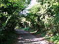
 Access lane to Appleton Manor - geograph.org.uk - 2345973.jpg 3,072 × 2,304; 2.72 MB
-
 Barley Close, Martin Mill - geograph.org.uk - 3119110.jpg 913 × 684; 171 KB
-
 Barley Close, Martin Mill - geograph.org.uk - 5061546.jpg 2,448 × 2,448; 1.91 MB
-
 Byway beside Cane Wood - geograph.org.uk - 2330810.jpg 3,072 × 2,304; 2.16 MB
-
 Byway junction near West Langdon - geograph.org.uk - 2330865.jpg 3,072 × 2,304; 2.49 MB
-
 Byway to Church Farm - geograph.org.uk - 2330870.jpg 3,072 × 2,304; 3.54 MB
-
 Church Farm Mews - geograph.org.uk - 2330556.jpg 3,072 × 2,304; 1.94 MB
-
 Citroën DS on The Street - geograph.org.uk - 1980146.jpg 1,024 × 683; 235 KB
-
 Converted Public House - geograph.org.uk - 1980133.jpg 1,024 × 683; 133 KB
-
 Crop Field off Forge Lane - geograph.org.uk - 1983248.jpg 1,024 × 768; 250 KB
-
 Delranch, East Langdon - geograph.org.uk - 1983264.jpg 1,024 × 768; 159 KB
-
 East Langdon across a field - geograph.org.uk - 3120420.jpg 640 × 479; 89 KB
-
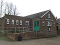 East Langdon Parish Hall - geograph.org.uk - 2330499.jpg 3,072 × 2,304; 1.61 MB
-
 East Langdon playing fields - geograph.org.uk - 3119119.jpg 848 × 636; 186 KB
-
 East Langdon Village Green - geograph.org.uk - 2330545.jpg 3,072 × 2,304; 2.65 MB
-
 Farmland, Famine Down - geograph.org.uk - 2968165.jpg 640 × 430; 25 KB
-
 Field south-west of Ringwould - geograph.org.uk - 5586857.jpg 640 × 480; 138 KB
-
 Fingerpost beside Pond Lane - geograph.org.uk - 3120427.jpg 979 × 734; 221 KB
-
 Fly tipping, Ringwould Road - geograph.org.uk - 5586848.jpg 640 × 480; 110 KB
-
 Footpath crosses Waldershare Lane - geograph.org.uk - 2330587.jpg 3,072 × 2,304; 1.97 MB
-
 Footpath junction near Martin Mill - geograph.org.uk - 2330480.jpg 3,072 × 2,304; 2.01 MB
-
 Footpath to Appleton Manor access road - geograph.org.uk - 2345967.jpg 3,072 × 2,304; 2.32 MB
-
 Footpath to Pineham - geograph.org.uk - 2330613.jpg 3,072 × 2,304; 2.17 MB
-
 Footpath to Pommeus Lane (2) - geograph.org.uk - 2345955.jpg 3,072 × 2,304; 2.1 MB
-
 Footpath to Pommeus Lane - geograph.org.uk - 2345980.jpg 3,072 × 2,304; 1.9 MB
-
 Footpath towards Hangman's Lane - geograph.org.uk - 2378183.jpg 3,072 × 2,304; 2.46 MB
-
 Forest Oak, Waterworks Lane, Martin - geograph.org.uk - 3283022.jpg 685 × 513; 112 KB
-
 Former Railway Bridge - geograph.org.uk - 1980158.jpg 1,024 × 768; 370 KB
-
 Four Bells, East Langdon - geograph.org.uk - 2330532.jpg 3,072 × 2,304; 2.33 MB
-
 Gated road to pumping station - geograph.org.uk - 4675613.jpg 640 × 480; 149 KB
-
 Guildford Cottages - geograph.org.uk - 1980152.jpg 1,024 × 768; 279 KB
-
 Guston Road, East Langdon - geograph.org.uk - 5061925.jpg 3,264 × 2,448; 2.44 MB
-
 Guston Road, East Langdon - geograph.org.uk - 5061927.jpg 3,264 × 2,448; 1.89 MB
-
 Guston Road, near East Langdon - geograph.org.uk - 5061933.jpg 3,264 × 2,448; 3.12 MB
-
 Hangman's Lane from Ringwould Road - geograph.org.uk - 5109596.jpg 2,592 × 1,936; 1.85 MB
-

-
 Hedge end - geograph.org.uk - 5785064.jpg 640 × 426; 38 KB
-
 Hollands Hill, Martin Mill - geograph.org.uk - 5061898.jpg 3,264 × 2,448; 2.41 MB
-
 Kent's road - panoramio (1).jpg 1,000 × 750; 571 KB
-
 Kent's road - panoramio.jpg 723 × 710; 397 KB
-
 Kissing gates and track to Poison Wood Farm - geograph.org.uk - 2330602.jpg 3,072 × 2,304; 1.62 MB
-
 Lane to East Langdon - geograph.org.uk - 1980161.jpg 1,024 × 768; 218 KB
-
 Lane towards Ringwould - geograph.org.uk - 5568909.jpg 640 × 480; 98 KB
-

-
 Lucerne Lane - geograph.org.uk - 5785076.jpg 640 × 395; 113 KB
-
 Lucerne Lane, Martin Mill - geograph.org.uk - 2968176.jpg 640 × 430; 73 KB
-
 Martin Dale Crescent, Martin Mill - geograph.org.uk - 3119097.jpg 913 × 684; 171 KB
-
 Martin Dale Crescent, Martin Mill - geograph.org.uk - 5061544.jpg 2,951 × 2,213; 1.59 MB
-
 Martin Lodge - geograph.org.uk - 2345989.jpg 3,072 × 2,304; 1.84 MB
-
 Martin Mill station - geograph.org.uk - 4675607.jpg 640 × 428; 84 KB
-
 Martin Mill Station - geograph.org.uk - 5785072.jpg 640 × 426; 81 KB
-
 Martin Mill Station - geograph.org.uk - 5785074.jpg 640 × 373; 86 KB
-
 Martin Mill Station - geograph.org.uk - 5785360.jpg 640 × 425; 111 KB
-
 North Downs Way in Cane Wood - geograph.org.uk - 2330826.jpg 3,072 × 2,304; 3.61 MB
-
 North Downs Way marker In Cane Wood - geograph.org.uk - 2330836.jpg 3,072 × 2,304; 2.72 MB
-
 North Downs Way to Cane Wood (2) - geograph.org.uk - 2330850.jpg 3,072 × 2,304; 2.45 MB
-
 North Downs Way to Cane Wood - geograph.org.uk - 2330778.jpg 3,072 × 2,304; 1.74 MB
-
 Ploughed field - geograph.org.uk - 4675618.jpg 640 × 480; 83 KB
-
 Ploughed fields and a belt of trees - geograph.org.uk - 4675405.jpg 640 × 480; 110 KB
-
 Pond, East Langdon - geograph.org.uk - 4675418.jpg 640 × 480; 148 KB
-
 Pumping Station by road - geograph.org.uk - 5785078.jpg 640 × 426; 106 KB
-
 Railway bridge BME2 855 - geograph.org.uk - 4675412.jpg 640 × 480; 138 KB
-
 Railway Bridge over Lucerne Lane, Martin Mill - geograph.org.uk - 5061538.jpg 3,264 × 2,448; 2.82 MB
-
 Railway Bridge over Lucerne Lane, Martin Mill - geograph.org.uk - 5061541.jpg 3,264 × 2,448; 4.49 MB
-
 Railway bridge, Ringwould Road - geograph.org.uk - 5586846.jpg 640 × 480; 127 KB
-
 Railway south of Ringwould Road bridge - geograph.org.uk - 5586838.jpg 640 × 480; 142 KB
-
 Riders on the Bridleway near Waterworks Hill - geograph.org.uk - 2332931.jpg 3,072 × 2,304; 2.06 MB
-
 Ringwould Road - geograph.org.uk - 3624617.jpg 640 × 427; 61 KB
-
 Ringwould Road - geograph.org.uk - 5586832.jpg 640 × 480; 89 KB
-
 Ringwould Road, Martin - geograph.org.uk - 3283038.jpg 913 × 684; 173 KB
-
 Ringwould Road, near Martin - geograph.org.uk - 5061503.jpg 3,264 × 2,448; 1.88 MB
-
 Ringwould Road, Ringwould - geograph.org.uk - 5061493.jpg 3,264 × 2,448; 2.11 MB
-
 Road Junction near East Langdon - geograph.org.uk - 2330569.jpg 3,072 × 2,304; 1.87 MB
-
 Road junction on Waterworks Hill - geograph.org.uk - 2333002.jpg 3,072 × 2,304; 2.48 MB
-
 Road seen from railway - geograph.org.uk - 5785070.jpg 640 × 426; 72 KB
-
 Route of dismantled railway - geograph.org.uk - 3119070.jpg 640 × 479; 87 KB
-
 Route of footpath to Solton Lane - geograph.org.uk - 2378172.jpg 3,072 × 2,304; 2.41 MB
-
 Sign, Martin Mill Station - geograph.org.uk - 2968169.jpg 640 × 430; 47 KB
-
 Solton Lane towards the A258 - geograph.org.uk - 2378194.jpg 3,072 × 2,304; 2.3 MB
-
 Station Road, Martin Mill - geograph.org.uk - 5061554.jpg 2,448 × 2,448; 2.17 MB
-
 Station Road, Martin Mill - geograph.org.uk - 5362130.jpg 3,264 × 2,448; 1.6 MB
-
 The centre of East Langdon - geograph.org.uk - 3119133.jpg 639 × 478; 105 KB
-
 The centre of Martin - geograph.org.uk - 3281695.jpg 1,142 × 856; 198 KB
-
 The North Downs Way heading towards Cane Wood - geograph.org.uk - 6243429.jpg 3,776 × 2,520; 4.15 MB
-
 The Old Lantern Inn sign, Martin - geograph.org.uk - 5061527.jpg 2,448 × 3,264; 2.05 MB
-
 The Old Lantern Inn, Martin - geograph.org.uk - 5061523.jpg 3,264 × 2,448; 2.41 MB
-
 The Street, East Langdon - geograph.org.uk - 5061899.jpg 2,369 × 2,187; 966 KB
-
 The Street, East Langdon - geograph.org.uk - 5061909.jpg 3,264 × 2,448; 3.02 MB
-
 The Street, Martin - geograph.org.uk - 3281705.jpg 1,044 × 783; 168 KB
-
 The Street, Martin - geograph.org.uk - 5061531.jpg 3,264 × 2,448; 1.65 MB
-
 The Street, Martin - geograph.org.uk - 5061534.jpg 3,264 × 2,448; 1.93 MB
-
 The village green, East Langdon - geograph.org.uk - 3120415.jpg 639 × 478; 93 KB
-
 Track to Martin Pumping Station - geograph.org.uk - 2332989.jpg 3,072 × 2,304; 2.28 MB
-
 Unseen footpath to Martin Mill - geograph.org.uk - 2378189.jpg 3,072 × 2,304; 2.22 MB
-
 Waldershare Lane, East Langdon - geograph.org.uk - 5061912.jpg 3,264 × 2,448; 1.75 MB
-
 Waterworks Hill - geograph.org.uk - 2332942.jpg 3,072 × 2,304; 1.87 MB
-
 Waterworks Hill - geograph.org.uk - 3281710.jpg 913 × 684; 169 KB
-
 Waterworks Lane, Martin - geograph.org.uk - 5061521.jpg 3,264 × 2,448; 2.34 MB
-
 West Side, East Langdon - geograph.org.uk - 5061905.jpg 2,901 × 2,177; 1.58 MB
-
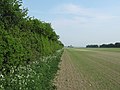
 Wheat Fields alongside Waldershare Lane - geograph.org.uk - 1983253.jpg 1,024 × 768; 259 KB
-
 Wheatsheafe Lane, Martin - geograph.org.uk - 5061528.jpg 3,264 × 2,448; 2.59 MB
-
 Woodland track in Cane Wood - geograph.org.uk - 2330797.jpg 3,072 × 2,304; 2.87 MB


_-_geograph.org.uk_-_2345955.jpg)


.jpg)


_-_geograph.org.uk_-_2330850.jpg)


