Category:West Kilbride (civil parish)
Jump to navigation
Jump to search
Scottish parish in North Ayrshire, Scotland, UK | |||||
| Upload media | |||||
| Instance of | |||||
|---|---|---|---|---|---|
| Part of |
| ||||
| Named after | |||||
| Location |
| ||||
| Population |
| ||||
| Area |
| ||||
 | |||||
Subcategories
This category has the following 4 subcategories, out of 4 total.
Media in category "West Kilbride (civil parish)"
The following 200 files are in this category, out of 827 total.
(previous page) (next page)-
 6 Mega Watt Turbine - Hunterston - geograph.org.uk - 3934670.jpg 1,620 × 1,080; 940 KB
-

-
 A hatch in a field - geograph.org.uk - 6060141.jpg 1,024 × 480; 244 KB
-
 A path through the bedrock at Portencross - geograph.org.uk - 5853013.jpg 1,024 × 768; 369 KB
-
 A path through the bedrock at Portencross - geograph.org.uk - 5853015.jpg 1,024 × 768; 445 KB
-
 A path through the bedrock at Portencross - geograph.org.uk - 5853016.jpg 1,024 × 768; 346 KB
-
 A path through the bedrock at Portencross - geograph.org.uk - 5853018.jpg 1,024 × 768; 323 KB
-
 A path through the bedrock at Portencross - geograph.org.uk - 5853021.jpg 1,024 × 768; 410 KB
-

-
 A78 at Carlung Farm - geograph.org.uk - 3069728.jpg 640 × 426; 46 KB
-
 A78 at Hunterston railway bridge - geograph.org.uk - 5850542.jpg 1,024 × 768; 415 KB
-
 A78 entering Fairlie - geograph.org.uk - 3069823.jpg 640 × 409; 54 KB
-
 A78 entering Seamill - geograph.org.uk - 3069661.jpg 640 × 401; 43 KB
-
 A78 from Loup car park - geograph.org.uk - 3068598.jpg 640 × 427; 59 KB
-
 A78 near Kilruskin turning - geograph.org.uk - 3069737.jpg 640 × 434; 54 KB
-
 A78 north from Hunterston roundabout - geograph.org.uk - 3069784.jpg 640 × 396; 79 KB
-
 A78 north near Glenfoot House - geograph.org.uk - 3069657.jpg 640 × 408; 39 KB
-
 A78 passing Bogriggs - geograph.org.uk - 3069725.jpg 640 × 468; 52 KB
-
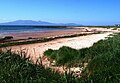
 Across Firth of Clyde from beach at Seamill, 1994 - geograph.org.uk - 4753053.jpg 2,390 × 1,470; 2.87 MB
-

-
 Alton Street, West Kilbride - geograph.org.uk - 4128637.jpg 1,920 × 1,280; 1.37 MB
-
 Alton Street, West Kilbride - geograph.org.uk - 4128883.jpg 1,920 × 1,280; 1.33 MB
-
 Alton Street, West Kilbride - geograph.org.uk - 4128888.jpg 1,920 × 1,280; 1.8 MB
-

-
 Approaching Fairlie - geograph.org.uk - 3493007.jpg 1,920 × 1,280; 1.06 MB
-
 Arable land, Ardneil - geograph.org.uk - 2659000.jpg 640 × 346; 189 KB
-
 Ardneil Bay - geograph.org.uk - 5621233.jpg 4,119 × 3,070; 1.99 MB
-
 Ardneil Farm - Portencross - geograph.org.uk - 5870613.jpg 2,771 × 3,785; 1.91 MB
-
 Ardneil Hill - geograph.org.uk - 5870615.jpg 3,215 × 4,320; 1.62 MB
-
 Ardneil Hill - geograph.org.uk - 5870619.jpg 4,163 × 3,215; 1.72 MB
-
 Ardneil Hill - geograph.org.uk - 5870730.jpg 4,185 × 3,083; 2.07 MB
-
 Ardrossan Road West Kilbride - geograph.org.uk - 3069701.jpg 640 × 453; 60 KB
-
 Ardrossan windfarm - geograph.org.uk - 1847984.jpg 640 × 480; 51 KB
-
 Argyll Cottage - Fairlie - geograph.org.uk - 5314164.jpg 4,247 × 3,143; 2.85 MB
-
 Arran from Hunterston - geograph.org.uk - 5851895.jpg 1,024 × 768; 210 KB
-
 Arran from Hunterston - geograph.org.uk - 5851896.jpg 1,024 × 768; 233 KB
-
 Arran from Portencross - geograph.org.uk - 5852963.jpg 1,024 × 768; 259 KB
-
 Arran from Portencross - geograph.org.uk - 5853934.jpg 1,024 × 768; 274 KB
-
 Arran from Portencross - geograph.org.uk - 5853935.jpg 1,024 × 768; 149 KB
-
 Arran from Seamill - geograph.org.uk - 6470776.jpg 1,024 × 768; 234 KB
-
 Arthur Street, West Kilbride - geograph.org.uk - 4128635.jpg 1,920 × 1,280; 1.45 MB
-

-
 ATV Track - geograph.org.uk - 5141371.jpg 4,320 × 3,240; 1.92 MB
-
 Auld Hill - Portencross - geograph.org.uk - 5870614.jpg 4,207 × 3,099; 1.81 MB
-
 Auld Man's Rest - West Kilbride - geograph.org.uk - 5653375.jpg 2,209 × 1,804; 1.32 MB
-
 Ayrshire Coastal Path - geograph.org.uk - 5138399.jpg 4,193 × 3,119; 1.3 MB
-
 Ayrshire Coastal Path - geograph.org.uk - 5636861.jpg 3,072 × 2,304; 3.17 MB
-
 Ayrshire Coastal Path at Arranview Gardens, Seamill - geograph.org.uk - 5857376.jpg 2,784 × 1,568; 2.12 MB
-
 Ayrshire Coastal Path at Hunterston - geograph.org.uk - 5850880.jpg 1,024 × 768; 457 KB
-
 Ayrshire Coastal Path at Hunterston - geograph.org.uk - 5850881.jpg 1,024 × 768; 525 KB
-
 Ayrshire Coastal Path at Hunterston - geograph.org.uk - 5850890.jpg 1,024 × 768; 460 KB
-
 Ayrshire Coastal Path signs at Hunterston - geograph.org.uk - 5850904.jpg 768 × 1,024; 564 KB
-
 Ayrshire potatoes - geograph.org.uk - 2405629.jpg 2,592 × 1,944; 2.78 MB
-
 B7047 at Seamill - geograph.org.uk - 5125871.jpg 1,024 × 682; 205 KB
-
 B7048 at the Portencross Car Park - geograph.org.uk - 5090532.jpg 640 × 481; 51 KB
-
 B782 junction from A78 - geograph.org.uk - 3069733.jpg 640 × 411; 50 KB
-
 Ballees Plantation - geograph.org.uk - 1017705.jpg 480 × 640; 205 KB
-
 Barley Field - geograph.org.uk - 1017069.jpg 640 × 455; 82 KB
-
 Barley Field - geograph.org.uk - 1017093.jpg 640 × 480; 78 KB
-
 Beach and path, West Kilbride - geograph.org.uk - 2659430.jpg 640 × 360; 203 KB
-
 Beach at Seamill - geograph.org.uk - 6470774.jpg 1,024 × 768; 327 KB
-
 Beach at South Inch - geograph.org.uk - 5269609.jpg 1,024 × 706; 666 KB
-
 Beach at West Kilbride - geograph.org.uk - 5859452.jpg 2,784 × 1,568; 2.13 MB
-
 Bedrock at Hunterston - geograph.org.uk - 5853255.jpg 1,024 × 660; 311 KB
-
 Bedrock at Portencross shore - geograph.org.uk - 5853000.jpg 1,024 × 768; 496 KB
-
 Bedrock at Portencross shore - geograph.org.uk - 5853004.jpg 1,024 × 768; 330 KB
-
 Bedrock at Portencross shore - geograph.org.uk - 5853007.jpg 1,024 × 707; 366 KB
-
 Beech Avenue - geograph.org.uk - 6494997.jpg 854 × 1,024; 302 KB
-
 Beech Avenue - geograph.org.uk - 6495003.jpg 768 × 1,024; 327 KB
-
 Biglees Hill (moorland) - geograph.org.uk - 4849445.jpg 4,320 × 2,432; 1.81 MB
-
 Biglees Hill - geograph.org.uk - 6470260.jpg 1,024 × 768; 380 KB
-
 Biglees Hill - geograph.org.uk - 6470280.jpg 1,024 × 768; 439 KB
-
 Biglees Quarry (disused) - geograph.org.uk - 5591551.jpg 4,320 × 3,175; 2.81 MB
-
 Biglees Quarry (disused) Track - geograph.org.uk - 5591575.jpg 4,154 × 2,978; 2.01 MB
-
 Biglees Quarry - geograph.org.uk - 3792664.jpg 2,592 × 1,936; 1.53 MB
-
 Biglees Quarry - geograph.org.uk - 5591295.jpg 4,155 × 3,215; 2.37 MB
-
 Biglees quarry - geograph.org.uk - 6061077.jpg 1,024 × 683; 429 KB
-
 Biglees quarry - geograph.org.uk - 6061380.jpg 1,024 × 584; 362 KB
-
 Biglees quarry - geograph.org.uk - 6061436.jpg 1,024 × 683; 392 KB
-
 Biglees quarry - geograph.org.uk - 6061465.jpg 1,024 × 683; 318 KB
-
 Biglees quarry - geograph.org.uk - 6061930.jpg 1,024 × 553; 293 KB
-
 Biglees quarry - geograph.org.uk - 6061933.jpg 1,024 × 683; 345 KB
-
 Biglees quarry road - geograph.org.uk - 6061137.jpg 1,024 × 683; 351 KB
-
 Biglees Waterfall (Lower Falls) - geograph.org.uk - 6266869.jpg 2,427 × 3,236; 3.7 MB
-
 Biglees Waterfall (Lower Falls) - geograph.org.uk - 6266894.jpg 3,240 × 4,320; 7.35 MB
-
 Biglees Waterfall (Lower Falls) - geograph.org.uk - 6281306.jpg 3,147 × 4,196; 6.78 MB
-
 Biglees Waterfall (Upper Falls) - geograph.org.uk - 6281118.jpg 3,240 × 4,320; 6.87 MB
-
 Biglees Waterfall (Upper Falls) - geograph.org.uk - 6281236.jpg 3,126 × 4,168; 6.18 MB
-
 Biglees Waterfall (Upper Falls) - geograph.org.uk - 6297117.jpg 3,133 × 4,177; 5.39 MB
-
 Biglees Waterfall (Upper Falls) - geograph.org.uk - 6298456.jpg 3,072 × 4,095; 6.7 MB
-
 Biglees Waterfall (Upper Falls) - geograph.org.uk - 6360797.jpg 3,240 × 4,320; 5.96 MB
-
 Biglees Waterfall (Upper Falls) - geograph.org.uk - 6363053.jpg 3,143 × 4,191; 6.92 MB
-
 Biglees Waterfall (Upper Falls) - geograph.org.uk - 6363348.jpg 3,240 × 4,320; 5.66 MB
-
 Biglees Waterfall (Upper Falls) - geograph.org.uk - 6477674.jpg 6,540 × 3,982; 5.89 MB
-
 Biglees Waterfall (upper falls) North Ayrshire - geograph.org.uk - 6506265.jpg 3,240 × 4,320; 5.4 MB
-
 Biglies Farm - geograph.org.uk - 5591787.jpg 3,819 × 3,061; 1.58 MB
-
 Biglies Farm - geograph.org.uk - 6060145.jpg 1,024 × 683; 252 KB
-
 Black Hill - geograph.org.uk - 6363921.jpg 3,462 × 2,578; 2.49 MB
-
 Blackdykes (ruin) - geograph.org.uk - 5143619.jpg 4,195 × 3,097; 1.52 MB
-
 Blackdykes - geograph.org.uk - 1158351.jpg 640 × 428; 56 KB
-
 Blackshaw Cup and Ring-marked Rock - West Kilbride - geograph.org.uk - 6308270.jpg 3,038 × 4,051; 3.44 MB
-
 Blackshaw Farm - geograph.org.uk - 4128930.jpg 1,920 × 1,280; 1.51 MB
-
 Blackshaw Farm Park 1995 - geograph.org.uk - 3377976.jpg 640 × 340; 121 KB
-
 Blackshaw Farm Park 1995 - geograph.org.uk - 3377982.jpg 640 × 276; 89 KB
-
 Blackshaw Hill (view indicator) - geograph.org.uk - 5143519.jpg 4,358 × 3,291; 1.68 MB
-
 Blackshaw Hill - geograph.org.uk - 5144169.jpg 4,320 × 3,240; 1.57 MB
-
 Blackshaw Hill - geograph.org.uk - 5144797.jpg 4,233 × 3,138; 1.24 MB
-
 Boulder by the Glen Burn - geograph.org.uk - 1606688.jpg 640 × 434; 94 KB
-
 Bowfield Road, West Kilbride - geograph.org.uk - 4128623.jpg 1,920 × 1,280; 1.64 MB
-
 Boydston shore from Loup Car Park - geograph.org.uk - 3068595.jpg 640 × 427; 91 KB
-
 Bungalows on Ardrossan Road, Seamill - geograph.org.uk - 3669564.jpg 1,024 × 768; 126 KB
-
 Bushglen Mount - West Kilbride - geograph.org.uk - 5657003.jpg 2,978 × 2,304; 2.08 MB
-
 Bushglen Mount - West Kilbride - geograph.org.uk - 6402079.jpg 4,065 × 3,048; 1.95 MB
-
 Cairn on Caldron Hill - geograph.org.uk - 2165461.jpg 2,048 × 1,536; 1.32 MB
-
 Cairn on Kaim Hill - geograph.org.uk - 4346319.jpg 5,184 × 3,456; 6.45 MB
-
 Cairn on Lairdside Hill - geograph.org.uk - 4346273.jpg 5,184 × 3,456; 7.32 MB
-
 Caldron Hill - geograph.org.uk - 4404263.jpg 3,072 × 2,048; 783 KB
-
 Caldron Hill - geograph.org.uk - 6544919.jpg 3,590 × 2,691; 4.65 MB
-
 Campbelton Farm - geograph.org.uk - 5309935.jpg 4,227 × 3,194; 2.14 MB
-
 Campbelton Farm - Hunterston - geograph.org.uk - 5621412.jpg 4,320 × 3,240; 2.59 MB
-
 Campbelton Farm and Hill across Carlung Moss , West Kilbride, North Ayrshire.jpg 4,896 × 2,752; 2.4 MB
-
 Campbelton Farm and Hill, West Kilbride, North Ayrshire.jpg 4,896 × 2,752; 2.33 MB
-
 Campbelton Hill - Hunterston - geograph.org.uk - 5621339.jpg 4,154 × 3,210; 3.98 MB
-
 Canalised burn - geograph.org.uk - 3048467.jpg 2,048 × 1,536; 1.58 MB
-
 Car Park at Fairlie - geograph.org.uk - 6080245.jpg 2,976 × 1,984; 2.2 MB
-
 Carlung Estate policies, West Kilbride, North Ayrshire.jpg 4,896 × 2,752; 2.64 MB
-
 Carlung Farm - geograph.org.uk - 5307749.jpg 4,190 × 3,125; 1.69 MB
-
 Carlung Farm, West Kilbride, North Ayrshire.jpg 4,381 × 1,811; 1.31 MB
-
 Carlung Farmhouse entrance, West Kilbride, North Ayrshire.jpg 4,896 × 2,752; 4.33 MB
-
 Carlung gatehouse, West Kilbride, North Ayrshire.jpg 2,628 × 2,023; 1.55 MB
-
 Cattle at North Kilruskin - geograph.org.uk - 6287755.jpg 1,600 × 1,067; 778 KB
-
 Cattle grid below the Crosbie Hills - geograph.org.uk - 5126958.jpg 1,024 × 682; 182 KB
-

-
 Cesscon Decom Hunterston - geograph.org.uk - 5918520.jpg 1,024 × 768; 154 KB
-
 CessCon Decom sign - geograph.org.uk - 6059901.jpg 683 × 1,024; 404 KB
-
 CessCon Decom sign on Port Road - geograph.org.uk - 6059898.jpg 1,024 × 683; 395 KB
-
 Chapelton Road - geograph.org.uk - 5125882.jpg 1,024 × 682; 232 KB
-
 Coast road, Portencross - geograph.org.uk - 2658982.jpg 640 × 360; 208 KB
-
 Coastal farmland at West Kilbride - geograph.org.uk - 5126669.jpg 1,024 × 682; 140 KB
-
 Coastal Path at Portencross - geograph.org.uk - 4128604.jpg 1,920 × 1,280; 1.77 MB
-
 Coastal path at Seamill - geograph.org.uk - 6470769.jpg 1,024 × 689; 450 KB
-
 Coastal path at Seamill - geograph.org.uk - 6470802.jpg 898 × 1,024; 489 KB
-
 Coastal path at Seamill - geograph.org.uk - 6470807.jpg 1,024 × 768; 359 KB
-
 Construction yard - geograph.org.uk - 3048452.jpg 2,048 × 1,536; 605 KB
-
 Conveyor at Hunterston - geograph.org.uk - 5988519.jpg 1,024 × 576; 113 KB
-
 Cooling water outflow at Hunterston - geograph.org.uk - 5851902.jpg 1,024 × 768; 266 KB
-
 Cooling water outflow at Hunterston - geograph.org.uk - 5851905.jpg 1,024 × 768; 220 KB
-
 Cottage at Northbank - geograph.org.uk - 5852942.jpg 1,024 × 768; 369 KB
-
 Cottage at Northbank - geograph.org.uk - 5852944.jpg 1,024 × 768; 447 KB
-
 Cottages at Portencross - geograph.org.uk - 5856073.jpg 1,024 × 768; 429 KB
-
 Covered reservoir - geograph.org.uk - 6016618.jpg 1,024 × 439; 182 KB
-
 Covered reservoir - geograph.org.uk - 6016619.jpg 1,024 × 683; 539 KB
-
 Covered reservoir - geograph.org.uk - 6016620.jpg 1,024 × 683; 410 KB
-
 Covered reservoir - geograph.org.uk - 6060101.jpg 1,024 × 683; 287 KB
-
 Craft Town Scotland noticeboard - geograph.org.uk - 5857242.jpg 1,024 × 768; 369 KB
-
 Crock Hill and Carlung Farm, West Kilbride, North Ayrshire.jpg 4,818 × 1,831; 1.8 MB
-
 Crock Hill, Carlung Estate, West Kilbride, North Ayrshire.jpg 4,876 × 2,482; 2.02 MB
-
 Crosbie Castle (Crosbie Towers) - West Kilbride - geograph.org.uk - 6380185.jpg 2,746 × 2,059; 2.53 MB
-
 Crosbie Dykes Sheepfold - geograph.org.uk - 5233158.jpg 4,320 × 3,240; 2.78 MB
-
 Crosbie Dykes Sheepfold - geograph.org.uk - 5233163.jpg 4,320 × 3,240; 2.08 MB
-
 Crosbie Hills - geograph.org.uk - 2165459.jpg 2,042 × 832; 710 KB
-
 Crosbie Reservoir - geograph.org.uk - 4849207.jpg 4,320 × 3,240; 4.43 MB
-
 Crosbie Reservoir - geograph.org.uk - 4849279.jpg 4,320 × 2,880; 2.28 MB
-
 Crosbie Reservoir - geograph.org.uk - 4849306.jpg 4,320 × 2,880; 2.25 MB
-
 Crosbie Reservoir - geograph.org.uk - 4849529.jpg 4,320 × 2,880; 2.18 MB
-
 Crosbie Reservoir - geograph.org.uk - 4849853.jpg 4,320 × 2,880; 1.89 MB
-
 Crosbie Waterworks - geograph.org.uk - 5141354.jpg 4,320 × 3,240; 2.26 MB
-
 Crossroad in West Kilbride - geograph.org.uk - 6470811.jpg 1,024 × 585; 233 KB
-
 Culvert at Southannan Sands - geograph.org.uk - 5850527.jpg 1,024 × 768; 467 KB
-
 Cumbrae-Largs Ferries - geograph.org.uk - 6080259.jpg 2,592 × 1,728; 1.98 MB
-
 Cumbrae-Largs Ferries - geograph.org.uk - 6080263.jpg 2,592 × 1,728; 1.82 MB
-
 Cup and ring marks, Blackshaw Hill, the Kings Road, West Kilbride, North Ayrshire.jpg 4,896 × 2,752; 7.45 MB
-
 Cup ^ Ring-marked Rock - geograph.org.uk - 4744370.jpg 3,399 × 1,913; 1.63 MB
-
 Cup ^ Ring-marked Rock - geograph.org.uk - 4744384.jpg 4,320 × 1,889; 1.44 MB
-
 Cup ^ Ring-marked Rock - geograph.org.uk - 4744415.jpg 4,320 × 2,432; 1.89 MB
-
 Cup ^ Ring-marked Rock - geograph.org.uk - 4744424.jpg 4,320 × 2,432; 2.59 MB
-
 Cup ^Ring-marked Rock - geograph.org.uk - 4744245.jpg 4,320 × 2,044; 1.38 MB
-
 Cycle path at Hunterston Estate - geograph.org.uk - 6470264.jpg 1,024 × 768; 384 KB
-
 Cycle path at Hunterston Estate - geograph.org.uk - 6470266.jpg 1,024 × 546; 179 KB
-
 Cycle path at Hunterston Estate - geograph.org.uk - 6470269.jpg 1,024 × 530; 230 KB
-
 Cycle path by A78 near West Kilbride - geograph.org.uk - 4269252.jpg 1,600 × 1,067; 658 KB
-
 Cycle path signs - geograph.org.uk - 6470285.jpg 1,024 × 634; 375 KB
-
 Cycle route signs at Fairlie - geograph.org.uk - 5850523.jpg 768 × 1,024; 350 KB
-
 Dalry Moor Road - geograph.org.uk - 5593377.jpg 4,210 × 3,147; 1.22 MB
-
 Dalry Moor Road - geograph.org.uk - 5593664.jpg 3,009 × 2,221; 1.25 MB
-
 Dead tree near Meadowhead - geograph.org.uk - 1090293.jpg 640 × 428; 54 KB
-
 Diamond Hill (summit) - geograph.org.uk - 4744392.jpg 4,320 × 2,432; 1.52 MB
-
 Diamond Hill - Fairlie - geograph.org.uk - 5682539.jpg 4,233 × 3,120; 2.87 MB
-
 Ditch near Meadowhead - geograph.org.uk - 1090304.jpg 640 × 428; 70 KB
-
 Drained lochan on Biglees Hill - geograph.org.uk - 6016134.jpg 1,024 × 683; 182 KB
-
 Drained lochan on Biglees Hill - geograph.org.uk - 6061982.jpg 1,024 × 592; 273 KB
-
 Drummilling Hill - geograph.org.uk - 6470944.jpg 1,024 × 605; 253 KB
-
 Drummilling Hill - West Kilbride - geograph.org.uk - 5653181.jpg 3,072 × 2,304; 3.82 MB
-
 Drystane dyke above the Gourock Burn - geograph.org.uk - 1158219.jpg 640 × 428; 45 KB
-
 Drystane dyke on Biglees Hill - geograph.org.uk - 6061967.jpg 1,024 × 683; 362 KB
-
 Entrance Road to Law Castle, West Kilbride - geograph.org.uk - 4128735.jpg 1,920 × 1,280; 2.38 MB
-
 Entrance to Fairlie - geograph.org.uk - 4235884.jpg 640 × 480; 50 KB
-
 Entrance to the Hunterston Estate, West Kilbride, North Ayrshire.jpg 4,896 × 2,752; 2.43 MB
-
 Entrance to West Kilbride Glen - geograph.org.uk - 4128780.jpg 1,920 × 1,280; 1.85 MB
-
 Fairlie Burn - Fairlie Glen - geograph.org.uk - 5596479.jpg 2,304 × 3,072; 1.4 MB


_-_geograph.org.uk_-_4849445.jpg)


_-_geograph.org.uk_-_5591551.jpg)
_Track_-_geograph.org.uk_-_5591575.jpg)


_-_geograph.org.uk_-_6266869.jpg)
_-_geograph.org.uk_-_6266894.jpg)
_-_geograph.org.uk_-_6281306.jpg)
_-_geograph.org.uk_-_6281118.jpg)
_-_geograph.org.uk_-_6281236.jpg)
_-_geograph.org.uk_-_6297117.jpg)
_-_geograph.org.uk_-_6298456.jpg)
_-_geograph.org.uk_-_6360797.jpg)
_-_geograph.org.uk_-_6363053.jpg)
_-_geograph.org.uk_-_6363348.jpg)
_-_geograph.org.uk_-_6477674.jpg)
_North_Ayrshire_-_geograph.org.uk_-_6506265.jpg)


_-_geograph.org.uk_-_5143619.jpg)


_-_geograph.org.uk_-_5143519.jpg)


_-_West_Kilbride_-_geograph.org.uk_-_6380185.jpg)


_-_geograph.org.uk_-_4744392.jpg)


&filefrom=Fairlie+Burn+-+Fairlie+Glen+-+geograph.org.uk+-+5596485.jpg#mw-category-media)