Category:Weather maps of Minnesota
Jump to navigation
Jump to search
States of the United States: Minnesota
Media in category "Weather maps of Minnesota"
The following 9 files are in this category, out of 9 total.
-
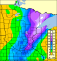
1991snow.png 399 × 426; 17 KB
-
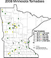
2008mntor.jpg 600 × 689; 94 KB
-
2009mntor.jpg 598 × 691; 98 KB
-
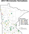
2017 Minnesota Tornadoes.jpg 2,392 × 2,796; 653 KB
-
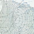
Armistice Day Blizzard surface map.jpg 722 × 729; 238 KB
-
Csptracks.png 1,245 × 767; 479 KB
-
Former lowest measured atmospheric pressure of Minnesota.jpg 522 × 400; 87 KB
-
March 29 1998 supercell.png 209 × 157; 16 KB
-
March 6th, 2017 Radar Image.png 838 × 600; 259 KB


