Category:Waxham
Jump to navigation
Jump to search
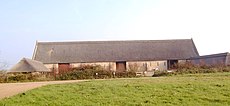
English: Waxham is a small village in Norfolk in eastern England. It lies on the north-east coast of the county in Sea Palling parish. Buildings in the village include Waxham Hall, the 14th-century St. John's Church and the 16th-century Waxham Barn. One of the largest barns in the county, it has recently been restored and opened to the public. The village has an extensive sandy beach backed by dunes.
village in United Kingdom | |||||
| Upload media | |||||
| Instance of |
| ||||
|---|---|---|---|---|---|
| Location | Sea Palling, North Norfolk, Norfolk, East of England, England | ||||
 | |||||
Subcategories
This category has the following 6 subcategories, out of 6 total.
Media in category "Waxham"
The following 54 files are in this category, out of 54 total.
-
A holiday home in the Marram Hills - geograph.org.uk - 1016625.jpg 480 × 640; 148 KB
-
A pillbox in the dunes - geograph.org.uk - 1016619.jpg 640 × 455; 146 KB
-
A sunny day on the beach - geograph.org.uk - 995106.jpg 480 × 640; 99 KB
-
A view from the Marham Hills - geograph.org.uk - 1016620.jpg 640 × 436; 129 KB
-
Brograve Drainage Mill - geograph.org.uk - 650056.jpg 640 × 480; 63 KB
-
Driveway to Poplar Farm - geograph.org.uk - 578531.jpg 640 × 480; 47 KB
-
Environment Agency 110809 131722.jpg 4,288 × 2,848; 4.21 MB
-
Environment Agency 110809 131727.jpg 4,288 × 2,848; 4.21 MB
-
Environment Agency 110809 131731.jpg 4,288 × 2,848; 5.02 MB
-
Environment Agency 110809 131736.jpg 4,288 × 2,848; 5.29 MB
-
Environment Agency 110809 131742a.jpg 4,288 × 2,848; 4.49 MB
-
Environment Agency 110809 131748.jpg 4,288 × 2,848; 4.53 MB
-
Environment Agency 110809 131904.jpg 4,288 × 2,848; 5.84 MB
-
Environment Agency 110809 131912.jpg 4,288 × 2,848; 5.72 MB
-
Environment Agency 110809 131919.jpg 4,288 × 2,848; 6.16 MB
-
Frenchs Farm - geograph.org.uk - 578480.jpg 640 × 480; 35 KB
-
Gateway into The Hall - geograph.org.uk - 995305.jpg 480 × 640; 186 KB
-
Heading west towards Waxham Road - geograph.org.uk - 578538.jpg 640 × 480; 49 KB
-
Horsey Gap (17566865835).jpg 3,264 × 2,448; 1.97 MB
-
House on the corner of Church Road - geograph.org.uk - 995315.jpg 640 × 480; 149 KB
-
Narrow road past The Hall - geograph.org.uk - 995262.jpg 480 × 640; 143 KB
-
Panorama of Waxham Beach, Norfolk - geograph.org.uk - 1954938.jpg 760 × 167; 17 KB
-
Path to the beach - geograph.org.uk - 1016624.jpg 640 × 480; 138 KB
-
Piebald horse - geograph.org.uk - 524137.jpg 640 × 480; 78 KB
-
Red-brick cottage on Church Road - geograph.org.uk - 995327.jpg 640 × 480; 192 KB
-
Sea fishing at Waxham - geograph.org.uk - 269864.jpg 640 × 480; 134 KB
-
Surrounded by fields - geograph.org.uk - 995329.jpg 480 × 640; 145 KB
-
The village of Waxham - geograph.org.uk - 1016616.jpg 640 × 440; 137 KB
-
Type FW3-24 pillbox - geograph.org.uk - 1016609.jpg 640 × 480; 160 KB
-
View along Church Road - geograph.org.uk - 995335.jpg 640 × 480; 130 KB
-
View north along Church Road - geograph.org.uk - 995319.jpg 640 × 480; 163 KB
-
Wall surrounding The Hall - geograph.org.uk - 995301.jpg 640 × 461; 143 KB
-
Waves break over a groyne near Waxham - geograph.org.uk - 269861.jpg 480 × 640; 116 KB
-
Waxham Barn - geograph.org.uk - 772111.jpg 640 × 480; 86 KB
-
Waxham Farm - geograph.org.uk - 772105.jpg 640 × 440; 67 KB
-
Waxham Hall and St John's church - geograph.org.uk - 995295.jpg 640 × 480; 138 KB
-
Access to Warren Farm - geograph.org.uk - 994983.jpg 480 × 640; 77 KB
-
Brograve Farm - geograph.org.uk - 578491.jpg 480 × 640; 79 KB
-
Empty beach at Waxham, Norfolk - geograph.org.uk - 319596.jpg 640 × 480; 204 KB
-
Horsey Gap - geograph.org.uk - 223016.jpg 480 × 640; 96 KB
-
Looking north on Waxham Road - geograph.org.uk - 578485.jpg 640 × 480; 85 KB
-
Looking north towards the sea wall - geograph.org.uk - 578510.jpg 640 × 480; 83 KB
-
Path to the Marram Hills - geograph.org.uk - 578502.jpg 640 × 480; 72 KB
-
Private road to Brograve Level - geograph.org.uk - 578540.jpg 640 × 480; 98 KB
-
Sea Defences at Horsey Gap - geograph.org.uk - 223017.jpg 480 × 640; 93 KB
-
Sea Defences at Horsey Gap - geograph.org.uk - 223019.jpg 480 × 640; 79 KB
-
Towards Horsey Mill - geograph.org.uk - 273977.jpg 640 × 480; 93 KB
-
Track at Horsey Corner - geograph.org.uk - 223023.jpg 640 × 480; 57 KB
-
Track to Lambridge Covert - geograph.org.uk - 578468.jpg 480 × 640; 63 KB
-
Waxham Hills - geograph.org.uk - 34252.jpg 640 × 448; 64 KB


