Category:Sea Palling
Jump to navigation
Jump to search
English: Sea Palling is a village and a civil parish covering east of the A149 between Kings Lynn and Great Yarmouth. The nearest railway station is at North Walsham for the Bittern Line which runs between Sheringham, Cromer and Norwich. The nearest airport is Norwich International Airport.
village and civil parish in North Norfolk, UK  | |||||
| Upload media | |||||
| Instance of | |||||
|---|---|---|---|---|---|
| Location | North Norfolk, Norfolk, East of England, England | ||||
| Population |
| ||||
| Area |
| ||||
| Said to be the same as | Sea Palling (Wikimedia duplicated page, civil parish) | ||||
 | |||||
Subcategories
This category has the following 4 subcategories, out of 4 total.
Media in category "Sea Palling"
The following 200 files are in this category, out of 383 total.
(previous page) (next page)-
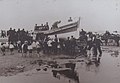 -1901-09-29 Launching Sea Palling West Norfolk Regiment.JPG 3,162 × 2,195; 1,011 KB
-
 A favourite pastime ... - geograph.org.uk - 578188.jpg 640 × 480; 79 KB
-
 A line of reefs - geograph.org.uk - 801134.jpg 640 × 480; 167 KB
-
 A Saturday afternoon in mid-March - geograph.org.uk - 1213733.jpg 578 × 600; 57 KB
-
 Access to beach, Delph Hills - geograph.org.uk - 5608657.jpg 1,600 × 1,200; 383 KB
-
 Arable fields and St John's church, Great Waxham - geograph.org.uk - 3607430.jpg 4,320 × 3,240; 3 MB
-
 Barn beside Stalham Road - geograph.org.uk - 4966951.jpg 640 × 480; 61 KB
-
 Beach access Sea Palling - geograph.org.uk - 5043742.jpg 3,648 × 2,432; 2.93 MB
-
 Beach access, Waxham - geograph.org.uk - 5608640.jpg 1,600 × 1,200; 195 KB
-
 Beach and artificial reefs, Sea Palling - geograph.org.uk - 1862893.jpg 1,280 × 853; 325 KB
-

-
 Beach at Sea Palling - geograph.org.uk - 2988726.jpg 4,320 × 3,240; 5.28 MB
-
 Beach behind offshore breakwater - geograph.org.uk - 5607688.jpg 1,600 × 1,200; 121 KB
-
 Beach House, Sea Palling - geograph.org.uk - 5978347.jpg 1,600 × 1,064; 585 KB
-
 Beach house, The Marrams, Sea Palling - geograph.org.uk - 4133339.jpg 1,600 × 1,064; 387 KB
-
 Beach Road at Sea Palling - geograph.org.uk - 5877876.jpg 640 × 429; 73 KB
-
 Beach Road, Sea Palling - geograph.org.uk - 2984366.jpg 4,320 × 3,240; 3.52 MB
-
 Beach Road, Sea Palling - geograph.org.uk - 4968020.jpg 640 × 480; 62 KB
-
 Beach Rock Leisure - geograph.org.uk - 1846185.jpg 3,648 × 2,736; 1,002 KB
-
 Beach Rock, Sea Palling - geograph.org.uk - 5978343.jpg 1,600 × 1,064; 605 KB
-
 Beach view - geograph.org.uk - 4756659.jpg 640 × 427; 42 KB
-
 Bed and Breakfast property, Beach Road, Sea Palling - geograph.org.uk - 1846155.jpg 3,648 × 2,736; 998 KB
-
 Bridge House Holidays - geograph.org.uk - 6191619.jpg 1,600 × 1,067; 537 KB
-
 Bridge over drain - geograph.org.uk - 547388.jpg 480 × 640; 126 KB
-
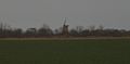
 Brograve Drainage Mill - geograph.org.uk - 6191616.jpg 1,600 × 1,107; 435 KB
-
 Brograve Drainage Mill - geograph.org.uk - 6678281.jpg 1,024 × 768; 132 KB
-
 Brograve Mill - geograph.org.uk - 5251622.jpg 2,399 × 1,599; 496 KB
-
 Brograve Mill - geograph.org.uk - 5917100.jpg 3,264 × 2,448; 1.83 MB
-
 Buildings at Lound Farm, Hickling - geograph.org.uk - 5853811.jpg 3,456 × 2,592; 3.89 MB
-

-
 Buried in the sand - geograph.org.uk - 1213708.jpg 600 × 581; 65 KB
-
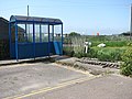 Bus shelter - geograph.org.uk - 802382.jpg 640 × 480; 177 KB
-
 Camping Out - geograph.org.uk - 548044.jpg 640 × 480; 94 KB
-
 Capless - geograph.org.uk - 547866.jpg 480 × 640; 37 KB
-
 Car park and Beach Rock, Sea Palling - geograph.org.uk - 6085138.jpg 3,264 × 2,448; 1.66 MB
-
 Car park near Sea Palling - geograph.org.uk - 5607703.jpg 1,600 × 1,200; 265 KB
-
 Cart Gap, Sea Palling - geograph.org.uk - 6085139.jpg 3,264 × 2,448; 1.58 MB
-
 Cereal crop, Waxham - geograph.org.uk - 4030449.jpg 3,648 × 2,736; 2.97 MB
-
 Chicken shed at Poplar Farm - geograph.org.uk - 5880625.jpg 640 × 448; 84 KB
-
 Church and graveyard, Sea Palling, Norfolk - geograph.org.uk - 2988764.jpg 4,320 × 3,240; 5.46 MB
-
 Church in Waxham, Norfolk - geograph.org.uk - 2989263.jpg 4,320 × 3,240; 5.59 MB
-
 Church Road, Waxham - geograph.org.uk - 5978039.jpg 1,600 × 1,064; 517 KB
-
 Church Road, Waxham - geograph.org.uk - 6191416.jpg 1,600 × 1,067; 317 KB
-
 Clink Lane, Sea Palling - geograph.org.uk - 5978355.jpg 1,600 × 1,116; 638 KB
-
 Clink Road at Sea Palling - geograph.org.uk - 5877814.jpg 640 × 429; 76 KB
-
 Clink Road, Sea Palling - geograph.org.uk - 5607709.jpg 1,600 × 1,200; 268 KB
-
 Close to high tide at Waxham - geograph.org.uk - 2989361.jpg 4,320 × 3,240; 5.62 MB
-

-
 Coast Road by Hall Farm, Waxham - geograph.org.uk - 6085161.jpg 3,264 × 2,241; 1.56 MB
-
 Coastal crop field - geograph.org.uk - 4968024.jpg 640 × 480; 87 KB
-
 Coastal crop field - geograph.org.uk - 4968083.jpg 640 × 480; 57 KB
-
 Commuting! - geograph.org.uk - 547876.jpg 640 × 480; 85 KB
-
 Cottage, Coast Road, Sea Palling - geograph.org.uk - 1846247.jpg 3,648 × 2,736; 1.13 MB
-
 Cottages on Beach Road - geograph.org.uk - 802372.jpg 640 × 460; 156 KB
-
 Cottages, Beach Road, Sea Palling - geograph.org.uk - 1846169.jpg 3,648 × 2,736; 1.03 MB
-
 Cottages, Coast Road, Sea Palling - geograph.org.uk - 1846240.jpg 3,648 × 2,736; 1,023 KB
-
 Cottages, Coast Road, Sea Palling - geograph.org.uk - 1846257.jpg 3,648 × 2,736; 1.06 MB
-

-
 Crop field beside woodland, Brograve - geograph.org.uk - 4968093.jpg 640 × 480; 85 KB
-
 Crop field near Walnut Farm - geograph.org.uk - 4968101.jpg 640 × 480; 85 KB
-
 Crop field off Stalham Road - geograph.org.uk - 4968006.jpg 640 × 480; 87 KB
-
 Crop field, Waxham - geograph.org.uk - 4968059.jpg 640 × 480; 84 KB
-
 Crops near Frenches Farm - geograph.org.uk - 2695212.jpg 2,848 × 2,144; 1.49 MB
-
 Crossroads near French's Farm - geograph.org.uk - 4968071.jpg 640 × 480; 69 KB
-
 Danger Keep Off Rocks - geograph.org.uk - 5850837.jpg 640 × 515; 77 KB
-
 Delph Hills - geograph.org.uk - 3197231.jpg 1,600 × 1,200; 748 KB
-
 Delph Hills - geograph.org.uk - 5607821.jpg 1,600 × 1,200; 312 KB
-
 Drain beside Stalham Road - geograph.org.uk - 4966955.jpg 640 × 480; 114 KB
-
 Drain beside Waxham Road - geograph.org.uk - 4968041.jpg 640 × 480; 76 KB
-
 Drain, Horsey - geograph.org.uk - 4968109.jpg 640 × 480; 82 KB
-

-
 Enjoying the warm sunshine - geograph.org.uk - 1213668.jpg 480 × 640; 46 KB
-
 Entering Horsey - geograph.org.uk - 4968107.jpg 640 × 480; 58 KB
-
 Entering Sea Palling - geograph.org.uk - 4968014.jpg 640 × 480; 60 KB
-
 Entering Waxham near Fir Tree Farm - geograph.org.uk - 6085188.jpg 3,264 × 2,259; 1.92 MB
-
 Environment Agency 110809 131649.jpg 4,288 × 2,848; 3.99 MB
-
 Environment Agency 110809 131653a.jpg 4,288 × 2,848; 5.16 MB
-
 Environment Agency 110809 131656a.jpg 4,288 × 2,848; 5.08 MB
-
 Environment Agency 110809 131704.jpg 4,288 × 2,848; 4.44 MB
-
 Environment Agency 110809 131709.jpg 4,288 × 2,848; 4.1 MB
-
 Environment Agency 110809 131712.jpg 4,288 × 2,848; 4.57 MB
-
 Environment Agency 110809 131716.jpg 4,288 × 2,848; 4.2 MB
-
 Environment Agency 110809 131755.jpg 4,288 × 2,848; 4.49 MB
-
 Environment Agency 110809 131758.jpg 4,288 × 2,848; 4.68 MB
-
 Environment Agency 110809 131810.jpg 4,288 × 2,848; 4.31 MB
-
 Environment Agency 110809 131847.jpg 4,288 × 2,848; 5.93 MB
-
 Environment Agency 110809 131856a.jpg 4,288 × 2,848; 5.58 MB
-
 Environment Agency 110809 131925.jpg 4,288 × 2,848; 5.95 MB
-
 Environment Agency 110809 131932.jpg 4,288 × 2,848; 5.03 MB
-
 Environment Agency 110809 131942a.jpg 4,288 × 2,848; 5.11 MB
-
 Environment Agency 110809 131950.jpg 4,288 × 2,848; 6.44 MB
-
 Environment Agency 110809 131952.jpg 4,288 × 2,848; 5.52 MB
-
 Environment Agency 110809 131955.jpg 4,288 × 2,848; 6.03 MB
-
 Environment Agency 110809 131958.jpg 4,288 × 2,848; 5.75 MB
-
 Environment Agency 110809 132003.jpg 4,288 × 2,848; 6.49 MB
-
 Family Amusements - geograph.org.uk - 802379.jpg 640 × 462; 147 KB
-
 Farmland and bales at French's Farm - geograph.org.uk - 5878881.jpg 640 × 390; 60 KB
-
 Farmland at Waxham - geograph.org.uk - 5878841.jpg 640 × 496; 108 KB
-
 Field near Sea Palling - geograph.org.uk - 5607657.jpg 1,600 × 1,129; 215 KB
-
 Field, French's Farm - geograph.org.uk - 4968067.jpg 640 × 480; 100 KB
-
 Fields near Sea Palling - geograph.org.uk - 5607701.jpg 1,600 × 1,200; 211 KB
-
 Fine red brick house - geograph.org.uk - 802376.jpg 480 × 640; 152 KB
-
 Former Coastguard cottages, Beach Road, Sea Palling - geograph.org.uk - 1846173.jpg 3,648 × 2,736; 1.27 MB
-
 Former Coastguard house-office, Beach Road, Sea Palling - geograph.org.uk - 1846179.jpg 3,648 × 2,736; 886 KB
-
 Former Farmworkers bungalows, Waxham - geograph.org.uk - 1846323.jpg 3,648 × 2,736; 1.26 MB
-
 Former fish and chips shop, Beach Road, Sea Palling - geograph.org.uk - 1846212.jpg 3,648 × 2,736; 843 KB
-
 Former post office - gift shop, Beach Road, Sea Palling - geograph.org.uk - 1846132.jpg 3,648 × 2,736; 984 KB
-
 French's Farm - geograph.org.uk - 4968073.jpg 640 × 480; 74 KB
-
 French's Farm, Waxham - geograph.org.uk - 6085170.jpg 3,042 × 2,262; 1.4 MB
-
 French's Farm, Waxham - geograph.org.uk - 6191411.jpg 1,600 × 1,067; 260 KB
-
 Frenches Farm and Coronation Cottage, Waxham - geograph.org.uk - 2989303.jpg 4,320 × 3,240; 5.91 MB
-
 Gap 35, Marram Hills - geograph.org.uk - 3197238.jpg 1,600 × 1,200; 654 KB
-
 Gap, Sea Palling - geograph.org.uk - 1846269.jpg 3,648 × 2,736; 1.04 MB
-
 Gated entrance to part of Hall Farm - geograph.org.uk - 6085163.jpg 3,135 × 2,164; 2.16 MB
-

-

-

-
 Grazing land between Sea Palling and Waxham - geograph.org.uk - 2988906.jpg 4,320 × 3,240; 5.25 MB
-
 Grazing near Horsey Corner - geograph.org.uk - 4968106.jpg 640 × 480; 77 KB
-
 Grazing off Waxham Road - geograph.org.uk - 4968038.jpg 640 × 480; 51 KB
-
 Growing sand dunes, Sea Palling - geograph.org.uk - 5607698.jpg 1,600 × 1,200; 147 KB
-
 Groyne at Waxham - geograph.org.uk - 5608649.jpg 1,600 × 1,200; 233 KB
-
 Heading south east towards Hemsby - geograph.org.uk - 4968084.jpg 640 × 480; 86 KB
-
 Heading south east towards Hemsby - geograph.org.uk - 4968104.jpg 640 × 480; 95 KB
-
 Holiday chalet, Waxham - geograph.org.uk - 5608631.jpg 1,600 × 1,200; 336 KB
-
 Horse near Waxham Barn - geograph.org.uk - 2989269.jpg 4,320 × 3,240; 5.42 MB
-
 House in Church Road Waxham - geograph.org.uk - 3723403.jpg 640 × 480; 72 KB
-
 House in Waxham - geograph.org.uk - 4968050.jpg 640 × 480; 77 KB
-
 House on Beach Road, Sea Palling - geograph.org.uk - 4968017.jpg 640 × 480; 69 KB
-
 House on Waxham Road - geograph.org.uk - 4968035.jpg 640 × 480; 81 KB
-
 Houses inside the dunes, Sea Palling - geograph.org.uk - 5607800.jpg 1,600 × 1,200; 341 KB
-
 Houses on Clink Road - geograph.org.uk - 801590.jpg 640 × 480; 147 KB
-
 Houses on coastal road at Sea Palling - geograph.org.uk - 3607445.jpg 4,320 × 3,240; 4.12 MB
-
 Independent Lifeboat Station - geograph.org.uk - 3345481.jpg 2,592 × 1,944; 1.3 MB
-
 Inside Waxham Great Barn - geograph.org.uk - 1846346.jpg 3,648 × 2,736; 1.16 MB
-
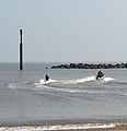
 Jet skiing - geograph.org.uk - 1213727.jpg 583 × 600; 42 KB
-
 Kite surfers on the beach - geograph.org.uk - 801560.jpg 640 × 480; 163 KB
-
 Kite surfing - geograph.org.uk - 801538.jpg 640 × 480; 153 KB
-
 Lambridge Mill - geograph.org.uk - 1222019.jpg 640 × 480; 27 KB
-
 Lambridge Mill.jpg 1,265 × 622; 83 KB
-
 Life boat on the beach at Sea Palling - geograph.org.uk - 2988746.jpg 4,320 × 3,240; 5.3 MB
-
 Lifeboat medals display, St Margaret's Church, Sea Palling - geograph.org.uk - 1846290.jpg 3,648 × 2,736; 1.02 MB
-
 Lifeboat service boards - geograph.org.uk - 1846281.jpg 3,648 × 2,736; 1.26 MB
-
 Lifeboat Service Boards, St Margaret's Church, Sea Palling - geograph.org.uk - 1846285.jpg 3,648 × 2,736; 1.01 MB
-
 Lifeboat Service Boards, St Margaret's Church, Sea Palling - geograph.org.uk - 1846287.jpg 3,648 × 2,736; 1.22 MB
-
 Lifeboat station and slipway - geograph.org.uk - 1213665.jpg 600 × 533; 73 KB
-
 Lifeguard on the beach - geograph.org.uk - 3000129.jpg 2,272 × 1,704; 1.45 MB
-
 Like mother like daughter - geograph.org.uk - 578167.jpg 480 × 640; 106 KB
-

-

-
 Man-made reef - geograph.org.uk - 801529.jpg 640 × 480; 184 KB
-
 Marram Hills near Waxham - geograph.org.uk - 5880635.jpg 640 × 377; 69 KB
-
 Marram Hills, Waxham - geograph.org.uk - 3197227.jpg 1,600 × 1,200; 846 KB
-
 Memorial to Peter van Beusekom - geograph.org.uk - 5607725.jpg 1,200 × 1,600; 418 KB
-
 Mill Lane (track) - geograph.org.uk - 4968031.jpg 640 × 480; 87 KB
-
 Mill Lane heading to the beach, Sea Palling - geograph.org.uk - 2988667.jpg 4,320 × 3,240; 5.96 MB
-
 Mill Lane, Sea Palling - geograph.org.uk - 2988681.jpg 4,320 × 3,240; 5.53 MB
-
 Mill Lane, Sea Palling, track to The Dunes - geograph.org.uk - 6085143.jpg 3,264 × 2,448; 1.67 MB
-
 Minor road near Brograve Farm - geograph.org.uk - 4968087.jpg 640 × 480; 95 KB
-
 Minor road near Fir Tree Farm - geograph.org.uk - 4968103.jpg 640 × 480; 74 KB
-
 Minor road near French's Farm - geograph.org.uk - 4968078.jpg 640 × 480; 58 KB
-
 Minor road, Brograve - geograph.org.uk - 4968099.jpg 640 × 480; 65 KB
-
 Modern houses at Sea Palling - geograph.org.uk - 3723172.jpg 640 × 480; 54 KB
-
 Nearshore reefs at Sea Palling - geograph.org.uk - 1213718.jpg 640 × 480; 47 KB
-
 New beach house, Sea Palling - geograph.org.uk - 5607707.jpg 1,600 × 1,200; 335 KB
-
 Norfolk Coast Path - geograph.org.uk - 5607796.jpg 1,600 × 1,200; 560 KB
-
 Norfolk Coast Path - geograph.org.uk - 5607811.jpg 1,600 × 1,200; 238 KB
-
 Norfolk Coast Path from Sea Palling - geograph.org.uk - 5607807.jpg 1,600 × 1,200; 569 KB
-
 Norfolk Coast Path near Poplar Farm - geograph.org.uk - 5880467.jpg 640 × 471; 93 KB
-
 Norfolk Coast Path to Sea Palling - geograph.org.uk - 5607788.jpg 1,600 × 1,200; 397 KB
-
 Norfolk Coast Path to Sea Palling - geograph.org.uk - 5607794.jpg 1,600 × 1,200; 419 KB
-
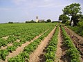 Norfolk potato field - geograph.org.uk - 180521.jpg 640 × 480; 140 KB
-
 Norwegian rocks - geograph.org.uk - 1213755.jpg 640 × 480; 65 KB
-
 Not draining away^ - geograph.org.uk - 547855.jpg 480 × 640; 123 KB
-
 Offshore reef, Sea Palling - geograph.org.uk - 5607700.jpg 1,600 × 1,200; 151 KB
-
 Old Alder Carr, Waxham - geograph.org.uk - 2989299.jpg 4,320 × 3,240; 6.01 MB
-
 Old cart shed at Lound Farm, Hickling - geograph.org.uk - 5853813.jpg 3,456 × 2,592; 3.84 MB
-
 Old Chapel Tea Room, Beach Road, Sea Palling - geograph.org.uk - 1846149.jpg 3,648 × 2,736; 981 KB
-
 Old Hall Inn, Sea Palling - geograph.org.uk - 554944.jpg 640 × 480; 63 KB
-
 Old Seaside Bungalow, Beach Road, Sea Palling - geograph.org.uk - 1846142.jpg 3,648 × 2,736; 996 KB
-
 Ordnance Survey 1GL Bolt - geograph.org.uk - 4218626.jpg 480 × 640; 104 KB
-
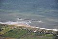
 Panorama of Waxham Beach, Norfolk - geograph.org.uk - 1954938.jpg 760 × 167; 17 KB
-
 Parked by the dunes - geograph.org.uk - 801442.jpg 640 × 480; 163 KB
-
 Parking by Church Lane, Waxham - geograph.org.uk - 5608636.jpg 1,600 × 1,200; 377 KB
-

-
 Path to church, Sea Palling - geograph.org.uk - 1846274.jpg 2,736 × 3,648; 1.2 MB
-

-
 Pillbox beside Stalham Road - geograph.org.uk - 4968011.jpg 640 × 480; 104 KB
-
 Pillbox in the sand dunes at Waxham - geograph.org.uk - 2989345.jpg 4,320 × 3,240; 5.88 MB
-
 Pillbox on Stalham Road - geograph.org.uk - 4968009.jpg 640 × 477; 74 KB
-
 Pipe dump, Horsey - geograph.org.uk - 5608681.jpg 1,600 × 1,200; 317 KB
-
 Pipe dump, Waxham - geograph.org.uk - 3197240.jpg 1,600 × 1,200; 650 KB
-
 Poplar Farm, Waxham - geograph.org.uk - 6085185.jpg 3,264 × 2,448; 1.57 MB
-
 Post Office on Beach Road, Sea Palling - geograph.org.uk - 5978056.jpg 1,600 × 1,064; 544 KB
-
 Post-war cottages - geograph.org.uk - 802373.jpg 640 × 480; 203 KB
-
 Potluck on Clink Lane, Sea Palling - geograph.org.uk - 5978356.jpg 1,600 × 1,064; 653 KB
-
 Public loos and bar, Sea Palling - geograph.org.uk - 5607716.jpg 1,600 × 1,200; 275 KB
-
 Ramp down to the beach at Sea Palling - geograph.org.uk - 3607440.jpg 4,320 × 3,240; 3.9 MB
-
 Ramp to flood gates - geograph.org.uk - 3102231.jpg 3,648 × 2,736; 2.32 MB
-
 Reefs as sea defences - geograph.org.uk - 801525.jpg 640 × 480; 135 KB


_-_geograph.org.uk_-_4968031.jpg)


