Category:Warmfield cum Heath
Jump to navigation
Jump to search
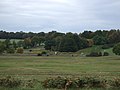
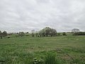
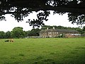
English: Warmfield cum Heath is a civil parish in the City of Wakefield in West Yorkshire, England. It has a population of 844. Until 1974 it formed part of Wakefield Rural District.
civil parish in Wakefield, West Yorkshire, England  | |||||
| Upload media | |||||
| Instance of | |||||
|---|---|---|---|---|---|
| Location | Wakefield, West Yorkshire, Yorkshire and the Humber, England | ||||
 | |||||
Subcategories
This category has the following 10 subcategories, out of 10 total.
Media in category "Warmfield cum Heath"
The following 200 files are in this category, out of 276 total.
(previous page) (next page)-
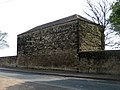
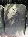
 1595 Hospital Foundation plaque - geograph.org.uk - 5272945.jpg 691 × 1,024; 140 KB
-
 A corner of Heath Common - geograph.org.uk - 3246102.jpg 4,000 × 2,248; 1.46 MB
-
 A horse but no groom - geograph.org.uk - 4913351.jpg 800 × 600; 130 KB
-

-

-
 A655 near Horse Race End - geograph.org.uk - 3784591.jpg 640 × 480; 45 KB
-
 A655 towards Wakefield - geograph.org.uk - 2616683.jpg 1,600 × 1,200; 408 KB
-
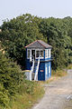
 Access Barrier on Trans Pennine Cycle Route - geograph.org.uk - 3520302.jpg 4,608 × 3,456; 3.26 MB
-
 Agbrigg Common - geograph.org.uk - 5958181.jpg 1,280 × 960; 1.51 MB
-
 Almshouse Lane - Heath Village - geograph.org.uk - 3939935.jpg 640 × 480; 90 KB
-
 Angler's platform on the Half Moon - geograph.org.uk - 6452116.jpg 1,600 × 1,200; 796 KB
-
 Apple blossom along the footpath to Kirkthorpe - geograph.org.uk - 6456827.jpg 1,600 × 1,200; 671 KB
-
 Approaching centre of Heath Village - geograph.org.uk - 3939931.jpg 640 × 480; 74 KB
-

-
 Ashfields carr, Southern Washlands nature corridor - geograph.org.uk - 6459480.jpg 1,600 × 1,200; 910 KB
-
 Ashfields circular walk marker - geograph.org.uk - 6459477.jpg 1,600 × 1,200; 737 KB
-
 Ashfields, Southern Washlands (1) - geograph.org.uk - 2571188.jpg 1,024 × 768; 928 KB
-
 Ashfields, Southern Washlands (2) - geograph.org.uk - 2571192.jpg 768 × 1,024; 828 KB
-
 Ashfields, Southern Washlands (3) - geograph.org.uk - 2571198.jpg 768 × 1,024; 916 KB
-
 Ashfields, Southern Washlands (4) - geograph.org.uk - 2571206.jpg 768 × 1,024; 955 KB
-
 Ashfields, Southern Washlands (5) - geograph.org.uk - 2716379.jpg 768 × 1,024; 945 KB
-
 Ashfields, Southern Washlands (6) - geograph.org.uk - 2716383.jpg 768 × 1,024; 1.04 MB
-
 Ashfields, Southern Washlands (7) - geograph.org.uk - 2716388.jpg 768 × 1,024; 1.07 MB
-
 Banks of the Calder - geograph.org.uk - 5832182.jpg 1,024 × 683; 743 KB
-
 Beech Lawn, Heath - geograph.org.uk - 2072921.jpg 1,024 × 768; 228 KB
-
 Bench in Low Wood - geograph.org.uk - 5831415.jpg 1,024 × 683; 734 KB
-
 Bend in the River Calder, looking upstream - geograph.org.uk - 6456818.jpg 1,389 × 1,042; 536 KB
-
 Black Road approaching the A638 - geograph.org.uk - 3784592.jpg 640 × 480; 43 KB
-
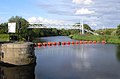
 Blue Bridge - geograph.org.uk - 959995.jpg 640 × 480; 99 KB
-
 Bluebells on the outer bank of the Half Moon - geograph.org.uk - 6452143.jpg 1,600 × 1,200; 874 KB
-
 Boathouse on the outer shore of the Half Moon - geograph.org.uk - 6452152.jpg 1,600 × 1,200; 583 KB
-

-
 Boundary Lane towards Kirkthorpe - geograph.org.uk - 2735091.jpg 640 × 480; 64 KB
-
 Briar and Vine Cottages, Heath - geograph.org.uk - 2074898.jpg 1,024 × 768; 244 KB
-
 Bridge over disused railway at Goosehill - geograph.org.uk - 6093248.jpg 4,320 × 3,240; 3.42 MB
-

-
 Bridge over the dismantled railway near Heath Farm - geograph.org.uk - 5299607.jpg 1,600 × 1,200; 1.06 MB
-
 Bridleway across Heath Common - geograph.org.uk - 3939928.jpg 480 × 640; 55 KB
-
 Bridleway bridge over the Normanton By-pass - geograph.org.uk - 3675383.jpg 1,600 × 1,200; 622 KB
-
 Bridleway from Kirkthorpe Lane - geograph.org.uk - 5831403.jpg 683 × 1,024; 775 KB
-
 Broadreach footbridge - geograph.org.uk - 2540024.jpg 800 × 530; 97 KB
-
 Broadreach Lock - lock keepers house - geograph.org.uk - 2060763.jpg 1,024 × 768; 923 KB
-
 Broadreach Lock from below - geograph.org.uk - 2540020.jpg 800 × 545; 116 KB
-
 Bus lane on A638 - geograph.org.uk - 3247153.jpg 800 × 533; 72 KB
-
 Bypass Construction - geograph.org.uk - 5837478.jpg 4,160 × 3,120; 1.79 MB
-
 Car Park on Heath Common - geograph.org.uk - 367335.jpg 640 × 480; 83 KB
-
 Carr, Ashfields, Southern Washlands nature corridor - geograph.org.uk - 6460264.jpg 1,600 × 1,200; 881 KB
-
 Cars parked at Heath - geograph.org.uk - 5831090.jpg 1,024 × 683; 522 KB
-
 Circular walk marker, Ashfields - geograph.org.uk - 6460275.jpg 1,600 × 1,200; 729 KB
-
 Cottage in Heath - geograph.org.uk - 5831099.jpg 1,024 × 683; 525 KB
-
 Cottage on Heath Common - geograph.org.uk - 365874.jpg 640 × 480; 114 KB
-
 Cottages on Heath Common - geograph.org.uk - 362261.jpg 640 × 427; 103 KB
-
 Cottages on Heath Common - geograph.org.uk - 4913353.jpg 800 × 600; 105 KB
-
 Dean Field - geograph.org.uk - 2590161.jpg 1,024 × 768; 170 KB
-
 Deershed in Heath Hall Park (1) - geograph.org.uk - 2396736.jpg 1,024 × 768; 678 KB
-
 Deershed in Heath Hall Park (2) - geograph.org.uk - 2396750.jpg 725 × 1,024; 273 KB
-
 Disused Railway Bridge, Goosehill - geograph.org.uk - 3520311.jpg 4,608 × 3,456; 3.59 MB
-
 Drain on the south bank of the Calder - geograph.org.uk - 6451283.jpg 1,600 × 1,200; 689 KB
-
 Electrical substation - geograph.org.uk - 5832183.jpg 1,024 × 683; 563 KB
-
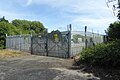
 Electricity Station Gate - geograph.org.uk - 6290290.jpg 640 × 427; 317 KB
-

-
 English bluebells on the south-east bank of the Calder - geograph.org.uk - 6456777.jpg 1,600 × 1,200; 823 KB
-
 Entrance to Heath Hall - geograph.org.uk - 4481810.jpg 1,024 × 768; 121 KB
-
 Entrance to Kirkthorpe Lock, Aire ^ Calder Navigation - geograph.org.uk - 6451292.jpg 1,600 × 1,200; 609 KB
-

-
 Farmland off Hell Lane - geograph.org.uk - 2616677.jpg 1,600 × 1,200; 295 KB
-
 Farmland off Kirkthorpe Lane - geograph.org.uk - 5831398.jpg 1,024 × 683; 492 KB
-
 Farmland off Red Lane - geograph.org.uk - 2616660.jpg 1,600 × 1,200; 431 KB
-
 Farmland, Goosehill - geograph.org.uk - 2735089.jpg 640 × 480; 119 KB
-
 Farmland, Kirkthorpe - geograph.org.uk - 2735114.jpg 640 × 480; 76 KB
-
 Field beside a bridleway - geograph.org.uk - 5831402.jpg 1,024 × 683; 481 KB
-
 Field beside Kirkthorpe Lane - geograph.org.uk - 5831397.jpg 1,024 × 683; 549 KB
-
 Field next to Kirkthorpe Lane - geograph.org.uk - 5831400.jpg 1,024 × 683; 496 KB
-
 Fields on the edge of Heath - geograph.org.uk - 5839940.jpg 1,280 × 853; 338 KB
-
 Fish pass entrance, Kirkthorpe Hydro, River Calder - geograph.org.uk - 6451231.jpg 1,600 × 1,200; 400 KB
-
 Footbridge on a public footpath north of Kirkthorpe - geograph.org.uk - 6459469.jpg 1,600 × 1,200; 826 KB
-
 Footpath - Black Road, Heath - geograph.org.uk - 3939977.jpg 640 × 480; 72 KB
-
 Footpath - Heath Village - geograph.org.uk - 3939936.jpg 640 × 480; 128 KB
-
 Footpath - looking towards Black Road - geograph.org.uk - 3939930.jpg 480 × 640; 109 KB
-
 Footpath above the River Calder - geograph.org.uk - 4481825.jpg 1,024 × 768; 196 KB
-
 Footpath approaching the River Calder, Wakefield - geograph.org.uk - 5840126.jpg 960 × 1,280; 790 KB
-
 Footpath near Heath - geograph.org.uk - 5832519.jpg 1,280 × 960; 516 KB
-

-
 Footpath under railway bridge near Kirkthorpe - geograph.org.uk - 4481821.jpg 1,024 × 768; 260 KB
-
 Former basin above Kirkthorpe lock - geograph.org.uk - 6456741.jpg 1,600 × 1,200; 729 KB
-
 Former Goose Hill Junction Normanton - geograph.org.uk - 2043031.jpg 640 × 439; 90 KB
-

-
 Former pipeline supports under an Ashfields tree - geograph.org.uk - 6460292.jpg 1,600 × 1,200; 852 KB
-
 Former pipeline supports, Ashfields - geograph.org.uk - 6460284.jpg 1,600 × 1,200; 771 KB
-
 Former Wakefield Power Station reminders (1) - geograph.org.uk - 2716448.jpg 768 × 1,024; 1.08 MB
-
 Former Wakefield Power Station reminders (2) - geograph.org.uk - 2716449.jpg 1,024 × 768; 827 KB
-
 Former Wakefield Power Station reminders (3) - geograph.org.uk - 2716452.jpg 768 × 1,024; 1,014 KB
-
 Former Wakefield Power Station reminders (4) - geograph.org.uk - 2716454.jpg 768 × 1,024; 1,008 KB
-
 Former Wakefield Power Station reminders (5) - geograph.org.uk - 2716459.jpg 1,024 × 768; 881 KB
-

-
 Garden entrance to Kirkthorpe Hall - geograph.org.uk - 2079572.jpg 1,024 × 768; 318 KB
-
 Gas Installation - Heath Village - geograph.org.uk - 3939933.jpg 640 × 480; 97 KB
-
 Gate on Trans Pennine Cycle Track - geograph.org.uk - 3520293.jpg 640 × 480; 93 KB
-
 Gate Piers to Old Heath Hall - geograph.org.uk - 2073454.jpg 1,024 × 768; 343 KB
-
 Gateposts at Heath Hall - geograph.org.uk - 5833682.jpg 1,280 × 960; 558 KB
-
 Gateway to the former Heath Old Hall - geograph.org.uk - 5832530.jpg 960 × 1,280; 549 KB
-
 GBRailfreight diesel locomotive - geograph.org.uk - 2716463.jpg 1,024 × 768; 812 KB
-
 Giant hogweed and Japanese knotweed - geograph.org.uk - 6456747.jpg 1,600 × 1,200; 812 KB
-
 Giant hogweed in riverbank woodland - geograph.org.uk - 6451261.jpg 1,600 × 1,200; 772 KB
-
 Goosehill Railway Bridge - geograph.org.uk - 3520315.jpg 4,608 × 3,456; 3.5 MB
-
 Grassy triangle near the pub - geograph.org.uk - 5831086.jpg 1,024 × 683; 524 KB
-
 Grave slabs at St Peter's, Kirkthorpe - geograph.org.uk - 2079262.jpg 1,600 × 1,200; 703 KB
-
 Green Lane towards the A655 - geograph.org.uk - 2735102.jpg 640 × 480; 150 KB
-
 Group of 9 grave tablets (1) - geograph.org.uk - 2391627.jpg 768 × 1,024; 817 KB
-
 Group of 9 grave tablets (2) - geograph.org.uk - 2391645.jpg 768 × 1,024; 716 KB
-
 Group of 9 grave tablets (3) - geograph.org.uk - 2391662.jpg 768 × 1,024; 770 KB
-
 Group of 9 grave tablets (4) - geograph.org.uk - 2391677.jpg 768 × 1,024; 733 KB
-
 Group of 9 grave tablets (5) - geograph.org.uk - 2391692.jpg 768 × 1,024; 797 KB
-
 Group of 9 grave tablets (6) - geograph.org.uk - 2391703.jpg 768 × 1,024; 886 KB
-
 Group of 9 grave tablets (7) - geograph.org.uk - 2391718.jpg 768 × 1,024; 865 KB
-
 Group of 9 grave tablets (8) - geograph.org.uk - 2391735.jpg 768 × 1,024; 1 MB
-
 Group of 9 grave tablets (9) - geograph.org.uk - 2391749.jpg 773 × 1,024; 1.01 MB
-
 Ha-ha at Heath Hall - geograph.org.uk - 5833681.jpg 1,280 × 960; 640 KB
-
 Ha-ha at the Dower House, Heath - geograph.org.uk - 5832524.jpg 1,280 × 960; 690 KB
-
 Half Moon Lake Footpath, Kirkthorpe - geograph.org.uk - 2079624.jpg 1,024 × 768; 359 KB
-
 Heath - geograph.org.uk - 2072538.jpg 1,024 × 796; 199 KB
-
 Heath boundary sign - geograph.org.uk - 2396766.jpg 1,024 × 768; 861 KB
-
 Heath Common - geograph.org.uk - 2616680.jpg 1,600 × 1,200; 331 KB
-
 Heath Common - geograph.org.uk - 3939927.jpg 640 × 480; 46 KB
-
 Heath Common - geograph.org.uk - 5831096.jpg 1,024 × 683; 517 KB
-
 Heath Common - geograph.org.uk - 5831107.jpg 1,024 × 683; 492 KB
-
 Heath Common - geograph.org.uk - 5839935.jpg 1,280 × 853; 566 KB
-
 Heath Common Pinfold 1, Looking into it - geograph.org.uk - 1830820.jpg 1,024 × 768; 311 KB
-

-
 Heath Common Trig Point - geograph.org.uk - 1584687.jpg 640 × 480; 127 KB
-

-

-
-
 Heath conservation village -postbox - geograph.org.uk - 1937228.jpg 480 × 640; 401 KB
-
 Heath Hall - geograph.org.uk - 4907893.jpg 800 × 600; 154 KB
-
 Heath Hall - geograph.org.uk - 6290284.jpg 640 × 427; 360 KB
-
 Heath Hall Farm - geograph.org.uk - 3675629.jpg 1,600 × 1,200; 881 KB
-
 Heath Hall Farm - geograph.org.uk - 5835087.jpg 1,280 × 960; 422 KB
-
 Heath Hall Farm - geograph.org.uk - 5835094.jpg 1,280 × 960; 429 KB
-
 Heath village postbox, ref.WF1 149 - geograph.org.uk - 5833674.jpg 960 × 1,280; 465 KB
-
 Hell Lane heading west - geograph.org.uk - 2616670.jpg 1,600 × 1,200; 410 KB
-
 Hell Lane heading west - geograph.org.uk - 2616678.jpg 1,600 × 1,200; 421 KB
-
 Horse tethered to a tree on Heath Common - geograph.org.uk - 4913363.jpg 800 × 600; 182 KB
-
 Informal riverside path, south bank of the Calder - geograph.org.uk - 6451241.jpg 1,600 × 1,200; 738 KB
-
 Intake screen and screen cleaner, Kirkthorpe Hydro - geograph.org.uk - 6451212.jpg 1,600 × 1,200; 228 KB
-
 Isolation penstock, Kirkthorpe Hydro - geograph.org.uk - 6451217.jpg 1,600 × 1,200; 303 KB
-
 Junction of paths - geograph.org.uk - 5831404.jpg 1,024 × 683; 746 KB
-
 K6 telephone kiosk and postbox at Heath - geograph.org.uk - 5833671.jpg 960 × 1,280; 486 KB
-
 Kirkthorpe Hydro, at the east end of Kirkthorpe weir - geograph.org.uk - 6446124.jpg 1,600 × 1,200; 680 KB
-
 Kirkthorpe Hydro, on the River Calder, from the south - geograph.org.uk - 6451203.jpg 1,819 × 1,365; 662 KB
-

-

-
 Kirkthorpe Lane towards Heath - geograph.org.uk - 2735103.jpg 640 × 480; 112 KB
-
 Kirkthorpe Lane, Heath - geograph.org.uk - 2072507.jpg 1,024 × 768; 172 KB
-
 Kirkthorpe Lane, Heath - geograph.org.uk - 5839927.jpg 1,280 × 960; 613 KB
-
 Kirkthorpe Lane, TPT Signposts - geograph.org.uk - 2393245.jpg 1,024 × 768; 943 KB
-
 Kirkthorpe Lock, Aire ^ Calder Navigation - geograph.org.uk - 6451300.jpg 2,432 × 1,824; 2.86 MB
-
 Kirkthorpe Wood looking out - geograph.org.uk - 1617583.jpg 548 × 391; 82 KB
-
 Kirkthorpe Wood, looking in - geograph.org.uk - 1617575.jpg 553 × 318; 49 KB
-

-
 Lady Gordon Crossing, Willow Lane - geograph.org.uk - 1617650.jpg 515 × 316; 48 KB
-

-
 Marshall Hill towards Kirkthorpe - geograph.org.uk - 2735095.jpg 640 × 480; 76 KB
-
 Moor House, Heath - geograph.org.uk - 5833677.jpg 1,280 × 960; 493 KB
-

-
 Narrow lake off Marshall Hill - geograph.org.uk - 2735094.jpg 640 × 480; 76 KB
-
 Nature takes over - geograph.org.uk - 6093260.jpg 4,320 × 2,766; 2.76 MB
-
 New homes built by Avant, off Neil Fox Way - geograph.org.uk - 6469005.jpg 1,600 × 1,200; 390 KB
-
 North of Hell Lane - geograph.org.uk - 2590133.jpg 1,024 × 768; 201 KB
-
 Northern edge of Dean Field - geograph.org.uk - 2590151.jpg 1,024 × 768; 178 KB
-

-
 Oak tree on the south bank of the River Calder - geograph.org.uk - 6451193.jpg 1,600 × 1,200; 548 KB
-
 Oakenshaw Beck - geograph.org.uk - 5413531.jpg 1,024 × 768; 227 KB
-

-
 Oakenshaw North Junction Signal Cabin - geograph.org.uk - 581982.jpg 426 × 640; 172 KB
-
 Off Kirkthorpe Lane, public footpath - geograph.org.uk - 2393262.jpg 768 × 1,024; 1.02 MB
-
-
 Outflows at Kirkthorpe Hydro - geograph.org.uk - 6468973.jpg 1,600 × 1,200; 481 KB
-
 Overgrown dismantled railway - geograph.org.uk - 2616675.jpg 1,600 × 1,200; 821 KB
-
-
 Path along the riverbank - geograph.org.uk - 5831417.jpg 683 × 1,024; 591 KB
-
 Path in Low Wood - geograph.org.uk - 5831413.jpg 683 × 1,024; 679 KB
-
 Path Junction - geograph.org.uk - 6290287.jpg 640 × 427; 486 KB
-
 Path junction near Heath - geograph.org.uk - 5840116.jpg 1,280 × 960; 775 KB
-
 Path under railway near Kirkthorpe - geograph.org.uk - 6093263.jpg 4,320 × 3,240; 2.89 MB
-
 Pipe bridge over the River Calder near Kirkthorpe - geograph.org.uk - 6456772.jpg 1,600 × 1,200; 799 KB
-
 Polluted drain between Low Wood and the Half Moon - geograph.org.uk - 6452161.jpg 1,600 × 1,200; 885 KB
-
 Pond below Goosehill - geograph.org.uk - 6093239.jpg 4,181 × 3,135; 4.05 MB
-
 Private Road with no Public Access - geograph.org.uk - 3520289.jpg 4,608 × 3,456; 3.55 MB
-
 Public footpath (2) - geograph.org.uk - 2060801.jpg 1,024 × 768; 765 KB
-
 Public footpath (4) - geograph.org.uk - 2067027.jpg 1,024 × 768; 828 KB
-
 Public footpath (4) - geograph.org.uk - 2067033.jpg 1,024 × 768; 732 KB
-
 Public footpath (5) - geograph.org.uk - 2067039.jpg 1,024 × 768; 827 KB
-
 Public footpath (6) - geograph.org.uk - 2067044.jpg 768 × 1,024; 828 KB
-
 Public footpath across a field of oil seed rape - geograph.org.uk - 5817162.jpg 1,024 × 768; 276 KB
-
 Public footpath from Kirkthorpe to Newland - geograph.org.uk - 6456755.jpg 1,600 × 1,200; 707 KB
-
 Public footpath heading east to the A655 - geograph.org.uk - 5817158.jpg 1,024 × 768; 239 KB
-

-
 Public footpath to the River Calder - geograph.org.uk - 5413513.jpg 1,024 × 768; 137 KB
-
 Public footpath, Heath Common (1) - geograph.org.uk - 1933086.jpg 480 × 640; 340 KB


_-_geograph.org.uk_-_2571188.jpg)
_-_geograph.org.uk_-_2571192.jpg)
_-_geograph.org.uk_-_2571198.jpg)
_-_geograph.org.uk_-_2571206.jpg)
_-_geograph.org.uk_-_2716379.jpg)
_-_geograph.org.uk_-_2716383.jpg)
_-_geograph.org.uk_-_2716388.jpg)


_-_geograph.org.uk_-_2396736.jpg)
_-_geograph.org.uk_-_2396750.jpg)


_towards_the_River_Calder_-_geograph.org.uk_-_2735098.jpg)


_-_geograph.org.uk_-_2716448.jpg)
_-_geograph.org.uk_-_2716449.jpg)
_-_geograph.org.uk_-_2716452.jpg)
_-_geograph.org.uk_-_2716454.jpg)
_-_geograph.org.uk_-_2716459.jpg)


_-_geograph.org.uk_-_2391627.jpg)
_-_geograph.org.uk_-_2391645.jpg)
_-_geograph.org.uk_-_2391662.jpg)
_-_geograph.org.uk_-_2391677.jpg)
_-_geograph.org.uk_-_2391692.jpg)
_-_geograph.org.uk_-_2391703.jpg)
_-_geograph.org.uk_-_2391718.jpg)
_-_geograph.org.uk_-_2391735.jpg)
_-_geograph.org.uk_-_2391749.jpg)


_-_geograph.org.uk_-_1936902.jpg)


_-_geograph.org.uk_-_2060801.jpg)
_-_geograph.org.uk_-_2067027.jpg)
_-_geograph.org.uk_-_2067033.jpg)
_-_geograph.org.uk_-_2067039.jpg)
_-_geograph.org.uk_-_2067044.jpg)


_-_geograph.org.uk_-_5817141.jpg)

_-_geograph.org.uk_-_1933086.jpg)