Category:Kirkthorpe
Jump to navigation
Jump to search
village in West Yorkshire, United Kingdom  | |||||
| Upload media | |||||
| Instance of | |||||
|---|---|---|---|---|---|
| Location | Warmfield cum Heath, Wakefield, West Yorkshire, Yorkshire and the Humber, England | ||||
 | |||||
English: Kirkthorpe is a village within the City of Wakefield metropolitan borough of West Yorkshire, England.
Subcategories
This category has the following 5 subcategories, out of 5 total.
Media in category "Kirkthorpe"
The following 70 files are in this category, out of 70 total.
-
 'Back Field', Kirkthorpe - geograph.org.uk - 365520.jpg 640 × 480; 100 KB
-
 Black Road - geograph.org.uk - 365611.jpg 640 × 480; 87 KB
-
 Boat House, Half Moon Lake, Kirkthorpe - geograph.org.uk - 2079604.jpg 1,024 × 768; 307 KB
-
 Bridge under Black Road - geograph.org.uk - 365664.jpg 640 × 480; 158 KB
-
 Church Avenue, Kirkthorpe - geograph.org.uk - 363122.jpg 640 × 480; 64 KB
-
 Community Centre, Kirkthorpe - geograph.org.uk - 365505.jpg 640 × 480; 80 KB
-
 Entering Kirkthorpe from the West - geograph.org.uk - 1617637.jpg 542 × 365; 53 KB
-
 Flooded weir basin - geograph.org.uk - 315964.jpg 640 × 480; 95 KB
-
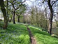
 Footpath at Kirkthorpe - geograph.org.uk - 365568.jpg 480 × 640; 172 KB
-
 Freeston Avenue, Kirkthorpe - geograph.org.uk - 362279.jpg 640 × 480; 115 KB
-
 Freeston Drive, Kirkthorpe, Wakefield - geograph.org.uk - 356390.jpg 640 × 480; 90 KB
-
 Green Lane, Kirkthorpe - geograph.org.uk - 365597.jpg 640 × 480; 124 KB
-
 Half Moon Lane, Kirkthorpe, Wakefield - geograph.org.uk - 356401.jpg 640 × 480; 143 KB
-
 Half Moon Wood, Kirkthorpe, Wakefield - geograph.org.uk - 356400.jpg 640 × 480; 167 KB
-
 House in Old Kirkthorpe - geograph.org.uk - 362182.jpg 640 × 480; 113 KB
-

-
 Kirkthorpe Conservation Village, former inn - geograph.org.uk - 2389058.jpg 1,024 × 768; 766 KB
-

-

-
 Kirkthorpe Conservation Village, Stocks (1) - geograph.org.uk - 2388999.jpg 768 × 1,024; 1.06 MB
-
 Kirkthorpe Conservation Village, Stocks (2) - geograph.org.uk - 2389003.jpg 1,024 × 768; 965 KB
-
 Kirkthorpe Conservation Village, Stocks (3) - geograph.org.uk - 2389007.jpg 1,024 × 768; 942 KB
-
 Kirkthorpe Conservation Village, Stocks (4) - geograph.org.uk - 2389015.jpg 1,024 × 768; 831 KB
-

-
 Kirkthorpe Hall, Kirkthorpe - geograph.org.uk - 2079292.jpg 1,024 × 768; 249 KB
-
 Kirkthorpe Lane, Kirkthorpe - geograph.org.uk - 363128.jpg 640 × 480; 71 KB
-
 Kirkthorpe Lane, Kirkthorpe - geograph.org.uk - 363135.jpg 640 × 480; 93 KB
-
 Kirkthorpe Post Office - geograph.org.uk - 356307.jpg 640 × 480; 100 KB
-
 Kirkthorpe Village - geograph.org.uk - 356329.jpg 640 × 480; 118 KB
-
 Kirkthorpe Village - geograph.org.uk - 356386.jpg 640 × 480; 107 KB
-
 Man Made Mountain - geograph.org.uk - 365539.jpg 640 × 480; 94 KB
-
 Marshall Hill, Warmfield - cum - Heath - geograph.org.uk - 356334.jpg 640 × 480; 123 KB
-
 New Community Centre, Kirkthorpe - geograph.org.uk - 356407.jpg 640 × 480; 109 KB
-
 New ponds, Newland - geograph.org.uk - 191208.jpg 640 × 267; 27 KB
-

-
 Park Avenue, Kirkthorpe - geograph.org.uk - 365497.jpg 640 × 480; 81 KB
-
 Park Avenue, Kirkthorpe, Wakefield - geograph.org.uk - 356387.jpg 640 × 480; 98 KB
-

-
 Poppies, Kirkthorpe - geograph.org.uk - 1393660.jpg 454 × 640; 277 KB
-
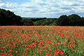 Poppy field, Kirkthorpe - geograph.org.uk - 1393656.jpg 640 × 425; 320 KB
-
 Public footpath (10) - geograph.org.uk - 2067070.jpg 1,024 × 768; 780 KB
-
 Railway Crossing at Kirkthorpe - geograph.org.uk - 365531.jpg 640 × 480; 128 KB
-

-
 River Calder near Kirkthorpe - geograph.org.uk - 362202.jpg 640 × 480; 100 KB
-
 River Calder weir close up - geograph.org.uk - 315969.jpg 640 × 480; 83 KB
-

-
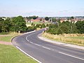
 Roadworks in Kirkthorpe - geograph.org.uk - 362233.jpg 640 × 480; 102 KB
-
 Snydale Junction - geograph.org.uk - 365656.jpg 640 × 480; 103 KB
-
 Spoil Bank - geograph.org.uk - 365716.jpg 640 × 480; 111 KB
-
 Stream on Welbeck - geograph.org.uk - 365549.jpg 640 × 480; 120 KB
-
 Swollen River Calder (2) - geograph.org.uk - 3033333.jpg 1,024 × 768; 680 KB
-
 Sycamore Cottage, Kirkthorpe - geograph.org.uk - 362225.jpg 640 × 480; 127 KB
-
 The Cheesecake Inn and Church, Kirkthorpe - geograph.org.uk - 362220.jpg 640 × 480; 160 KB
-
 The Graveyard, Kirkthorpe - geograph.org.uk - 365593.jpg 640 × 480; 130 KB
-
 The Half Moon lake, Kirkthorpe - geograph.org.uk - 2571242.jpg 1,024 × 768; 745 KB
-
 The Half Moon, Kirkthorpe - geograph.org.uk - 362194.jpg 640 × 480; 140 KB
-
 The Top Field Kirkthorpe - geograph.org.uk - 1617733.jpg 640 × 367; 26 KB
-
 Trees hiding The Secret Pond - geograph.org.uk - 1630661.jpg 640 × 309; 47 KB
-
 Village Stocks, Kirkthorpe, Wakefield - geograph.org.uk - 356338.jpg 640 × 480; 174 KB
-
 Village Stocks, Kirkthorpe, Wakefield - geograph.org.uk - 356341.jpg 640 × 480; 184 KB
-
 W. C. Machan, Kirkthorpe near Wakefield.jpg 1,522 × 982; 864 KB
-
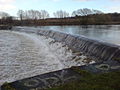
 Weir on River Calder - geograph.org.uk - 315961.jpg 640 × 480; 96 KB
-

-

-
 Welbeck Land-fill Site, Wakefield - geograph.org.uk - 356371.jpg 640 × 480; 87 KB
-
 Welbeck Land-fill Site, Wakefield - geograph.org.uk - 356377.jpg 640 × 427; 83 KB
-
 Welbeck Landfill Site, Wakefield - geograph.org.uk - 356367.jpg 640 × 471; 80 KB
-
 Willow Lane, Kirkthorpe - geograph.org.uk - 365514.jpg 640 × 480; 151 KB
-
 Woodland Avenue, Kirkthorpe - geograph.org.uk - 363131.jpg 640 × 480; 69 KB
-
 Church Hall, Kirkthorpe, Wakefield - geograph.org.uk - 356397.jpg 640 × 480; 111 KB


_-_geograph.org.uk_-_2389038.jpg)
_-_geograph.org.uk_-_2389048.jpg)
_-_geograph.org.uk_-_2388999.jpg)
_-_geograph.org.uk_-_2389003.jpg)
_-_geograph.org.uk_-_2389007.jpg)
_-_geograph.org.uk_-_2389015.jpg)


_-_geograph.org.uk_-_2067070.jpg)


_-_geograph.org.uk_-_3033333.jpg)


