Category:Old maps of Los Angeles
Jump to navigation
Jump to search
Subcategories
This category has the following 8 subcategories, out of 8 total.
B
Media in category "Old maps of Los Angeles"
The following 59 files are in this category, out of 59 total.
-
 1902 Map of La Ballona and Port Ballona.jpg 341 × 311; 43 KB
-
 1909 Los Angeles precinct map.png 700 × 881; 556 KB
-
 1921 map of Glen Airy subdivision, Los Angeles, California.png 936 × 739; 1.69 MB
-
-
 Addition annexation of land to the city of Los Angeles 01.jpg 658 × 997; 143 KB
-
 Addition annexation of land to the city of Los Angeles 02.jpg 655 × 1,011; 133 KB
-
 Addition annexation of land to the city of Los Angeles 03.jpg 675 × 1,024; 145 KB
-
 Addition annexation of land to the city of Los Angeles 04.jpg 653 × 1,007; 245 KB
-
 Addition annexation of land to the city of Los Angeles 05.jpg 673 × 1,005; 145 KB
-

-
 Baist's 1910 Real Estate Map Plate 3 with some post-1920 street alignments shown.png 2,101 × 1,459; 6.39 MB
-
 Ballona diseño 2 Gaucho Guashna.jpg 1,482 × 1,014; 572 KB
-

-
 California Botanic Garden map, 1928.jpg 5,339 × 6,987; 1.65 MB
-
 Colegrove Addition 1909 annexation to City of Los Angeles.jpg 1,431 × 2,282; 957 KB
-

-
 Downtown Los Angeles map 1901.jpg 1,020 × 1,310; 628 KB
-
 Elliott’s map of Los Angeles (1891).jpg 11,317 × 7,999; 17.93 MB
-
 Geologic map of Los Angeles basin (1933).jpg 3,156 × 2,529; 2.28 MB
-
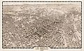
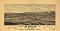
 Greater Los Angeles - the wonder city of America LOC 2006626011.jpg 10,350 × 6,727; 14.52 MB
-
 Greater Los Angeles - the wonder city of America LOC 2006626011.tif 10,350 × 6,727; 199.2 MB
-
 Lankershim Los Angeles California post office application 02.jpg 1,905 × 1,135; 558 KB
-
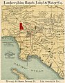 Lankershim Ranch Land and Water Company 1890 map of Los Angeles basin.jpg 786 × 1,000; 439 KB
-
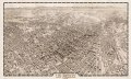
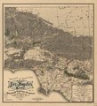
 Los Angeles 1909. LOC 75693097.jpg 11,338 × 6,858; 19.91 MB
-
 Los Angeles 1909. LOC 75693097.tif 11,338 × 6,858; 222.46 MB
-
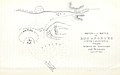
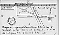
 Los Angeles and Independence Railroad.jpg 1,091 × 273; 222 KB
-
 Los Angeles Central Manufacturing District map 1923.jpg 750 × 858; 304 KB
-
 Los Angeles post office application 1880s showing rail lines and river.jpg 2,017 × 2,465; 1.2 MB
-
 Los Angeles, California, the city and county written by Harry Ellington Brook. 1912.jpg 1,572 × 1,965; 815 KB
-
 LosAngelesBasinOilGasFields.png 744 × 581; 305 KB
-
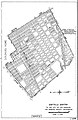
 Map of a Portion of the City of San Marino, California - NARA - 103396526.jpg 6,976 × 8,259; 4.07 MB
-

-
 Map of Los Angeles County - October 1893.jpg 1,577 × 2,406; 1.27 MB
-
 Map of Los Angeles Rail in 1906.jpg 4,000 × 4,517; 9.7 MB
-
 Map of the California Botanic Garden.jpg 1,200 × 754; 182 KB
-

-
 Oil and gas yielding formations of California (1900) (14763061531).jpg 3,961 × 1,690; 1.09 MB
-
 Old Los Angeles overlay labeled.jpeg 1,024 × 1,015; 665 KB
-
-
 Palms Annexation Map.gif 821 × 481; 118 KB
-
 Phenomenal Growth of Los Angeles Toward the Ocean 1912 map.jpg 4,799 × 2,602; 3.43 MB
-
 Photos 2881 large WPA Federal Writers' Project map of ranchos of Los Angeles County California.jpg 10,743 × 6,898; 18.67 MB
-
 Pictorial and Historical map of Old Los Angeles County 1938 by George W. Kirkman.jpg 3,496 × 3,268; 2.83 MB
-
 Post office application Los Angeles 1866 01.jpg 1,987 × 2,427; 1.62 MB
-
 Post office application Los Angeles 1866 02.jpg 1,868 × 2,381; 1.49 MB
-

-
-

-
-

-
-

-

-

-
-
-
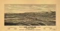
 View of San Gabriel, Cal. LOC 75693105.jpg 6,600 × 4,272; 5.1 MB
-
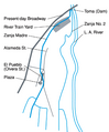 Zanja Madre map.png 372 × 449; 55 KB
-
 Zanja-Madre-map-1868.jpg 2,333 × 1,696; 2.21 MB


.jpg)


.jpg)
.jpg)


_(14763061531).jpg)

.jpg)


_(14738050976).jpg)
_(14760523892).jpg)
_(14780865443).jpg)
_(14780867863).jpg)


.jpg)


.jpg)