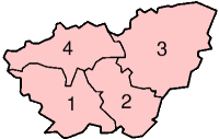
Category:Views of South Yorkshire
Appearance
Wikimedia category | |||||
| Upload media | |||||
| Instance of | |||||
|---|---|---|---|---|---|
| Category combines topics | |||||
| South Yorkshire | |||||
county of England, UK | |||||
| Instance of |
| ||||
| Location | Yorkshire and the Humber, England | ||||
| Capital | |||||
| Inception |
| ||||
| Population |
| ||||
| Area |
| ||||
| Different from | |||||
| official website | |||||
 | |||||
Subcategories
This category has the following 5 subcategories, out of 5 total.
*
B
P
V
Media in category "Views of South Yorkshire"
The following 50 files are in this category, out of 50 total.
-
A6023 and Conisbrough - geograph.org.uk - 243090.jpg 480 × 640; 80 KB
-
Andrew Carr Farm from Whalejaw Hill - geograph.org.uk - 256996.jpg 640 × 480; 104 KB
-
Barnburgh village viewed from NE - geograph.org.uk - 131723.jpg 640 × 480; 98 KB
-
Bernard Road (geograph 3405872).jpg 640 × 480; 101 KB
-
Cropland by Dovecliffe Road - geograph.org.uk - 1714948.jpg 2,560 × 1,920; 956 KB
-
Dry stone wall and gate to nowhere - geograph.org.uk - 1063159.jpg 640 × 391; 76 KB
-
Farm on Flight Hill, Scholes - geograph.org.uk - 1251883.jpg 640 × 436; 75 KB
-
Foulstone Moor - geograph.org.uk - 1316910.jpg 640 × 480; 50 KB
-
Foulstone Road on Foulstone Moor - geograph.org.uk - 160691.jpg 640 × 480; 96 KB
-
Houghton Main colliery 1979 - geograph.org.uk - 1582212.jpg 640 × 329; 39 KB
-
Industrial Hedge Line - geograph.org.uk - 1133893.jpg 640 × 427; 58 KB
-
Looking down towards Darton - geograph.org.uk - 1211060.jpg 640 × 480; 52 KB
-
Looking to Carlton from Wood Lane - geograph.org.uk - 888760.jpg 640 × 480; 72 KB
-
Low Levels - geograph.org.uk - 1218152.jpg 640 × 480; 31 KB
-
Micklebring Viewpoint - geograph.org.uk - 551815.jpg 640 × 480; 129 KB
-
Myrtle Road - geograph.org.uk - 1241468.jpg 640 × 480; 66 KB
-
NUM R.I.P. - geograph.org.uk - 1490742.jpg 640 × 480; 88 KB
-
Pot of Gold over Darfield - geograph.org.uk - 748573.jpg 640 × 417; 53 KB
-
Roman Ridge Road - geograph.org.uk - 1407306.jpg 640 × 480; 64 KB
-
SheffieldCitySkyline.jpg 960 × 546; 233 KB
-
Source of the Tinker Brook - geograph.org.uk - 979908.jpg 640 × 480; 101 KB
-
Stannington from Bell Hagg - geograph.org.uk - 1151535.jpg 640 × 480; 62 KB
-
The Tops - geograph.org.uk - 799590.jpg 640 × 480; 158 KB
-
Treeton Dyke - geograph.org.uk - 435644.jpg 640 × 480; 199 KB
-
View across Abbey Clough - geograph.org.uk - 186353.jpg 640 × 480; 107 KB
-
View from Burbage Edge North - geograph.org.uk - 582983.jpg 640 × 482; 57 KB
-
View from Car Hill - geograph.org.uk - 799490.jpg 640 × 480; 140 KB
-
View from Cusworth Hall - panoramio.jpg 2,048 × 1,536; 611 KB
-
View from Park Grange Road, 1980 - geograph.org.uk - 480377.jpg 640 × 413; 47 KB
-
View from Skiers Hall lane - geograph.org.uk - 1505586.jpg 640 × 479; 78 KB
-
View from Upper Burbage Bridge - geograph.org.uk - 578809.jpg 482 × 640; 91 KB
-
View from White Stones - geograph.org.uk - 266687.jpg 640 × 480; 111 KB
-
View over Royds Farm - geograph.org.uk - 583876.jpg 640 × 425; 66 KB
-
Warren Lane - geograph.org.uk - 471842.jpg 640 × 480; 113 KB
-
Wincobank - Don Valley from Fort.jpg 2,272 × 1,704; 1.13 MB
-
Wincobank - Fort - geograph.org.uk - 598063.jpg 640 × 480; 84 KB
-
Windhill Gate - geograph.org.uk - 404619.jpg 640 × 480; 108 KB
-
Windhill Gate - geograph.org.uk - 404630.jpg 640 × 480; 91 KB
-
Woodhead in Winter - geograph.org.uk - 911663.jpg 639 × 480; 36 KB
-
Beautiful View - geograph.org.uk - 585851.jpg 640 × 480; 70 KB
-
Cairn on Duke's Road - geograph.org.uk - 259530.jpg 640 × 480; 66 KB
-
Duke's Road - geograph.org.uk - 259535.jpg 640 × 480; 109 KB
-
View from Brecks Lane - geograph.org.uk - 208712.jpg 640 × 427; 58 KB
-
View from Round Hill - geograph.org.uk - 245918.jpg 640 × 480; 139 KB
-
View from Sugworth Road - geograph.org.uk - 111318.jpg 640 × 480; 98 KB
-
View over lodge moor - geograph.org.uk - 59074.jpg 600 × 450; 33 KB


