Category:Valid SVG created with ArcMap
Jump to navigation
Jump to search
Subcategories
This category has only the following subcategory.
Media in category "Valid SVG created with ArcMap"
The following 68 files are in this category, out of 68 total.
-
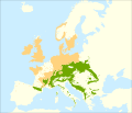 Abies alba range.svg 992 × 850; 983 KB
-
 Albany, New York Map plain.svg 765 × 765; 341 KB
-
 Algadefe - Mapa municipal.svg 778 × 413; 526 KB
-
 Alija del Infantado - Mapa municipal.svg 778 × 413; 526 KB
-
 Almanza - Mapa municipal.svg 778 × 413; 526 KB
-
 Ardón - Mapa municipal.svg 778 × 413; 526 KB
-
 Arganza - Mapa municipal.svg 778 × 413; 526 KB
-
 Asturias - Mapa municipal.svg 778 × 413; 268 KB
-
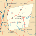 Brunswick, New York Map 2.svg 765 × 765; 273 KB
-
 Brunswick, New York Map2.svg 765 × 765; 83 KB
-
 Cantabria - Mapa municipal.svg 778 × 413; 206 KB
-
 Castropol Asturies map.svg 778 × 413; 102 KB
-
 Cebu Airport Route Map.svg 720 × 720; 2.41 MB
-
 Coastal California Map.svg 585 × 720; 125 KB
-
 ColumbusOhioCongressionalDistricts.svg 1,000 × 800; 704 KB
-
 County1860.svg 1,260 × 990; 7.49 MB
-
 Districts of Manicaland Province, Zimbabwe.svg 437 × 625; 1.03 MB
-
 Districts of Mashonaland Central Province, Zimbabwe.svg 750 × 625; 1.12 MB
-
 Districts of Mashonaland East Province, Zimbabwe.svg 563 × 625; 1.17 MB
-
 Districts of Mashonaland West Province, Zimbabwe.svg 563 × 625; 1.05 MB
-
 Districts of Masvingo Province, Zimbabwe.svg 563 × 625; 857 KB
-
 Districts of Matabeleland North Province, Zimbabwe.svg 625 × 625; 860 KB
-
 Districts of Matabeleland South Province, Zimbabwe.svg 625 × 500; 837 KB
-
 Districts of Midlands Province, Zimbabwe.svg 437 × 625; 1.02 MB
-
 Drainage basins in Sweden.svg 2,105 × 2,980; 6.28 MB
-
 Florida Panther Habitat.svg 990 × 765; 7.25 MB
-
 Khorasan Razavi administrative map.svg 750 × 693; 429 KB
-
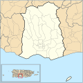
 Localització de Banyalbufar respecte de Mallorca.svg 440 × 413; 528 KB
-
 Localització de Calvià respecte de Mallorca.svg 440 × 413; 528 KB
-
 Localització de Valldemossa respecte de Mallorca.svg 440 × 413; 528 KB
-
 Locator map AZO SMG VFC Ribeira das Tainhas.svg 886 × 709; 2.59 MB
-
 Lokasi Kecamatan Bati-Bati Desa Bati-Bati.svg 746 × 525; 124 KB
-
 Lokasi Kecamatan Bati-Bati Desa Bentok Darat.svg 746 × 525; 122 KB
-
 Lokasi Kecamatan Bati-Bati Desa Bentok Kampung.svg 746 × 525; 117 KB
-
 Lokasi Kecamatan Bati-Bati Desa Benua Raya.svg 746 × 525; 117 KB
-
 Lokasi Kecamatan Bati-Bati Desa Kait-Kait Baru.svg 746 × 525; 116 KB
-
 Lokasi Kecamatan Bati-Bati Desa Kait-Kait.svg 746 × 525; 116 KB
-
 Lokasi Kecamatan Bati-Bati Desa Liang Anggang.svg 746 × 525; 110 KB
-
 Lokasi Kecamatan Bati-Bati Desa Nusa Indah.svg 746 × 525; 104 KB
-
 Lokasi Kecamatan Bati-Bati Desa Padang.svg 746 × 525; 108 KB
-
 Lokasi Kecamatan Bati-Bati Desa Pandahan.svg 746 × 525; 107 KB
-
 Lokasi Kecamatan Bati-Bati Desa Sambangan.svg 746 × 525; 105 KB
-
 Lokasi Kecamatan Bati-Bati Desa Ujung Baru.svg 746 × 525; 104 KB
-
 Lokasi Kecamatan Bati-Bati Desa Ujung.svg 746 × 525; 105 KB
-
 Magueyes, Ponce, Puerto Rico.svg 765 × 765; 326 KB
-
 Map commune FR insee code 01180.svg 709 × 567; 284 KB
-
 Map of Taiwan Provincial Highways.svg 744 × 1,052; 3.83 MB
-
 Mapa de la carretera PR-123 en Ponce, Puerto Rico (M123).svg 585 × 827; 809 KB
-
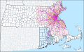 MBTA Commuter Rail and funding district map.svg 904 × 553; 2.37 MB
-
 MD-10.svg 1,812 × 1,075; 312 KB
-
 MD-363.svg 1,812 × 1,075; 1,021 KB
-
 Nederland gemeenten 2010.svg 757 × 958; 2.3 MB
-
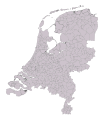 Nederland gemeenten 2012.svg 687 × 791; 656 KB
-
 NRHP Colorado Map.svg 990 × 765; 8.22 MB
-
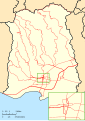
 Nudo de los pastos 200.svg 894 × 608; 629 KB
-
 Ponce barrios map labeled.svg 765 × 765; 374 KB
-
 Ponce barrios map.svg 765 × 765; 303 KB
-
 Ponce roads maps.svg 585 × 827; 723 KB
-
 Population speaking French at home in New England, sum by county.svg 487 × 467; 1.78 MB
-
 Quebrada Limon, Ponce, Puerto Rico.svg 765 × 765; 326 KB
-
 Randers Amtskreds 1960.svg 673 × 532; 1.29 MB
-
 Razavi Khorasan province 2021 (Colorless-Untitled).svg 667 × 613; 197 KB
-
 Real, Ponce, Puerto Rico.svg 765 × 765; 326 KB
-
 Regional Ambassadors Map.svg 990 × 630; 5.3 MB
-
 Sri Lanka Ampara District Workaround.svg 419 × 596; 62 KB
-
 Tenerife municipios.svg 200 × 200; 22 KB
-
 Utah State Route 61.svg 990 × 765; 2.2 MB
-
 Wendover Cut-off.svg 990 × 765; 3.04 MB


.svg)


.svg)


