Category:Invalid SVG created with ArcMap
Jump to navigation
Jump to search
Subcategories
This category has only the following subcategory.
Media in category "Invalid SVG created with ArcMap"
The following 75 files are in this category, out of 75 total.
-
 Canarias mancomunidad de municipios de montaña no costeros.svg 300 × 300; 101 KB
-
 Mapa Canarias El Hierro.svg 977 × 410; 27 KB
-
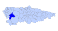 Allande Asturies map.svg 778 × 413; 292 KB
-
 Amieva Asturies map.svg 778 × 413; 292 KB
-
 Ayer Asturies map.svg 778 × 413; 292 KB
-
 Bimenes Asturies map.svg 778 × 413; 292 KB
-
 Bual Asturies map.svg 778 × 413; 292 KB
-
 Cabrales Asturies map.svg 778 × 413; 292 KB
-
 Cabranes Asturies map.svg 778 × 413; 292 KB
-
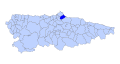
 Candamu Asturies map.svg 778 × 413; 292 KB
-
 Cangas del Narcea Asturies map.svg 778 × 413; 292 KB
-
 Cangues d Onis Asturies map.svg 778 × 413; 292 KB
-
 Caravia Asturies map.svg 778 × 413; 292 KB
-
 Carreno Asturies map.svg 778 × 413; 292 KB
-
 Castrillon Asturies map.svg 778 × 413; 292 KB
-
 Casu Asturies map.svg 778 × 413; 292 KB
-
 Colunga Asturies map.svg 778 × 413; 292 KB
-
 Corvera Asturies map.svg 778 × 413; 292 KB
-
 Cuana Asturies map.svg 778 × 413; 292 KB
-
 Cuideiru Asturies map.svg 778 × 413; 292 KB
-
 Degana Asturies map.svg 778 × 413; 292 KB
-
 Eilao Asturies map.svg 778 × 413; 292 KB
-
 El Franco Asturies map.svg 778 × 413; 292 KB
-
 Gozon Asturies map.svg 778 × 413; 292 KB
-
 Grandas de Salime Asturies map.svg 778 × 413; 292 KB
-
 Grau Asturies map.svg 778 × 413; 292 KB
-
 Ibias Asturies map.svg 778 × 413; 292 KB
-
 Illas Asturies map.svg 778 × 413; 292 KB
-
 L.lena Asturies map.svg 778 × 413; 292 KB
-
 Lanzarote municipio Arrecife.svg 200 × 200; 12 KB
-
 Les Regueres Asturies map.svg 778 × 413; 292 KB
-
 Llanes Asturies map.svg 778 × 413; 292 KB
-
 Llangreu Asturies map.svg 778 × 413; 292 KB
-
 Llaviana Asturies map.svg 778 × 413; 292 KB
-
 Miranda Asturies map.svg 778 × 413; 292 KB
-
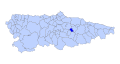
 Morcin Asturies map.svg 778 × 413; 292 KB
-
 Muros de Nalon Asturies map.svg 778 × 413; 292 KB
-
 Nava Asturies map.svg 778 × 413; 292 KB
-
 Navia Asturies map.svg 778 × 413; 292 KB
-
 Norena Asturies map.svg 778 × 413; 292 KB
-
 Onis Asturies map.svg 778 × 413; 292 KB
-
 Parres Asturies map.svg 778 × 413; 292 KB
-
 Penamellera Alta Asturies map.svg 778 × 413; 292 KB
-
 Penamellera Baxa Asturies map.svg 778 × 413; 292 KB
-
 Pezos Asturies map.svg 778 × 413; 292 KB
-
 Pilona Asturies map.svg 778 × 413; 292 KB
-
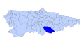
 Ponga Asturies map.svg 778 × 413; 292 KB
-
 Pravia Asturies map.svg 778 × 413; 292 KB
-
 Proaza Asturies map.svg 778 × 413; 292 KB
-
 Quiros Asturies map.svg 778 × 413; 292 KB
-
 Ribedeva Asturies map.svg 778 × 413; 292 KB
-
 Ribera d Arriba Asturies map.svg 778 × 413; 292 KB
-
 Ribesella Asturies map.svg 778 × 413; 292 KB
-
 Riosa Asturies map.svg 778 × 413; 292 KB
-
 Salas Asturies map.svg 778 × 413; 292 KB
-
 Samartin d Ozcos Asturies map.svg 778 × 413; 292 KB
-
 Samartin del Rei Aureliu Asturies map.svg 778 × 413; 292 KB
-
 Santalla d Ozcos Asturies map.svg 778 × 413; 292 KB
-
 Santiso d Abres Asturies map.svg 778 × 413; 292 KB
-
 Santo Adriano Asturies map.svg 778 × 413; 292 KB
-
 Sariegu Asturies map.svg 778 × 413; 292 KB
-
 Siero Asturies map.svg 778 × 413; 292 KB
-
 Sobrescobiu Asturies map.svg 778 × 413; 292 KB
-
 Somiedu Asturies map.svg 778 × 413; 292 KB
-
 Sotu l Barcu Asturies map.svg 778 × 413; 292 KB
-
 Tapia Asturies map.svg 778 × 413; 292 KB
-
 Teberga Asturies map.svg 778 × 413; 292 KB
-
 Tineu Asturies map.svg 778 × 413; 292 KB
-
 Uvieu Asturies map.svg 778 × 413; 292 KB
-
 Valdes Asturies map.svg 778 × 413; 292 KB
-
 Vilanova d Ozcos Asturies map.svg 778 × 413; 292 KB
-
 Villayon Asturies map.svg 778 × 413; 292 KB
-
 Yernes y Tameza Asturies map.svg 778 × 413; 292 KB
-
 Sri Lanka Ampara District.svg 419 × 596; 196 KB
-
 Sorbus aucuparia range.svg 2,055 × 850; 1.96 MB


