Category:Utah State Route 264
Jump to navigation
Jump to search
 | number: | (two sixty-four) |
|---|---|---|
| State highways in Utah: | 247 · 248 · 252 · 256 · 257 · 258 · 259 · 260 · 261 · 262 · 263 · 264 · 265 · 266 · 268 · 269 · 270 · 271 · 273 · 274 · 275 · 276 · 279 · 280 · 281 · 282 · 284 |
state highway in Sanpete, Emery, and Carbon counties in Utah, United States | |||||
| Upload media | |||||
| Instance of | |||||
|---|---|---|---|---|---|
| Part of | |||||
| Located in protected area | |||||
| Location |
| ||||
| Transport network | |||||
| Owned by | |||||
| Maintained by | |||||
| Inception |
| ||||
| Length |
| ||||
| Terminus | |||||
| Partially coincident with | |||||
| |||||
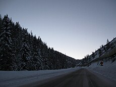
English: Media related to Utah State Route 264 a state highway entirely within the Manti-La Sal National Forest in Sanpete, Emery, and Carbon counties in Utah, United States, that connects Utah State Route 31 with Utah State Route 96. The highway is part of the The Energy Loop, which is part of The Energy Loop: Huntington/Eccles Canyons Scenic Byway, a National Scenic Byway
Subcategories
This category has the following 4 subcategories, out of 4 total.
Media in category "Utah State Route 264"
The following 2 files are in this category, out of 2 total.
-
Utah 264.svg 750 × 600; 73 KB
-
Utah SR 264.svg 385 × 385; 8 KB


