Category:United States House of Representatives election maps of Illinois
Jump to navigation
Jump to search
States of the United States: Alabama · Alaska · Arizona · Arkansas · California · Colorado · Connecticut · Delaware · Florida · Hawaii · Idaho · Illinois · Indiana · Iowa · Kansas · Kentucky · Louisiana · Maine · Maryland · Massachusetts · Michigan · Minnesota · Mississippi · Missouri · Montana · Nebraska · Nevada · New Hampshire · New Jersey · New Mexico · New York · North Carolina · North Dakota · Ohio · Oklahoma · Oregon · Pennsylvania · Rhode Island · South Carolina · South Dakota · Tennessee · Texas · Utah · Vermont · Virginia · Washington · West Virginia · Wisconsin · Wyoming – Washington, D.C.
Subcategories
This category has the following 4 subcategories, out of 4 total.
2
Media in category "United States House of Representatives election maps of Illinois"
The following 14 files are in this category, out of 14 total.
-
 1846 Illinois US House District 7 results.svg 32 × 49; 62 KB
-

-

-
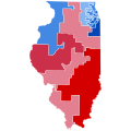
 2010 House Illinois.svg 600 × 1,054; 21 KB
-
 2012 Illinois 13th district Democratic primary results map.svg 800 × 693; 100 KB
-

-
 2018 Congressional election in Illinois' 1st district by county.svg 800 × 664; 19 KB
-
 2018 U.S. House elections in Illinois.svg 810 × 810; 448 KB
-
 Elections legislatives de 2002 en Illinois.png 456 × 400; 10 KB
-
 Elections legislatives de 2004 en Illinois.png 456 × 400; 10 KB
-
 Elections legislatives de 2006 en Illinois.png 456 × 400; 10 KB
-
 Elections legislatives de 2008 en Illinois.png 456 × 400; 10 KB
-
 Elections legislatives de 2010 en Illinois.png 456 × 400; 10 KB
-
 Elections legislatives de 2012 dans l'Illinois.png 223 × 390; 6 KB


