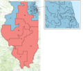
Category:2020 United States House of Representatives election maps of Illinois
Appearance
States of the United States: Arizona · California · Colorado · Illinois · Iowa · Kentucky · Michigan · New Mexico · Ohio · Oklahoma · Pennsylvania · South Carolina · Texas · Virginia · Wisconsin
Media in category "2020 United States House of Representatives election maps of Illinois"
The following 8 files are in this category, out of 8 total.
-
2020 Congressional election in Illinois' 1st district by county.svg 800 × 664; 19 KB
-
2020 Illinois 11th district Democratic primary results map.svg 800 × 613; 22 KB
-
2020 Illinois 14th district Republican primary results map.svg 800 × 1,335; 36 KB
-
2020 Congressional election in Illinois' 2nd district by county.svg 800 × 887; 19 KB
-
2020 U.S. House elections in Illinois.svg 810 × 810; 448 KB
-
Βουλευτικές εκλογές Ηνωμένων Πολιτειών 2020 - Ιλινόις.png 2,270 × 1,956; 1.58 MB


