Category:United States Geological Survey - volcanological maps
Jump to navigation
Jump to search
Subcategories
This category has the following 2 subcategories, out of 2 total.
Media in category "United States Geological Survey - volcanological maps"
The following 6 files are in this category, out of 6 total.
-
 1950 eruption of Mauna Loa.jpg 445 × 333; 53 KB
-
 May 25 Kilauea map.jpg 3,300 × 2,550; 649 KB
-
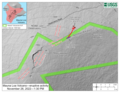
 USGS map of Mauna Loa eruptive activity 2022-11-28 1330.jpg 3,300 × 2,550; 1.49 MB
-
 USGS map of Mauna Loa eruptive activity 2022-11-28 1330.PNG 3,300 × 2,550; 4.88 MB
-
 USGS map of Mauna Loa eruptive activity 2022-11-29 1200.png 2,550 × 3,300; 5.17 MB
-
 USGS map of Mauna Loa eruptive activity.png 811 × 1,063; 863 KB


