Category:United Kingdom photographs taken on 2016-03-21
Jump to navigation
Jump to search
| ← | Monday 21 March 2016 | → | ||
| ← | March 2016 | → | ||

United Kingdom photographs taken on 21 March 2016.
Image files should be categorized here automatically using {{taken on}} template. Direct categorisation is also possible, if automatic is impossible.
Media in category "United Kingdom photographs taken on 2016-03-21"
The following 69 files are in this category, out of 69 total.
-
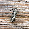
 (0695) Agonopterix alstromeriana - Flickr - Bennyboymothman.jpg 1,264 × 1,628; 1.57 MB
-
 (73.201) (BF2236) Pale Pinion (Lithophane socia) - Flickr - Bennyboymothman (2).jpg 1,500 × 2,371; 2.79 MB
-

-
 2016-03021 Ringway 001.jpg 7,010 × 3,122; 11.73 MB
-
 Agonopteris heracliana - Flickr - Bennyboymothman.jpg 1,500 × 1,345; 2.01 MB
-
 Ardoch Farm near St Johns Town of Dalry - panoramio.jpg 1,980 × 1,320; 1.87 MB
-
 Back across Culmark Hill from Stroanpatrick - panoramio.jpg 1,980 × 1,320; 1.86 MB
-
 Barlaes Farm and Barlaes Hill - panoramio.jpg 1,980 × 1,320; 2.33 MB
-
 Benbrack and Striding Arch - panoramio.jpg 1,980 × 1,320; 1.96 MB
-
 Benbrack from Manquhill Hill - panoramio.jpg 1,980 × 1,320; 2.03 MB
-
 Benbrack from south - panoramio.jpg 1,980 × 1,320; 2 MB
-
 Black Water and Glenshimmeroch Hill - panoramio.jpg 1,980 × 1,320; 2.36 MB
-
 Black Water near Mackilston Hill - panoramio.jpg 1,980 × 1,320; 2.12 MB
-
 Boggy ground at foot of Waterside Hill - panoramio.jpg 1,980 × 1,320; 3.68 MB
-
 Buildings near Ardoch Farm - panoramio.jpg 1,320 × 1,980; 2.37 MB
-
 Burn on Culmark Moss - panoramio.jpg 1,980 × 1,320; 1.93 MB
-
 Cantilevered learning block at St Peter's Seminary.jpg 1,080 × 1,080; 126 KB
-
 Cattle on Barlaes Farm - panoramio.jpg 1,980 × 1,320; 1.99 MB
-
 ColinTheLitterVolunteer.JPG 3,648 × 2,736; 4.87 MB
-
 Copland road - panoramio.jpg 1,024 × 768; 400 KB
-
 Culmark Farm - panoramio.jpg 1,980 × 1,320; 1.47 MB
-
 Deer on Manquhill Hill - panoramio.jpg 1,980 × 1,320; 2.54 MB
-
 Descent into Culmark Farm - panoramio.jpg 1,980 × 1,320; 2.23 MB
-
 Descent into St Johns Town of Dalry - panoramio.jpg 1,980 × 1,320; 2.01 MB
-
 Diurnea fagella - Flickr - Bennyboymothman (2).jpg 1,500 × 1,496; 1.82 MB
-
 Drumbuie Hill near St Johns Town of Dalry - panoramio.jpg 1,980 × 1,320; 2.31 MB
-
 Earlston Burn at Barlaes - panoramio.jpg 1,980 × 1,320; 2.68 MB
-
 Farmyard at Culmark - panoramio.jpg 1,980 × 1,320; 2.09 MB
-
 Galloway Forest Park from Blawquhairn Hill - panoramio.jpg 1,980 × 1,320; 2.3 MB
-
 Garroch Burn at Clenrie Farm - panoramio.jpg 1,980 × 1,320; 2.07 MB
-
 Garroch Burn in woodland near St Johns Town of Dalry - panoramio.jpg 1,980 × 1,320; 3.81 MB
-
 Garroch Burn near Garroch Hill at St Johns Town of Dalry - panoramio.jpg 1,320 × 1,980; 3.52 MB
-
 Horse on public road into St Johns Town of Dalry - panoramio.jpg 1,980 × 1,320; 2.84 MB
-
 Ibrox - panoramio.jpg 1,024 × 768; 435 KB
-
 Leaving forest onto shoulder of Benbrack - panoramio.jpg 1,320 × 1,980; 3.04 MB
-
 Looking back across Barlaes from Culmark Hill - panoramio.jpg 1,980 × 1,320; 1.6 MB
-
 Looking north on Sedgewick Lane (geograph 4873102).jpg 800 × 600; 128 KB
-
 Looking south from Manquhill Hill - panoramio.jpg 1,980 × 1,320; 2.22 MB
-
 Macro Moths 20th March - Flickr - Bennyboymothman.jpg 1,500 × 1,076; 1.18 MB
-
 Main stand - panoramio.jpg 1,024 × 768; 387 KB
-

-
 Road sign in North Stoke, Somerset, with St Martin's parish church in the background.jpg 2,304 × 1,704; 1.76 MB
-
 St Martins church, North Stoke, Somerset (geograph 4872711).jpg 2,304 × 1,704; 1.75 MB
-
 St Martins tower, North Stoke (geograph 4873892).jpg 1,704 × 2,304; 2.09 MB
-
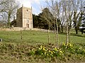 St Martins, North Stoke, Somerset, in the Spring (geograph 4873960).jpg 2,304 × 1,704; 1.67 MB
-

-
 North towards Benbrack from Culmark Hill - panoramio.jpg 1,980 × 1,320; 2.37 MB
-
 North towards the arches at Barlaes - panoramio.jpg 1,980 × 1,320; 1.71 MB
-
 Old Ford tractor at Ardoch Farm - panoramio.jpg 1,320 × 1,980; 2.5 MB
-
 On Culmark Hill - panoramio.jpg 1,980 × 1,320; 1.45 MB
-
 Sheep at Barlaes - panoramio.jpg 1,980 × 1,320; 1.37 MB
-
 Southern Upland Way at Blawquhairn Hill - panoramio.jpg 1,320 × 1,980; 3.31 MB
-
 Southern Upland Way joins a minor road at Mackilston near Barlaes - panoramio.jpg 1,980 × 1,320; 1.67 MB
-
 Southern Upland Way near Clenrie Farm at St Johns Town of Dalry - panoramio.jpg 1,980 × 1,320; 2.08 MB
-
 Southern Upland Way sign at Stroanpatrick - panoramio.jpg 1,980 × 1,320; 1.89 MB
-
 Southern Upland Way towards Ardoch Farm - panoramio.jpg 1,980 × 1,320; 2.14 MB
-
 Start of ascent of Culmark Hill - panoramio.jpg 1,980 × 1,320; 2.32 MB
-
 Start of ascent of Manquhill Hill - panoramio.jpg 1,980 × 1,320; 2.36 MB
-
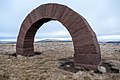
 Striding Arch on Benbrack - panoramio.jpg 1,980 × 1,320; 2.09 MB
-
 Striding Arch on Benbrack from south - panoramio.jpg 1,980 × 1,320; 1.25 MB
-
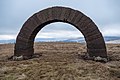
 Summit of Benbrack and Striding Arch - panoramio.jpg 1,980 × 1,320; 2.07 MB
-
 Town hall at St Johns Town of Dalry - panoramio.jpg 1,320 × 1,980; 2.89 MB
-
 Trailstar at Benbrack under Striding Arch - panoramio.jpg 1,980 × 1,485; 2.16 MB
-
 View across Barlaes Farm - panoramio.jpg 1,980 × 1,320; 2.26 MB
-
 View north at Corseglass near Barlaes - panoramio.jpg 1,980 × 1,320; 2.15 MB
-
 View towards Galloway Forest Park from St Johns Town of Dalry - panoramio.jpg 1,980 × 1,320; 1.84 MB
-

-
 Water of Ken at St Johns Town of Dalry - panoramio.jpg 1,980 × 1,320; 2.72 MB
-
 Waterside Hill with St Johns Town of Dalry in background - panoramio.jpg 1,980 × 1,320; 2.07 MB
_Agonopterix_alstromeriana_-_Flickr_-_Bennyboymothman.jpg)
_(BF2236)_Pale_Pinion_(Lithophane_socia)_-_Flickr_-_Bennyboymothman_(2).jpg)


.jpg)


.jpg)


.jpg)
.jpg)
.jpg)


