Category:United Kingdom photographs taken on 2016-03-19
Jump to navigation
Jump to search
| ← | Saturday 19 March 2016 | → | ||
| ← | March 2016 | → | ||

United Kingdom photographs taken on 19 March 2016.
Image files should be categorized here automatically using {{taken on}} template. Direct categorisation is also possible, if automatic is impossible.
Subcategories
This category has the following 2 subcategories, out of 2 total.
S
Media in category "United Kingdom photographs taken on 2016-03-19"
The following 82 files are in this category, out of 82 total.
-
 'Stand back from the edge of the platform'. - panoramio.jpg 3,840 × 2,160; 2.74 MB
-
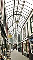 . . Okehampton Arcade. - panoramio.jpg 2,111 × 3,757; 2.54 MB
-
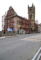
 34-38 West George Street - view of upper storeys from S.jpg 5,407 × 3,605; 4.74 MB
-
 Approaching Beehive Bothy at Laggangarn on Southern Upland Way - panoramio.jpg 1,980 × 1,320; 2.56 MB
-
 Approaching Craig Airie Fell on Southern Upland Way - panoramio.jpg 1,980 × 1,320; 1.9 MB
-
 Approaching forest near Laggangarn - panoramio.jpg 1,980 × 1,320; 2.13 MB
-
 Approaching Knowe on Southern Upland Way - panoramio.jpg 1,320 × 1,980; 2.71 MB
-
 Ayuntamiento - panoramio (10).jpg 3,456 × 2,304; 3.43 MB
-
 Bare tree near Loch Derry on Southern Upland Way - panoramio.jpg 1,320 × 1,980; 3.11 MB
-
 Bench on Southern Upland Way by Water of Minnoch - panoramio.jpg 1,980 × 1,320; 3.29 MB
-
 Brighton Bandstand.jpg 5,095 × 3,632; 1.8 MB
-
 Broken kist containing hoard in Galloway Forest Park - panoramio.jpg 1,320 × 1,980; 3.81 MB
-
 Buchan Hill behind Water of Minnoch in Galloway Forest Park - panoramio.jpg 1,980 × 1,320; 2.61 MB
-
 Carpenters Arms pub, Fitzrovia.JPG 4,000 × 3,000; 3.96 MB
-
 Cattle at Garchew Farm near Bargrennan on Southern Upland Way - panoramio.jpg 1,980 × 1,320; 1.9 MB
-
 Cleveland Mews, London.JPG 4,000 × 3,000; 4.16 MB
-
 Dark skies - April 2016 - panoramio.jpg 4,000 × 3,000; 3 MB
-
 Devonshire Mews Street 03.JPG 4,000 × 3,000; 4.04 MB
-
 Devonshire Mews Street 04.JPG 4,000 × 3,000; 4.1 MB
-
 Dumbarton Bridge - composite panoramic view from SE.jpg 19,212 × 3,651; 46.36 MB
-
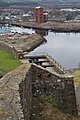
 Dumbarton Castle - view entrance gateway from E.jpg 2,972 × 4,458; 4.56 MB
-
 Dumbarton Castle - view of Prince Regent's Battery.jpg 3,648 × 5,472; 5.79 MB
-
 Dumbarton Castle - view up stair to portcullis arch.jpg 3,648 × 5,472; 5.86 MB
-
 Entering Galloway Forest Park on Southern Upland Way near Bargrennan - panoramio.jpg 1,980 × 1,320; 2.42 MB
-
 Farm ruins at Derry on Southern Upland Way - panoramio.jpg 1,980 × 1,320; 2.54 MB
-
 Fields close to Sawtry - April 2016 - panoramio (1).jpg 4,000 × 3,000; 3.66 MB
-
 Fields close to Sawtry - April 2016 - panoramio.jpg 4,000 × 3,000; 4 MB
-
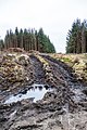 Forest operations on path at Southern Upland Way near Laggangarn - panoramio.jpg 1,320 × 1,980; 2.7 MB
-
 Former Dumbarton Academy - detail of carved stone at entrance, prior to repair.jpg 3,624 × 5,436; 4.86 MB
-
 Former Dumbarton Academy - view from NW, prior to repair.jpg 3,559 × 5,197; 11.84 MB
-
 G. R. ELKINGTON - Newhall Street Birmingham B3.jpg 1,500 × 2,000; 585 KB
-
 Glencairn Tenement - view of upper storeys from N.jpg 5,472 × 3,648; 5.69 MB
-
 Hathaway Street (geograph 4890359).jpg 640 × 365; 109 KB
-
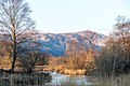
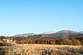 Hills behind Loch Trool in Galloway Forest Park - panoramio.jpg 1,980 × 1,320; 1.95 MB
-
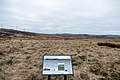 Information board by Balmurrie Fell - panoramio.jpg 1,980 × 1,320; 2.2 MB
-
 Lanchester Library, Coventry University (geograph 4870856).jpg 1,600 × 1,105; 491 KB
-
 Liskeard (25888637756).jpg 3,217 × 1,749; 3.68 MB
-
 Loch Derry near White Hill on Southern Upland Way - panoramio.jpg 1,980 × 1,320; 3.32 MB
-
 Loch Ochiltree from Ochiltree Hill on Southern Upland Way - panoramio.jpg 1,980 × 1,320; 3 MB
-
 Looking towards the Caldons from Southern Upland Way in Galloway Forest Park - panoramio.jpg 1,320 × 1,980; 1.95 MB
-
 Maryhill Barracks commemorative plaque (geograph 4890283).jpg 640 × 480; 195 KB
-
 Maryhill Barracks wall (geograph 4890272).jpg 640 × 397; 146 KB
-
 Maryhill Burgh Hall (geograph 4890186).jpg 640 × 563; 152 KB
-
 Maryhill Burgh Hall (geograph 4890189).jpg 640 × 392; 114 KB
-
 Maryhill Road (geograph 4890240).jpg 640 × 480; 125 KB
-
 NCN Millennium Milepost MP222 Appleford Oxfordshire.jpeg 1,200 × 1,600; 610 KB
-
 New housing on the edge of Sawtry - April 2016 - panoramio.jpg 4,000 × 3,000; 3.36 MB
-
 Ochiltree Farm on Southern Upland Way - panoramio.jpg 1,980 × 1,320; 2.98 MB
-
 Old Bridge of Minnoch in Galloway Forest Park - panoramio.jpg 1,320 × 1,980; 3.19 MB
-
 Open fields and big sky - Sawtry April 2016 - panoramio.jpg 4,000 × 3,000; 3.66 MB
-
 Path through forest at Muirglass - panoramio.jpg 1,320 × 1,980; 2.72 MB
-
 Regents Park underground station 19 March 2016.JPG 3,000 × 4,000; 4.38 MB
-
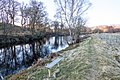
 River Bladnoch near Waterside on Southern Upland Way - panoramio.jpg 1,980 × 1,320; 2.26 MB
-
 River Cree near Bargrennan on Southern Upland Way - panoramio.jpg 1,320 × 1,980; 3.4 MB
-
 Riverside Parish Church - view from W.jpg 3,608 × 5,412; 4.37 MB
-
 Round Church, Cambridge - 10.jpg 1,786 × 3,945; 6.48 MB
-
 SECR Class P No 323 Bluebell Horsted Keynes.jpg 2,466 × 1,852; 1.14 MB
-
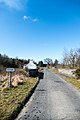
 Sign outside Glenruther on Southern Upland Way - panoramio.jpg 1,320 × 1,980; 3.44 MB
-
 Signing visitor book at Beehive Bothy at Laggangarn - panoramio.jpg 1,980 × 1,320; 2.03 MB
-
 Signpost on ascent to Craig Airie Fell on Southern Upland Way - panoramio.jpg 1,980 × 1,320; 1.33 MB
-
 Small Quaker and Hebrew Character - Flickr - Bennyboymothman.jpg 1,500 × 1,163; 1.93 MB
-
 Southern Upland Way at start of Galloway Forest near Bargrennan - panoramio.jpg 1,980 × 1,320; 4.19 MB
-
 Southern Upland Way from Knowe towards Glenruther - panoramio.jpg 1,980 × 1,320; 3.4 MB
-
 Southern Upland Way from Waterside towards Knowe - panoramio.jpg 1,980 × 1,320; 2.54 MB
-
 Standing stones near Laggangarn on Southern Upland Way - panoramio.jpg 1,980 × 1,320; 3.08 MB
-
 Sutton Courtenay War Memorial (geograph 5044661).jpg 533 × 800; 94 KB
-
 The castle - panoramio (2).jpg 3,456 × 2,304; 3.63 MB
-
 The Hill House, Helensburgh - view through boundary wall, from W.jpg 3,648 × 5,472; 4.65 MB
-
 The Hill House, Helensburgh - view through gates, from SW.jpg 3,487 × 5,407; 9.72 MB
-
 The Merrick seen from Waterside on Southern Upland Way - panoramio.jpg 1,320 × 1,980; 1.67 MB
-
 The old mill - Sawtry - April 2016 - panoramio.jpg 4,000 × 3,000; 2.87 MB
-
 Trees across path on Southern Upland Way outside Knowe - panoramio.jpg 1,980 × 1,320; 3.89 MB
-
 Trig point on Ochiltree Hill on Southern Upland Way - panoramio.jpg 1,980 × 1,320; 2.58 MB
-
 Victoria Halls, Helensburgh - view from SW.jpg 3,648 × 5,472; 4.98 MB
-
 Victoria street - panoramio.jpg 3,456 × 2,304; 3.59 MB
-
 View from Craig Airie Fell on Southern Upland Way - panoramio.jpg 1,980 × 1,320; 1.73 MB
-
 View from Great St Mary's Cambridge - 05.jpg 5,184 × 3,456; 6.43 MB
-
 View from Great St Mary's Cambridge - 07.jpg 5,184 × 3,456; 7.37 MB
-
 View towards Galloway Forest Park from Southern Upland Way near Loch Derry - panoramio.jpg 1,980 × 1,320; 2.41 MB
-
 Water of Minnoch in Galloway Forest Park - panoramio (1).jpg 1,980 × 1,320; 3.25 MB
-
 Water of Minnoch in Galloway Forest Park - panoramio.jpg 1,320 × 1,980; 2.94 MB
-
 Water of Minnoch in Galloway Forest Park from Southern Upland Way - panoramio.jpg 1,320 × 1,980; 1.97 MB


.jpg)


.jpg)


.jpg)


.jpg)
.jpg)


.jpg)
.jpg)
.jpg)
.jpg)
.jpg)


.jpg)
.jpg)


.jpg)

