Category:United Kingdom photographs taken on 2009-09-10
Jump to navigation
Jump to search
| ← | Thursday 10 September 2009 | → | ||
| ← | September 2009 | → | ||

United Kingdom photographs taken on 10 September 2009.
Image files should be categorized here automatically using {{taken on}} template. Direct categorisation is also possible, if automatic is impossible.
Subcategories
This category has the following 2 subcategories, out of 2 total.
L
Media in category "United Kingdom photographs taken on 2009-09-10"
The following 200 files are in this category, out of 1,199 total.
(previous page) (next page)-
 "Suttingham" Palace - Front Gates - panoramio.jpg 2,400 × 1,926; 3.89 MB
-
 03 norfolk Holkham - Flickr - histogram man.jpg 3,008 × 1,769; 2.9 MB
-
 1 in 10 climbout of Avening - geograph.org.uk - 1481913.jpg 640 × 480; 73 KB
-
 15th century timber framed houses - geograph.org.uk - 1482193.jpg 640 × 503; 104 KB
-
 A bend in the Ridgeway unclassified road - geograph.org.uk - 1481561.jpg 640 × 413; 112 KB
-
 A Boggy Derwent - geograph.org.uk - 1491005.jpg 427 × 640; 119 KB
-
 A cairn at the site of St Conal's Church - geograph.org.uk - 1518505.jpg 640 × 427; 133 KB
-
 A goat - geograph.org.uk - 1481583.jpg 585 × 640; 160 KB
-
 A lot of Hope - geograph.org.uk - 1485262.jpg 640 × 479; 114 KB
-
 A Rickle o' Stanes - geograph.org.uk - 1481316.jpg 640 × 427; 198 KB
-
 A Straight Scar - geograph.org.uk - 1502051.jpg 640 × 427; 95 KB
-
-
 A Typical Dark Peak Stream - geograph.org.uk - 1494210.jpg 480 × 640; 132 KB
-

-
-
 A view towards Laghead - geograph.org.uk - 1510287.jpg 640 × 428; 60 KB
-
 A walk along the edge at Alderley Edge - geograph.org.uk - 1481317.jpg 640 × 480; 132 KB
-
 A Young Meander - geograph.org.uk - 1490612.jpg 640 × 427; 147 KB
-
 A Young River Derwent - geograph.org.uk - 1494208.jpg 427 × 640; 150 KB
-
 A429 Fosse Way - geograph.org.uk - 1483384.jpg 640 × 480; 72 KB
-
 Aberthaw Road, Newport - geograph.org.uk - 1481832.jpg 640 × 389; 153 KB
-
 Above Clapdale Wood - geograph.org.uk - 1490054.jpg 640 × 480; 169 KB
-
 Above Nether Tillylair - geograph.org.uk - 1481313.jpg 640 × 427; 166 KB
-
 Above Pin Dale - geograph.org.uk - 1485216.jpg 640 × 479; 115 KB
-
 Acacia Avenue, Newport - geograph.org.uk - 1481799.jpg 640 × 430; 154 KB
-
 Aldi store - Moxley - geograph.org.uk - 1483163.jpg 640 × 480; 98 KB
-
 All Saints church, Moxley - geograph.org.uk - 1483172.jpg 480 × 640; 90 KB
-

-

-

-
 Allotments south of Forsyth Road (2) - geograph.org.uk - 1568118.jpg 640 × 480; 132 KB
-
 Allotments south of Forsyth Road (3) - geograph.org.uk - 1568122.jpg 640 × 480; 130 KB
-
 Allotments south of Forsyth Road - geograph.org.uk - 1568112.jpg 640 × 480; 123 KB
-

-
 Approach to bridge over A14 - geograph.org.uk - 1481818.jpg 640 × 480; 62 KB
-
 Approaching the traffic lights - geograph.org.uk - 1483289.jpg 640 × 480; 89 KB
-
 Arable field near Callis Hagg - geograph.org.uk - 1555750.jpg 640 × 480; 142 KB
-
 Arable land near Park Springs Wood - geograph.org.uk - 1574421.jpg 640 × 480; 116 KB
-
 Arable land north of Coppice Farm - geograph.org.uk - 1555764.jpg 640 × 480; 131 KB
-
 Arable land north of Moorgreen - geograph.org.uk - 1553416.jpg 640 × 480; 125 KB
-

-

-
 Archway, St Mary's church - geograph.org.uk - 1482271.jpg 480 × 640; 90 KB
-
 Army Careers Information Office, Newport - geograph.org.uk - 1482612.jpg 640 × 480; 173 KB
-
 Arriva Guildford & West Surrey 3928 GK51 SZF breakdown.JPG 3,328 × 1,872; 1.79 MB
-
 Ascending Crinkle Crags - geograph.org.uk - 1482159.jpg 640 × 480; 71 KB
-
 Ashurst Beacon seen from Wood Lane - geograph.org.uk - 1713295.jpg 3,648 × 2,736; 2.49 MB
-
 Aylesbury Street, Swindon - geograph.org.uk - 1482054.jpg 640 × 480; 222 KB
-
 B4014 going into Gatcombe Woods. - geograph.org.uk - 1483446.jpg 640 × 480; 82 KB
-
 B4203 At Upper Sapey - geograph.org.uk - 1482401.jpg 640 × 480; 166 KB
-
 B4203 In The Forestry Land - geograph.org.uk - 1482369.jpg 640 × 480; 235 KB
-
 B600 at the entrance to Church Road - geograph.org.uk - 1553317.jpg 640 × 480; 64 KB
-
 B6023 Mansfield Road - geograph.org.uk - 1548081.jpg 640 × 480; 85 KB
-
 Back of Dowson Road - geograph.org.uk - 1481482.jpg 606 × 640; 138 KB
-

-
 Barns above Hope Station - geograph.org.uk - 1485392.jpg 640 × 479; 107 KB
-
 Bay on Loch Euphort - geograph.org.uk - 1512110.jpg 640 × 480; 71 KB
-
 Beauvale Lodge - geograph.org.uk - 1579724.jpg 640 × 480; 128 KB
-
 Beech hanger - geograph.org.uk - 1485329.jpg 640 × 452; 103 KB
-
 Beecham Street,Alway - geograph.org.uk - 1482102.jpg 640 × 362; 158 KB
-
 Beechwood Electronics,Newport - geograph.org.uk - 1481456.jpg 640 × 473; 190 KB
-
 Beechwood Park entrance,Newport - geograph.org.uk - 1481447.jpg 640 × 336; 122 KB
-
 Beechwood Road,Newport - geograph.org.uk - 1481451.jpg 640 × 402; 156 KB
-
 Beesands - geograph.org.uk - 1490760.jpg 640 × 419; 60 KB
-
 Bell cage, East Bergholt Church - geograph.org.uk - 1481471.jpg 640 × 475; 132 KB
-

-
 Bend in the Wye - geograph.org.uk - 1496586.jpg 480 × 640; 94 KB
-

-
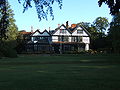
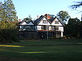
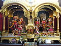
 Bhaktivedanta Manor - 01.JPG 2,304 × 1,728; 1.01 MB
-
 Bhaktivedanta Manor - 02.JPG 2,304 × 1,728; 1.05 MB
-
 Bhaktivedanta Manor - 03.JPG 2,304 × 1,728; 1.05 MB
-
 Bhaktivedanta Manor - 04.JPG 1,728 × 2,304; 791 KB
-
 Bhaktivedanta Manor - 05.JPG 2,304 × 1,728; 1.03 MB
-
 Bhaktivedanta Manor - 06.JPG 1,728 × 2,304; 1.14 MB
-
 Bhaktivedanta Manor - 07.JPG 1,728 × 2,304; 1.25 MB
-
 Bhaktivedanta Manor - 08.JPG 2,304 × 1,728; 1.01 MB
-
 Bhaktivedanta Manor - 12.JPG 2,304 × 1,728; 1.02 MB
-
 Bhaktivedanta Manor - 13.JPG 2,304 × 1,728; 1.01 MB
-
 Bhaktivedanta Manor - 14.JPG 2,304 × 1,728; 1.04 MB
-
 Bhaktivedanta Manor - 15.JPG 2,304 × 1,728; 1.04 MB
-
 Bhaktivedanta Manor - 16.JPG 2,304 × 1,728; 1.01 MB
-
 Bhaktivedanta Manor - 17.JPG 2,304 × 1,728; 1.03 MB
-
 Bhaktivedanta Manor - 18.JPG 2,304 × 1,728; 1.02 MB
-
 Bhaktivedanta Manor - 19.JPG 2,304 × 1,728; 1 MB
-
 Bhaktivedanta Manor - 20.JPG 2,304 × 1,728; 1.01 MB
-
 Bhaktivedanta Manor - 21.JPG 2,304 × 1,728; 1.01 MB
-
 Bhaktivedanta Manor - 22.JPG 2,304 × 1,728; 1.03 MB
-
 Bhaktivedanta Manor - 23.JPG 2,304 × 1,728; 1,018 KB
-
 Bhaktivedanta Manor - 24.JPG 2,304 × 1,728; 1 MB
-
 Bhaktivedanta Manor - 25.JPG 2,304 × 1,728; 1.03 MB
-
 Bhaktivedanta Manor - 26.JPG 2,304 × 1,728; 1.04 MB
-
 Bhaktivedanta Manor - 27.JPG 2,304 × 1,728; 1.02 MB
-
 Bhaktivedanta Manor - 28.JPG 2,304 × 1,728; 1.03 MB
-
 Bhaktivedanta Manor - 29.JPG 1,648 × 1,235; 640 KB
-
 Bhaktivedanta Manor - 30.JPG 1,253 × 934; 462 KB
-
 Bhaktivedanta Manor - 31.JPG 2,304 × 1,728; 1.02 MB
-
 Bhaktivedanta Manor - 32.JPG 2,304 × 1,728; 1.02 MB
-
 Bhaktivedanta Manor - 33.JPG 1,728 × 2,304; 926 KB
-
 Bhaktivedanta Manor - 34.JPG 2,304 × 1,728; 1,015 KB
-
 Bhaktivedanta Manor - 35.JPG 2,304 × 1,728; 1.01 MB
-
 Bhaktivedanta Manor - 36.JPG 1,728 × 2,304; 1.05 MB
-
 Bhaktivedanta Manor - 37.JPG 2,304 × 1,728; 1.05 MB
-
 Bhaktivedanta Manor - 38.JPG 2,304 × 1,728; 1.02 MB
-

-
-
 Black Castle Drain, Soyland Moor - geograph.org.uk - 1483546.jpg 640 × 480; 139 KB
-
 Black Castle Drain, Soyland Moor - geograph.org.uk - 1483561.jpg 640 × 480; 147 KB
-
 Black Rabbit - geograph.org.uk - 1485343.jpg 640 × 479; 124 KB
-
 Blast^ Missed again^ - geograph.org.uk - 1482518.jpg 640 × 640; 45 KB
-

-
 Boats, Hallsands - geograph.org.uk - 1490716.jpg 640 × 460; 107 KB
-
 Boats, Hallsands - geograph.org.uk - 1490728.jpg 640 × 421; 88 KB
-
 Boggy Ground in Swains Greave - geograph.org.uk - 1495447.jpg 427 × 640; 121 KB
-
 Borage (3907166835).jpg 1,653 × 1,233; 424 KB
-

-
 Boxleaf Honeysuckle (Lonicera nitida) (3907165157).jpg 1,279 × 955; 230 KB
-
 Bracken (Pteridium aquilinum) (3907163813).jpg 3,472 × 2,604; 1.88 MB
-
 Bradwell Moor - geograph.org.uk - 1485289.jpg 640 × 479; 82 KB
-
 Bridford Bridge, over the River Teign - geograph.org.uk - 1746445.jpg 640 × 480; 119 KB
-
 Bridge 40 on the Leeds and Liverpool canal - geograph.org.uk - 1713146.jpg 3,648 × 2,736; 2.81 MB
-
 Bridleway at Eckensfield - geograph.org.uk - 1482690.jpg 640 × 360; 68 KB
-
 Bridleway descends to Willykay Clough - geograph.org.uk - 1482296.jpg 480 × 640; 130 KB
-
 Bridleway to Bradwell - geograph.org.uk - 1485384.jpg 479 × 640; 159 KB
-
 Bucks Head Hill, Meonstoke - geograph.org.uk - 1529310.jpg 640 × 428; 74 KB
-
 St Peter's Church, Buntingford - geograph.org.uk - 1485454.jpg 640 × 480; 82 KB
-
 Burwell Post Office - geograph.org.uk - 1482243.jpg 640 × 480; 112 KB
-
 Burwell Village Sign - geograph.org.uk - 1482299.jpg 640 × 640; 67 KB
-
 Burwell, High Street 2009 - geograph.org.uk - 1482820.jpg 640 × 404; 77 KB
-
 By Flatford Mill - geograph.org.uk - 1482272.jpg 640 × 480; 118 KB
-
 By the River Stour - geograph.org.uk - 1481628.jpg 640 × 456; 110 KB
-
 By the riverbank - geograph.org.uk - 1481662.jpg 640 × 453; 131 KB
-

-

-

-

-

-

-
 Bywell Castle - geograph.org.uk - 1571528.jpg 640 × 480; 105 KB
-
 Bywell St. Andrew (2) - geograph.org.uk - 1573191.jpg 640 × 480; 105 KB
-
 Bywell St. Andrew - 18th C gravestone - geograph.org.uk - 1573429.jpg 480 × 640; 104 KB
-
-
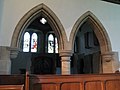
 Bywell St. Andrew - chancel - geograph.org.uk - 1573457.jpg 640 × 480; 67 KB
-
 Bywell St. Andrew - chancel and nave - geograph.org.uk - 1573478.jpg 480 × 640; 56 KB
-
 Bywell St. Andrew - churchyard (2) - geograph.org.uk - 1573414.jpg 640 × 480; 140 KB
-
 Bywell St. Andrew - churchyard (3) - geograph.org.uk - 1573419.jpg 640 × 480; 97 KB
-
 Bywell St. Andrew - churchyard (4) - geograph.org.uk - 1573428.jpg 640 × 480; 85 KB
-
 Bywell St. Andrew - churchyard - geograph.org.uk - 1573408.jpg 480 × 640; 127 KB
-
 Bywell St. Andrew - font - geograph.org.uk - 1573488.jpg 480 × 640; 54 KB
-
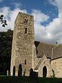
 Bywell St. Andrew - geograph.org.uk - 1573180.jpg 640 × 480; 106 KB
-
 Bywell St. Andrew - gravestone - geograph.org.uk - 1573435.jpg 480 × 640; 127 KB
-
 Bywell St. Andrew - hatchment - geograph.org.uk - 1573513.jpg 640 × 480; 38 KB
-
 Bywell St. Andrew - hatchment - geograph.org.uk - 1573519.jpg 640 × 480; 44 KB
-
 Bywell St. Andrew - hatchment - geograph.org.uk - 1575599.jpg 640 × 480; 35 KB
-
 Bywell St. Andrew - lectern - geograph.org.uk - 1573495.jpg 480 × 640; 59 KB
-
-

-
-

-

-

-

-
-

-
 Bywell St. Andrew - nave - geograph.org.uk - 1573442.jpg 480 × 640; 59 KB
-
-
 Bywell St. Andrew - north chapel - geograph.org.uk - 1573396.jpg 480 × 640; 68 KB
-
 Bywell St. Andrew - organ - geograph.org.uk - 1573508.jpg 480 × 640; 54 KB
-
 Bywell St. Andrew - pulpit - geograph.org.uk - 1573491.jpg 480 × 640; 69 KB
-
-

-
 Bywell St. Andrew - south transept - geograph.org.uk - 1575555.jpg 480 × 640; 57 KB
-
 Bywell St. Andrew - tower (2) - geograph.org.uk - 1573243.jpg 480 × 640; 97 KB
-

-
-

-

-

-

-

-
 Bywell St. Peter - chancel - geograph.org.uk - 1570877.jpg 480 × 640; 54 KB
-
 Bywell St. Peter - churchyard (2) - geograph.org.uk - 1570722.jpg 640 × 480; 129 KB
-
 Bywell St. Peter - churchyard (3) - geograph.org.uk - 1570732.jpg 640 × 480; 125 KB
-
 Bywell St. Peter - churchyard (4) - geograph.org.uk - 1570738.jpg 640 × 480; 139 KB
-
 Bywell St. Peter - churchyard - geograph.org.uk - 1570715.jpg 640 × 480; 77 KB
-

-

-
 Bywell St. Peter - font - geograph.org.uk - 1570749.jpg 480 × 640; 66 KB
-
 Bywell St. Peter - geograph.org.uk - 1570129.jpg 640 × 480; 82 KB
-
 Bywell St. Peter - gravestone - geograph.org.uk - 1571537.jpg 640 × 480; 127 KB
-
 Bywell St. Peter - gravestone - geograph.org.uk - 1571540.jpg 480 × 640; 100 KB
-
 Bywell St. Peter - gravestone - geograph.org.uk - 1571547.jpg 640 × 480; 122 KB
-

-
 Bywell St. Peter - lectern - geograph.org.uk - 1570762.jpg 480 × 640; 67 KB
-

-
 Bywell St. Peter - nave and chancel - geograph.org.uk - 1570873.jpg 480 × 640; 77 KB
-

-
 Bywell St. Peter - organ - geograph.org.uk - 1570766.jpg 480 × 640; 74 KB
-
 Bywell St. Peter - porch - geograph.org.uk - 1570645.jpg 640 × 480; 91 KB
-
 Bywell St. Peter - pulpit - geograph.org.uk - 1570755.jpg 640 × 480; 65 KB
-


_-_geograph.org.uk_-_1568155.jpg)
_-_geograph.org.uk_-_1568161.jpg)

_-_geograph.org.uk_-_1568118.jpg)
_-_geograph.org.uk_-_1568122.jpg)


.jpg)

_(3907165157).jpg)
_(3907163813).jpg)


_-_geograph.org.uk_-_1573191.jpg)


_-_geograph.org.uk_-_1573414.jpg)
_-_geograph.org.uk_-_1573419.jpg)
_-_geograph.org.uk_-_1573428.jpg)


_-_geograph.org.uk_-_1575596.jpg)


_-_geograph.org.uk_-_1573473.jpg)


_-_geograph.org.uk_-_1575583.jpg)

_-_geograph.org.uk_-_1573243.jpg)
_-_geograph.org.uk_-_1573221.jpg)

_-_geograph.org.uk_-_1573231.jpg)
_-_geograph.org.uk_-_1573267.jpg)


_-_geograph.org.uk_-_1570722.jpg)
_-_geograph.org.uk_-_1570732.jpg)
_-_geograph.org.uk_-_1570738.jpg)


