Category:United Kingdom photographs taken on 2009-09-06
Jump to navigation
Jump to search
| ← | Sunday 6 September 2009 | → | ||
| ← | September 2009 | → | ||

United Kingdom photographs taken on 6 September 2009.
Image files should be categorized here automatically using {{taken on}} template. Direct categorisation is also possible, if automatic is impossible.
Subcategories
This category has only the following subcategory.
Media in category "United Kingdom photographs taken on 2009-09-06"
The following 200 files are in this category, out of 1,030 total.
(previous page) (next page)-
 "Reflections" at Claddach Baleshare - geograph.org.uk - 1478756.jpg 640 × 480; 90 KB
-
 "Reflections" at Claddach Baleshare - geograph.org.uk - 1478763.jpg 640 × 480; 117 KB
-
 "Reflections" at Claddach Baleshare - geograph.org.uk - 1478764.jpg 640 × 480; 122 KB
-

-

-

-
 14 The Calls, Leeds - geograph.org.uk - 1603615.jpg 640 × 480; 78 KB
-
 14 The Calls, Leeds. Closer - geograph.org.uk - 1603637.jpg 480 × 640; 77 KB
-
 158907 Danesmoor (3893668322).jpg 1,898 × 2,000; 1.83 MB
-
 222003 Danesmoor (3892848555).jpg 1,799 × 2,000; 1.99 MB
-
 5 seconds or 5 minutes - geograph.org.uk - 1478924.jpg 640 × 479; 92 KB
-
 8-12 The Highway, Hawarden - geograph.org.uk - 1476795.jpg 640 × 480; 136 KB
-

-

-
 A surprising sight in Mill Lane (2) - geograph.org.uk - 1475992.jpg 640 × 480; 136 KB
-
-
 A14 passes over Fornham Road - geograph.org.uk - 1479645.jpg 640 × 481; 64 KB
-
 A57 Sheffield Road, Glossop - geograph.org.uk - 1479844.jpg 640 × 480; 85 KB
-
 A624 at Little Hayfield - geograph.org.uk - 1479815.jpg 640 × 480; 49 KB
-
 Abandoned football pitch - geograph.org.uk - 1481044.jpg 640 × 480; 76 KB
-
 Access Track to Hungriggs - geograph.org.uk - 1485190.jpg 640 × 480; 92 KB
-
 Albrighton Primary School - geograph.org.uk - 1475562.jpg 640 × 480; 95 KB
-
 Alderman White College - geograph.org.uk - 1478171.jpg 640 × 479; 40 KB
-
 Alderman White School - geograph.org.uk - 1478850.jpg 640 × 479; 108 KB
-
 All Saints', Crondall - geograph.org.uk - 1769213.jpg 1,907 × 2,868; 2.21 MB
-
 Alley to Scotland Place, Ramsbottom - geograph.org.uk - 1477852.jpg 640 × 480; 152 KB
-
-
 Andover - Chantry Centre - geograph.org.uk - 1779669.jpg 640 × 480; 69 KB
-
 Andover - Chantry Centre - geograph.org.uk - 1779673.jpg 640 × 480; 75 KB
-
 Andover - Chantry Centre - geograph.org.uk - 1779679.jpg 640 × 480; 60 KB
-
 Andover - Chantry Centre - geograph.org.uk - 1779686.jpg 640 × 480; 68 KB
-
 Andover - Shepherds Spring Lane - geograph.org.uk - 1779764.jpg 640 × 480; 99 KB
-
 Andover - Shepherds Spring Lane - geograph.org.uk - 1779774.jpg 640 × 480; 118 KB
-
 Andover - Shepherds Spring Lane - geograph.org.uk - 1779798.jpg 640 × 480; 87 KB
-
 Andover - Yard - geograph.org.uk - 1779809.jpg 640 × 480; 113 KB
-
 Annadorn Road, Woodgrange - geograph.org.uk - 1476249.jpg 640 × 480; 66 KB
-

-
 Approaching junction with B4213 - geograph.org.uk - 1732904.jpg 800 × 600; 104 KB
-
 Archway Court day nursery, Newport - geograph.org.uk - 1476487.jpg 640 × 515; 76 KB
-
 Arthur Chambers, Belfast - geograph.org.uk - 1477746.jpg 640 × 575; 60 KB
-
 Ash fruit (3896603735).jpg 1,641 × 2,189; 618 KB
-
 Ash tree - geograph.org.uk - 1478887.jpg 479 × 640; 124 KB
-
 Auchencloigh castle - geograph.org.uk - 1475791.jpg 640 × 480; 96 KB
-
 Aumbrey, St Sampson's Church, Cricklade - geograph.org.uk - 1476634.jpg 640 × 640; 331 KB
-
 Avenue of Juniper - geograph.org.uk - 1593511.jpg 640 × 480; 97 KB
-
 B4213 junction with the A38 - geograph.org.uk - 1732920.jpg 800 × 496; 80 KB
-
-
 Balmacara Pond - geograph.org.uk - 1638773.jpg 640 × 436; 104 KB
-
 God Save the King - geograph.org.uk - 1479068.jpg 479 × 640; 71 KB
-
 Beeston Bus Station - geograph.org.uk - 1479052.jpg 640 × 479; 90 KB
-
 Beeston Fields Golf Course - geograph.org.uk - 1478173.jpg 640 × 479; 96 KB
-
 Beeston Library - geograph.org.uk - 1479080.jpg 640 × 479; 91 KB
-

-
 Beeston Square - geograph.org.uk - 1479054.jpg 474 × 640; 96 KB
-
 Beeston Town Hall - geograph.org.uk - 1479071.jpg 640 × 479; 71 KB
-
-
 Berkeley Arms, Purton - geograph.org.uk - 1708664.jpg 800 × 601; 184 KB
-
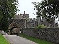 Berkeley Castle - geograph.org.uk - 1732429.jpg 800 × 600; 147 KB
-
 Berkeley Castle - geograph.org.uk - 1732502.jpg 800 × 599; 132 KB
-
 Berkeley Castle - geograph.org.uk - 1732536.jpg 800 × 600; 220 KB
-
 Berkeley Castle, courtyard - geograph.org.uk - 1732509.jpg 800 × 600; 150 KB
-
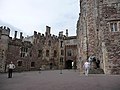 Berkeley Castle, courtyard - geograph.org.uk - 1732528.jpg 800 × 600; 149 KB
-
 Berkeley Castle, garden - geograph.org.uk - 1732486.jpg 800 × 600; 230 KB
-
 Berkeley Castle, garden - geograph.org.uk - 1732545.jpg 800 × 600; 272 KB
-
 Berkeley Castle, garden - geograph.org.uk - 1732796.jpg 800 × 600; 222 KB
-
 Berkeley Castle, garden - geograph.org.uk - 1732811.jpg 800 × 600; 219 KB
-
 Berkeley Castle, garden - geograph.org.uk - 1732817.jpg 800 × 600; 270 KB
-
 Berkeley Castle, garden - geograph.org.uk - 1732825.jpg 800 × 600; 259 KB
-
 Berkeley Castle, garden - geograph.org.uk - 1732851.jpg 800 × 600; 239 KB
-
 Berkeley Castle, terrace - geograph.org.uk - 1732493.jpg 800 × 600; 169 KB
-
 Berkeley churchyard - geograph.org.uk - 1732383.jpg 800 × 600; 233 KB
-
 Berkeley churchyard - geograph.org.uk - 1732394.jpg 800 × 600; 245 KB
-
 Berkeley churchyard and bell tower - geograph.org.uk - 1732402.jpg 800 × 601; 199 KB
-
 Berkeley High Street - geograph.org.uk - 1732420.jpg 800 × 600; 113 KB
-
 Beside the canal at Purton - geograph.org.uk - 1708640.jpg 800 × 601; 174 KB
-
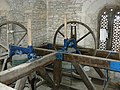
 Big wheel in St Giles - geograph.org.uk - 1479842.jpg 640 × 480; 47 KB
-
 Bildeston Clock Tower - geograph.org.uk - 1475924.jpg 640 × 480; 68 KB
-
 Birdfeeders And Birches - geograph.org.uk - 1638200.jpg 640 × 480; 164 KB
-
 Blandford Road Bus Stop - geograph.org.uk - 1478882.jpg 479 × 640; 73 KB
-
 Blue Sky Brown Fields - geograph.org.uk - 1475879.jpg 640 × 480; 93 KB
-
 Boswednack Manor - geograph.org.uk - 1483669.jpg 640 × 480; 97 KB
-
-
 Bridge near Sunnybrook Farm - geograph.org.uk - 1708526.jpg 800 × 600; 208 KB
-
 Bridge near Sunnybrook Farm - geograph.org.uk - 1708547.jpg 1,024 × 769; 327 KB
-
 Bridge No 37 at Kingswood Junction - geograph.org.uk - 1712797.jpg 640 × 445; 136 KB
-
 Bridge Road, Sharpness Docks - geograph.org.uk - 1708426.jpg 800 × 549; 130 KB
-
 Bright Street - Lord Street - geograph.org.uk - 1484730.jpg 640 × 480; 255 KB
-
 Village street, Broadwell - geograph.org.uk - 1476353.jpg 640 × 480; 72 KB
-
 Broadwell's Golden Jubilee bench - geograph.org.uk - 1479380.jpg 640 × 480; 106 KB
-
 Bucks Head Road, Magheralagan - geograph.org.uk - 1476435.jpg 640 × 480; 57 KB
-

-

-

-
-

-

-

-
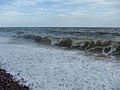 Budleigh Salterton , Breaking Waves - geograph.org.uk - 1476729.jpg 640 × 480; 59 KB
-
 Budleigh Salterton , Car Park - geograph.org.uk - 1476703.jpg 640 × 480; 67 KB
-

-

-

-

-

-

-

-

-

-
-

-

-

-

-

-
-

-

-

-
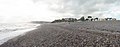
 Budleigh Salterton , Pebbly Beach - geograph.org.uk - 1476731.jpg 640 × 480; 82 KB
-
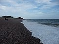
 Budleigh Salterton , Pebbly Beach - geograph.org.uk - 1476738.jpg 640 × 480; 63 KB
-
-
-
-
-

-
-
-

-

-
 Building at Boswednack Farm - geograph.org.uk - 1483662.jpg 640 × 480; 96 KB
-
 Buildings on High Road - geograph.org.uk - 1479015.jpg 640 × 479; 69 KB
-

-
 Bus stop at Sandby Court - geograph.org.uk - 1478189.jpg 640 × 479; 108 KB
-
 Bus to Inham Nook - geograph.org.uk - 1478177.jpg 640 × 479; 72 KB
-
 Camping, Church Bay, Anglesey - panoramio.jpg 2,048 × 1,536; 1.29 MB
-
 Canonbury Street, Berkeley - geograph.org.uk - 1732366.jpg 800 × 600; 158 KB
-
 Blind Arcading, St. Mary's, Canons Ashby - geograph.org.uk - 1522216.jpg 640 × 249; 197 KB
-
 Priory Church of St. Mary, West Front - geograph.org.uk - 1522198.jpg 503 × 640; 182 KB
-
 Canons Ashby Manor House - geograph.org.uk - 1524080.jpg 640 × 480; 173 KB
-
 Car Park Bus - geograph.org.uk - 2244708.jpg 800 × 600; 115 KB
-

-
 Carluccios, St Johns Wood, NW8 (4242286820).jpg 3,475 × 2,606; 3.67 MB
-
 Castle Drogo visitor's centre - geograph.org.uk - 1477264.jpg 640 × 480; 193 KB
-
 Castle Drogo visitor's centre car park - geograph.org.uk - 1477267.jpg 640 × 480; 161 KB
-

-
 Cattle, Woodgrange Townland - geograph.org.uk - 1476213.jpg 640 × 480; 133 KB
-
-
 Chalk pit near Fovant - geograph.org.uk - 1476603.jpg 640 × 480; 141 KB
-
 Chancel, St Sampson's Church, Cricklade - geograph.org.uk - 1479554.jpg 480 × 640; 254 KB
-
 Chapel Milton Viaduct - geograph.org.uk - 1478951.jpg 640 × 480; 48 KB
-
 Chase Side - geograph.org.uk - 1479856.jpg 640 × 480; 230 KB
-
 Chattenden shunts the Sierra Leone coaches (cropped).jpg 3,390 × 2,053; 2.96 MB
-
 Chattenden shunts the Sierra Leone coaches.jpg 3,888 × 2,592; 4.75 MB
-
 Chilwell College House Junior School - geograph.org.uk - 1479049.jpg 640 × 479; 78 KB
-
 Chilwell conservation area - geograph.org.uk - 1478997.jpg 640 × 479; 50 KB
-
 Chilwell Memorial Institute - geograph.org.uk - 1479039.jpg 640 × 479; 73 KB
-
 Christ Church, Tintwistle - geograph.org.uk - 1478348.jpg 640 × 440; 51 KB
-
 Church Lane - geograph.org.uk - 1475949.jpg 640 × 480; 103 KB
-
 Church of Our Lady of the Assumption - geograph.org.uk - 1479064.jpg 640 × 479; 71 KB
-
 Church Street, Tewkesbury, - geograph.org.uk - 1728790.jpg 800 × 600; 159 KB
-
 Chykembro house - geograph.org.uk - 1483646.jpg 640 × 480; 80 KB
-
 Claremont Avenue - geograph.org.uk - 1478168.jpg 640 × 479; 118 KB
-
 Claremont Avenue - geograph.org.uk - 1478169.jpg 640 × 479; 97 KB
-
 Clarks Shopping Village - geograph.org.uk - 1475832.jpg 480 × 640; 168 KB
-
 Claxton Castle - isolated pier - geograph.org.uk - 1476642.jpg 640 × 482; 70 KB
-
 Claxton Manor (north façade) - geograph.org.uk - 1476655.jpg 640 × 480; 73 KB
-
 Claxton Manor (south façade) - geograph.org.uk - 1476631.jpg 640 × 555; 84 KB
-
 Claxton Manor and Castle - geograph.org.uk - 1476662.jpg 640 × 485; 84 KB
-
 Claxton Manor.jpg 640 × 475; 123 KB
-
 Cley beach car park - geograph.org.uk - 1492667.jpg 640 × 427; 124 KB
-
 Cliff top on Newdowns Head - geograph.org.uk - 1477209.jpg 480 × 640; 80 KB
-
 Clunie Church - geograph.org.uk - 1476692.jpg 640 × 480; 100 KB
-
 Coach and Horses Public House - geograph.org.uk - 1479661.jpg 640 × 480; 97 KB
-
 Cogload Flyover 43198.jpg 1,024 × 768; 221 KB
-
 Cogload Flyover 6024.jpg 1,024 × 768; 209 KB
-
 Collow Pill, Newnham on Severn - geograph.org.uk - 1476626.jpg 640 × 427; 62 KB
-
 Collow Pill, SS Freshspring - geograph.org.uk - 1476633.jpg 640 × 427; 73 KB
-
 Colquhar Brae - geograph.org.uk - 1475678.jpg 640 × 480; 95 KB
-
 Colquhar Brae - geograph.org.uk - 1475688.jpg 640 × 480; 70 KB
-
 Colquhar Shank - geograph.org.uk - 1475663.jpg 640 × 436; 71 KB
-
 Colquhar Shank - geograph.org.uk - 1475673.jpg 640 × 480; 78 KB
-
 Common Lane, Bramcote - geograph.org.uk - 1478857.jpg 479 × 640; 123 KB
-
 Communications Mast, Tom a' Chait - geograph.org.uk - 1479451.jpg 427 × 640; 250 KB
-
 Conservation objects - geograph.org.uk - 1479007.jpg 640 × 479; 69 KB
-
 Conservatory, Orestone Manor - geograph.org.uk - 1480512.jpg 480 × 640; 71 KB
-

-
 Corbishley Railway Bridge - geograph.org.uk - 1478383.jpg 640 × 480; 98 KB
-
 Corby Craigs from Priesthope Hill - geograph.org.uk - 1476468.jpg 640 × 480; 76 KB
-
 Corfe Castle - geograph.org.uk - 1524251.jpg 640 × 455; 95 KB
-
 Corfe Castle - geograph.org.uk - 1524259.jpg 640 × 455; 97 KB
-
 Corfe Castle - geograph.org.uk - 1524289.jpg 640 × 455; 125 KB
-
 Corner shop - geograph.org.uk - 1479097.jpg 640 × 479; 79 KB
-
 Cornmarket, Belfast (2) - geograph.org.uk - 1477305.jpg 640 × 419; 99 KB
-
 Cottages - Lacy's Hill - geograph.org.uk - 1475997.jpg 640 × 480; 69 KB
-
 Cottages at Higher Bal - geograph.org.uk - 1477277.jpg 640 × 480; 93 KB
-
 Country Road - geograph.org.uk - 1480683.jpg 480 × 640; 87 KB
-
 Cow Lane - geograph.org.uk - 1478165.jpg 640 × 479; 141 KB
-
 Crawfordstown Road, Seavaghan - geograph.org.uk - 1476015.jpg 640 × 480; 64 KB
-
 Bell, St Sampson's Church, Cricklade - geograph.org.uk - 1476296.jpg 640 × 479; 290 KB
-


.jpg)
.jpg)


_-_geograph.org.uk_-_1475992.jpg)


.jpg)


.jpg)


.jpg)


_-_geograph.org.uk_-_1476655.jpg)
_-_geograph.org.uk_-_1476631.jpg)


_-_geograph.org.uk_-_1477305.jpg)


