Category:United Kingdom photographs taken on 2009-03-14
Jump to navigation
Jump to search
| ← | Saturday 14 March 2009 | → | ||
| ← | March 2009 | → | ||

United Kingdom photographs taken on 14 March 2009.
Image files should be categorized here automatically using {{taken on}} template. Direct categorisation is also possible, if automatic is impossible.
Subcategories
This category has the following 2 subcategories, out of 2 total.
Media in category "United Kingdom photographs taken on 2009-03-14"
The following 200 files are in this category, out of 1,353 total.
(previous page) (next page)-
 "Balance", Market Street, Omagh - geograph.org.uk - 1203020.jpg 480 × 640; 88 KB
-
 "Fleur de Lys" - geograph.org.uk - 1203595.jpg 640 × 371; 58 KB
-

-
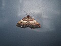
 (1663) March Moth (Alsophila aescularia) (3354258033).jpg 956 × 672; 105 KB
-
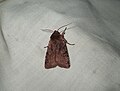
 (1746) Shoulder-stripe (Anticlea badiata) (3354257755).jpg 941 × 702; 142 KB
-
 (2139) Red Chestnut (Cerastis rubricosa) (3354257581).jpg 928 × 706; 113 KB
-
 (2188) Clouded Drab (Orthosia incerta) (3353726480).jpg 2,848 × 2,136; 2.74 MB
-
 (2188) Clouded Drab (Orthosia incerta) (3353727930).jpg 2,848 × 2,136; 2.58 MB
-
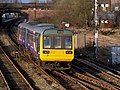 142040 Castleton East Junction.jpg 1,600 × 1,200; 1.24 MB
-
 142062 Castleton East Junction (1).jpg 1,600 × 1,200; 1.03 MB
-
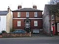 192 Emscote Road, Warwick - geograph.org.uk - 1205322.jpg 640 × 480; 63 KB
-
 222001 South Wingfield,Derbyshire (3353410637).jpg 3,168 × 2,060; 2.93 MB
-
 222002 South Wingfield (3353510801).jpg 1,878 × 1,890; 1.14 MB
-
 3 Pipe Bridge on Ardochy Forest Track - geograph.org.uk - 1203186.jpg 640 × 480; 138 KB
-
 43046 Claycross Jct (3354003829).jpg 2,523 × 2,112; 1.39 MB
-
 66418 South Wingfield (3354280194).jpg 2,581 × 2,175; 1.92 MB
-
 66557 Claycross Jct (3352798487).jpg 2,485 × 2,017; 2.41 MB
-

-
 A footbridge over a stream - geograph.org.uk - 1206104.jpg 600 × 450; 306 KB
-
 A large bare field off Hackington Rd - geograph.org.uk - 1208121.jpg 640 × 430; 89 KB
-
 A large fishing lake - geograph.org.uk - 1203468.jpg 640 × 480; 128 KB
-
 A private fishing lake - geograph.org.uk - 1203454.jpg 640 × 480; 124 KB
-
 A row of Daffodils through the trees - geograph.org.uk - 1210583.jpg 640 × 430; 150 KB
-
 A sign on 'Ippikin's Way' - geograph.org.uk - 1206128.jpg 600 × 450; 257 KB
-
 A small stream, North Bishopden Wood - geograph.org.uk - 1209783.jpg 430 × 640; 137 KB
-
 A stand of conifers, Clowes Wood - geograph.org.uk - 1211426.jpg 640 × 430; 102 KB
-
 A stand of conifers, Clowes Wood - geograph.org.uk - 1211553.jpg 640 × 430; 135 KB
-
 A stand of conifers, Clowes Wood - geograph.org.uk - 1211608.jpg 640 × 430; 99 KB
-
 A stream south of Denstroude Lane - geograph.org.uk - 1210565.jpg 640 × 430; 134 KB
-
 A very strange mating ritual - geograph.org.uk - 1207066.jpg 640 × 480; 103 KB
-
 A well-guarded entrance - geograph.org.uk - 1203588.jpg 600 × 513; 126 KB
-
 A1065 - level crossing, Brandon - geograph.org.uk - 1212373.jpg 640 × 480; 69 KB
-
 A140 switchback viewed from cyclepath - geograph.org.uk - 1209479.jpg 480 × 640; 148 KB
-
 Abbey chicken - geograph.org.uk - 1203380.jpg 640 × 479; 117 KB
-
 Above the Wye Valley - geograph.org.uk - 1203808.jpg 426 × 640; 59 KB
-
 Access road to Gutter Farm - geograph.org.uk - 1206093.jpg 600 × 450; 332 KB
-

-
 Across The Gala Water Valley - geograph.org.uk - 1207295.jpg 640 × 417; 80 KB
-
 Adventure centre, Symonds Yat (West) - geograph.org.uk - 1206601.jpg 640 × 426; 60 KB
-
 Afon Dwyryd - geograph.org.uk - 1212164.jpg 640 × 428; 75 KB
-
 Agricultural buildings - geograph.org.uk - 1203328.jpg 640 × 480; 179 KB
-
 Air ambulance, Bangor - geograph.org.uk - 1203230.jpg 640 × 376; 73 KB
-
 Aldburgh Mews - geograph.org.uk - 1203714.jpg 488 × 640; 103 KB
-
 All along the communications tower - geograph.org.uk - 1204433.jpg 480 × 640; 31 KB
-

-

-
 Allt an Doire Fheàrna approaching bridge - geograph.org.uk - 1203302.jpg 640 × 480; 101 KB
-
-

-
 Allt an Doire Fheàrna Tributary. - geograph.org.uk - 1203241.jpg 640 × 480; 109 KB
-
 An arable field near Well Court - geograph.org.uk - 1208862.jpg 640 × 430; 69 KB
-
 An empty pasture - geograph.org.uk - 1203631.jpg 640 × 480; 144 KB
-
 An extensive garden - geograph.org.uk - 1203566.jpg 640 × 480; 123 KB
-

-
 Anchor House - geograph.org.uk - 1203308.jpg 640 × 480; 102 KB
-
 Ancient Dockyard - geograph.org.uk - 1204244.jpg 640 × 428; 84 KB
-
 Another view of the Old Down School - geograph.org.uk - 1207084.jpg 640 × 480; 61 KB
-
 Apple Orchard, Amery Court - geograph.org.uk - 1208885.jpg 640 × 430; 75 KB
-

-
 Approaching Slievenaglogh - geograph.org.uk - 1205512.jpg 640 × 480; 394 KB
-
-

-

-

-
-
 Arbrook Common - geograph.org.uk - 1203657.jpg 640 × 480; 129 KB
-
-
-
-

-
 Arnish Point Light House.jpg 3,872 × 2,592; 5.23 MB
-
 Arrival from Cardiff - geograph.org.uk - 1207578.jpg 640 × 480; 78 KB
-
 Art Gallery in North Street - geograph.org.uk - 1203669.jpg 480 × 640; 69 KB
-

-
 Artworks at Christ Church, Ross-on-Wye - geograph.org.uk - 1204036.jpg 640 × 480; 213 KB
-
 Ascending Slievenaglogh - geograph.org.uk - 1205560.jpg 640 × 480; 347 KB
-
 Ascending Slievenagore - geograph.org.uk - 1205494.jpg 640 × 600; 555 KB
-
 Ascending Slievenagore - geograph.org.uk - 1205497.jpg 640 × 436; 341 KB
-
 Ascending Slievenagore - geograph.org.uk - 1205503.jpg 640 × 480; 325 KB
-
 Ash Tree Grove - Moore Avenue - geograph.org.uk - 1203234.jpg 640 × 455; 173 KB
-
 Ashwood sheltered housing complex - geograph.org.uk - 1225064.jpg 640 × 427; 77 KB
-
 Assize Court, Lincoln Castle, Lincoln, England.jpg 3,430 × 2,287; 5.34 MB
-
 Auckland Road - Moore Avenue - geograph.org.uk - 1204042.jpg 640 × 480; 244 KB
-
 Avon Aqueduct, Warwick - geograph.org.uk - 1204075.jpg 640 × 480; 84 KB
-
 Awaiting redevelopment - geograph.org.uk - 1207130.jpg 640 × 426; 97 KB
-
-
 Aylesbury Arm, Lock No 7 - geograph.org.uk - 1443001.jpg 640 × 480; 59 KB
-

-
 Aylesbury Arm, Wilstone Lock (No 8) - geograph.org.uk - 1442999.jpg 640 × 480; 77 KB
-

-
 Babbacombe beach - geograph.org.uk - 1493448.jpg 640 × 492; 103 KB
-
 Bakers Mews - geograph.org.uk - 1203151.jpg 480 × 640; 70 KB
-
 Balliemore Farm - geograph.org.uk - 1203125.jpg 640 × 480; 118 KB
-
 Balliemore Farm - geograph.org.uk - 1204097.jpg 640 × 480; 107 KB
-
 Bandstand, South Beach, Blyth - geograph.org.uk - 1205679.jpg 640 × 480; 107 KB
-
 Banns Road near Attical - geograph.org.uk - 1205098.jpg 640 × 442; 251 KB
-
 Banns Road near Slievenaglogh - geograph.org.uk - 1206363.jpg 640 × 480; 371 KB
-
 Banns Road near Slievenaglogh - geograph.org.uk - 1206365.jpg 640 × 421; 311 KB
-
 Banns Road near Slievenaglogh - geograph.org.uk - 1206371.jpg 640 × 480; 402 KB
-
 Banns Road near Slievenagore - geograph.org.uk - 1205716.jpg 640 × 464; 464 KB
-
 Baptistery area of St George's - geograph.org.uk - 1203759.jpg 640 × 480; 86 KB
-
 Barclays Bank, Claygate - geograph.org.uk - 1203505.jpg 480 × 640; 85 KB
-
 Barnacarry Burn flowing into Loch Fyne - geograph.org.uk - 1204100.jpg 640 × 480; 104 KB
-

-
 Bazil Point, near Overton - geograph.org.uk - 1206633.jpg 640 × 427; 120 KB
-
 Beach at Staithes - panoramio.jpg 1,600 × 1,200; 322 KB
-
 Beach at Staithes - Picture 2 - panoramio.jpg 1,600 × 1,200; 334 KB
-
 Bed of Dismantled railway - geograph.org.uk - 1208868.jpg 640 × 430; 145 KB
-
 Beechwood Avenue - Auckland Road - geograph.org.uk - 1204043.jpg 640 × 480; 252 KB
-
 Beechwood Road - geograph.org.uk - 1204044.jpg 640 × 480; 237 KB
-
 Behind the railings, Omagh - geograph.org.uk - 1202986.jpg 640 × 480; 57 KB
-
 Beldon Lane - Poplar Grove - geograph.org.uk - 1203259.jpg 640 × 414; 151 KB
-
 Bend in River Street - geograph.org.uk - 1203123.jpg 480 × 640; 70 KB
-
 Bend in Silverlock Place - geograph.org.uk - 1203087.jpg 640 × 480; 64 KB
-
 Birch and conifers, Clowes Wood - geograph.org.uk - 1211466.jpg 640 × 430; 99 KB
-
 Birch trees, Blean Wood (2) - geograph.org.uk - 1209704.jpg 640 × 430; 129 KB
-
 Birch trees, Blean Wood - geograph.org.uk - 1209692.jpg 640 × 430; 142 KB
-
 Birch trees, Clowes Wood - geograph.org.uk - 1211588.jpg 640 × 430; 127 KB
-
 Bird hide on the Clumber Wetland - geograph.org.uk - 1206592.jpg 640 × 480; 86 KB
-
 Bishop Monkton Corn Mill - geograph.org.uk - 1203295.jpg 640 × 523; 99 KB
-
 Bishop Monkton Cottages - geograph.org.uk - 1203122.jpg 640 × 480; 117 KB
-
 Bishop Monkton Ford - geograph.org.uk - 1203134.jpg 640 × 480; 123 KB
-
 Bishop Monkton Granary - geograph.org.uk - 1203099.jpg 640 × 542; 151 KB
-
 Blake's Lane, Wargrave - geograph.org.uk - 1231328.jpg 640 × 480; 146 KB
-

-
 Blean Wood Nature Reserve - geograph.org.uk - 1209653.jpg 640 × 430; 128 KB
-
 Blocked Track in Ardochy Forest - geograph.org.uk - 1203068.jpg 480 × 640; 106 KB
-
 Bloomfield Place - geograph.org.uk - 1203592.jpg 605 × 640; 92 KB
-
 Blue Plaque 'Martin Van Buren' - geograph.org.uk - 1203690.jpg 640 × 294; 45 KB
-
 Blue Plaque 'Sir Julius Benedict' - geograph.org.uk - 1203752.jpg 640 × 454; 86 KB
-
 Blyth Harbour - geograph.org.uk - 1208572.jpg 640 × 420; 104 KB
-
 Blyth Harbour - geograph.org.uk - 1208577.jpg 640 × 425; 73 KB
-
 Blyth Harbour - geograph.org.uk - 1208583.jpg 640 × 480; 67 KB
-
 Blyth Harbour - geograph.org.uk - 1208587.jpg 640 × 480; 66 KB
-
 Blyth Harbour - geograph.org.uk - 1208591.jpg 640 × 480; 43 KB
-
 Blyth Harbour - geograph.org.uk - 1208592.jpg 431 × 640; 106 KB
-
 Blyth Harbour - geograph.org.uk - 1208595.jpg 479 × 640; 120 KB
-
 Boncyff Pres Portmeirion Money Stump - geograph.org.uk - 1212153.jpg 640 × 428; 125 KB
-

-

-
 Bourne Lodge Close, Blean - geograph.org.uk - 1208906.jpg 640 × 430; 50 KB
-
-
 Bracken Farm Barn - geograph.org.uk - 1203538.jpg 640 × 480; 79 KB
-
 Bracken Farm House - geograph.org.uk - 1203552.jpg 640 × 480; 94 KB
-
 Brandon signal box - geograph.org.uk - 1212335.jpg 640 × 480; 76 KB
-
 Brandon station - geograph.org.uk - 1212351.jpg 640 × 480; 56 KB
-
 Brelston Court - geograph.org.uk - 1206659.jpg 640 × 426; 83 KB
-
 Bricksbury Hill - geograph.org.uk - 1763657.jpg 640 × 426; 76 KB
-
-

-
 Bridge across Allt a' Chaorainn - geograph.org.uk - 1203076.jpg 640 × 480; 104 KB
-
 Bridge and footpath over the Afon Alun - geograph.org.uk - 1203603.jpg 640 × 480; 198 KB
-
 Bridge over River Blackwater - geograph.org.uk - 1203074.jpg 640 × 480; 155 KB
-
 Bridge over the River Wissey - geograph.org.uk - 1620409.jpg 640 × 480; 84 KB
-
 Bridge Street, Warwick - geograph.org.uk - 1204495.jpg 640 × 480; 113 KB
-
 Bridgend Cottage - geograph.org.uk - 1203110.jpg 640 × 480; 99 KB
-
 Bridgwater railway station MMB 01.jpg 2,364 × 1,554; 2.78 MB
-
 Bridgwater railway station MMB 02 43366.jpg 2,346 × 1,600; 2.82 MB
-
 Bridgwater railway station MMB 03.jpg 2,355 × 1,438; 2.23 MB
-
 Bridgwater railway station MMB 04 158763.jpg 2,361 × 1,437; 2.36 MB
-
 Bridgwater railway station MMB 05 158763.jpg 2,400 × 1,600; 2.67 MB
-
 Bridgwater railway station MMB 06.jpg 1,544 × 2,372; 1.97 MB
-
 Bridgwater railway station MMB 07.jpg 2,400 × 1,600; 2.68 MB
-
 Bridgwater railway station MMB 08.jpg 2,337 × 1,506; 2.39 MB
-
 Bridgwater railway station MMB 09.jpg 2,353 × 1,521; 2.65 MB
-
 Bridgwater railway station MMB 10.jpg 2,338 × 1,521; 2.71 MB
-
 Bridgwater railway station MMB 11.jpg 2,278 × 1,536; 2.07 MB
-
 Bridgwater railway station MMB 12.jpg 2,187 × 1,191; 1.82 MB
-
 Bridgwater railway station MMB 13 150261.jpg 2,307 × 1,372; 2.55 MB
-
 Bridleway across Clumber Park - geograph.org.uk - 1207961.jpg 640 × 480; 92 KB
-

-

-

-

-

-
 Bridleway leaves Shillinglee Road - geograph.org.uk - 1203531.jpg 640 × 360; 52 KB
-
 Bridleway through the potatoes - geograph.org.uk - 1208865.jpg 640 × 430; 100 KB
-
 Bridleway towards Crookford Farm - geograph.org.uk - 1206700.jpg 640 × 480; 80 KB
-
 Briggs Avenue - Briggs Grove - geograph.org.uk - 1204046.jpg 640 × 450; 170 KB
-
 Briggs Place - Moore Avenue - geograph.org.uk - 1204050.jpg 640 × 439; 200 KB
-
 Broad Lane - geograph.org.uk - 1259566.jpg 480 × 640; 99 KB
-
 Broadsea Bay - geograph.org.uk - 1204208.jpg 498 × 640; 129 KB
-
 Brook St - geograph.org.uk - 1211705.jpg 640 × 430; 70 KB
-
 Brook's Mews - geograph.org.uk - 1203109.jpg 640 × 480; 85 KB
-
 War Memorial - geograph.org.uk - 1203222.jpg 261 × 640; 50 KB
-

-
 Bus stop in Commonside - geograph.org.uk - 1203096.jpg 640 × 480; 49 KB
-
 Bus stop in North Street - geograph.org.uk - 1203708.jpg 640 × 480; 111 KB
-
 Bus stop in The Square, Westbourne - geograph.org.uk - 1203522.jpg 480 × 640; 49 KB
-
-
 Bus Stop, Blean Common (A290) - geograph.org.uk - 1209013.jpg 640 × 430; 61 KB
-
 Bus stop, Emscote Road, Warwick - geograph.org.uk - 1205144.jpg 640 × 480; 64 KB
-
 Bus terminus... - geograph.org.uk - 1203680.jpg 640 × 426; 72 KB
-
 Butlers, Old Ford, E9 (3399108119).jpg 3,289 × 2,193; 3.04 MB
-
 Byway heading North - geograph.org.uk - 1208881.jpg 640 × 430; 103 KB
-
 Byway heading South - geograph.org.uk - 1208877.jpg 640 × 430; 105 KB
-
 Caesar's Camp, looking towards Aldershot - geograph.org.uk - 1763642.jpg 3,008 × 2,000; 2.36 MB
-
 Cairn, Slievenaglogh - geograph.org.uk - 1205655.jpg 640 × 408; 339 KB
-
 Cairn, Slievenagore - geograph.org.uk - 1205504.jpg 640 × 466; 246 KB
-
 Cairn, Slievenagore - geograph.org.uk - 1205506.jpg 640 × 480; 341 KB


_March_Moth_(Alsophila_aescularia)_(3354258033).jpg)
_Shoulder-stripe_(Anticlea_badiata)_(3354257755).jpg)
_Red_Chestnut_(Cerastis_rubricosa)_(3354257581).jpg)
_Clouded_Drab_(Orthosia_incerta)_(3353726480).jpg)
_Clouded_Drab_(Orthosia_incerta)_(3353727930).jpg)

.jpg)

.jpg)
.jpg)

.jpg)
.jpg)
.jpg)


_-_geograph.org.uk_-_1206601.jpg)


_-_geograph.org.uk_-_1235879.jpg)

_-_geograph.org.uk_-_1442998.jpg)
_-_geograph.org.uk_-_1442999.jpg)
_-_geograph.org.uk_-_1442995.jpg)


_-_geograph.org.uk_-_1209704.jpg)


_-_geograph.org.uk_-_1208876.jpg)


_-_geograph.org.uk_-_1209013.jpg)


.jpg)


