Category:United Kingdom photographs taken on 2009-03-12
Jump to navigation
Jump to search
| ← | Thursday 12 March 2009 | → | ||
| ← | March 2009 | → | ||

United Kingdom photographs taken on 12 March 2009.
Image files should be categorized here automatically using {{taken on}} template. Direct categorisation is also possible, if automatic is impossible.
Subcategories
This category has the following 3 subcategories, out of 3 total.
L
Media in category "United Kingdom photographs taken on 2009-03-12"
The following 200 files are in this category, out of 860 total.
(previous page) (next page)-
 'For Modernisation' - geograph.org.uk - 1200335.jpg 640 × 428; 124 KB
-
 (2182) Small Quaker (Orthosia cruda) (3348061065).jpg 2,848 × 2,136; 2.44 MB
-
 (2182) Small Quaker (Orthosia cruda) (3348064323).jpg 2,848 × 2,136; 2.47 MB
-
 (2182) Small Quaker (Orthosia cruda) (3348896586).jpg 2,848 × 2,136; 2.66 MB
-
 (2187) Common Quaker (Orthosia cerasi) (3348895528).jpg 2,848 × 2,136; 2.67 MB
-
 364 Lee High Road, Lewisham - geograph.org.uk - 1209879.jpg 640 × 480; 78 KB
-
 400kV Power - geograph.org.uk - 1276835.jpg 640 × 512; 90 KB
-
 A cottage near England Springs Crossing - geograph.org.uk - 1200382.jpg 640 × 357; 317 KB
-
 A detail at Swinton Kirk - geograph.org.uk - 1202705.jpg 640 × 446; 119 KB
-
 A sundial at Swinton Kirk - geograph.org.uk - 1202701.jpg 427 × 640; 150 KB
-
 A view from the ruins of Twizel Castle - geograph.org.uk - 1202961.jpg 427 × 640; 130 KB
-
 A working street - geograph.org.uk - 1201184.jpg 640 × 428; 72 KB
-
 A1174 Swine Moor Roundabout - geograph.org.uk - 1201269.jpg 640 × 427; 303 KB
-
 A417 Looking East - geograph.org.uk - 1200750.jpg 640 × 480; 160 KB
-
 A417 Looking West - geograph.org.uk - 1200748.jpg 640 × 480; 141 KB
-
 A59 - geograph.org.uk - 1201079.jpg 640 × 480; 79 KB
-
 Abandoned Cars - geograph.org.uk - 1200791.jpg 640 × 427; 253 KB
-
 Abandoned Cottage, Cloghfin - geograph.org.uk - 1200568.jpg 640 × 479; 87 KB
-
 Aberdovey Close, North Bransholme - geograph.org.uk - 1201306.jpg 640 × 465; 81 KB
-
 Abingdon Street Car Park entrance - geograph.org.uk - 1201286.jpg 640 × 549; 50 KB
-
-
 Achormlarie from Forest Track - geograph.org.uk - 1201541.jpg 640 × 480; 59 KB
-

-
-
 Across the fields towards Sabden - geograph.org.uk - 1233013.jpg 640 × 480; 58 KB
-
 Afon Bran at Llandovery - geograph.org.uk - 1217636.jpg 640 × 480; 111 KB
-
 ALT at work - geograph.org.uk - 1200530.jpg 640 × 426; 79 KB
-
 Altars at Partrishow-Patricio - geograph.org.uk - 1213932.jpg 480 × 640; 89 KB
-

-
 Another slag-heap - geograph.org.uk - 1201000.jpg 640 × 480; 51 KB
-
 Antique Post Box. - geograph.org.uk - 1200431.jpg 427 × 640; 121 KB
-
 Aqueduct near Hard Gap Lane - geograph.org.uk - 1201955.jpg 640 × 329; 55 KB
-
 Architect's home - geograph.org.uk - 1200764.jpg 640 × 428; 102 KB
-
 Ardley Railway Tunnel - geograph.org.uk - 1612527.jpg 640 × 480; 142 KB
-
 Ardley Tunnel Date Stone - geograph.org.uk - 1612545.jpg 640 × 480; 123 KB
-
 Ardley Tunnel Nameboard - geograph.org.uk - 1612538.jpg 640 × 480; 100 KB
-

-
 Arrow Valley Pastures - geograph.org.uk - 1200611.jpg 640 × 480; 193 KB
-
 Arvalee Townland - geograph.org.uk - 1201468.jpg 640 × 479; 70 KB
-
 Ashopton Viaduct From Toadhole Cote - geograph.org.uk - 1207457.jpg 640 × 480; 62 KB
-
 Back of Darwin's laboratory - geograph.org.uk - 1200512.jpg 474 × 640; 120 KB
-
 Badgeworth Nurseries - geograph.org.uk - 1201430.jpg 640 × 480; 232 KB
-
 Banchory Ternan East parish church - geograph.org.uk - 1207350.jpg 480 × 640; 110 KB
-
 Bank by track on Older Hill - geograph.org.uk - 1200856.jpg 640 × 360; 77 KB
-
 Bank of daffodils - geograph.org.uk - 1200971.jpg 640 × 480; 221 KB
-
 Bank Street - geograph.org.uk - 1202378.jpg 640 × 480; 84 KB
-
 Bankside Lane - geograph.org.uk - 1202395.jpg 640 × 400; 62 KB
-
 Bar Dyke - geograph.org.uk - 1245452.jpg 480 × 640; 80 KB
-
 Barn at Low Blayshaw - geograph.org.uk - 1201654.jpg 640 × 480; 82 KB
-
 Beacon Masts View - geograph.org.uk - 1201793.jpg 640 × 480; 65 KB
-
 Beautiful mountain path 1 - geograph.org.uk - 1244399.jpg 480 × 640; 134 KB
-
 Beautiful mountain path 2 - geograph.org.uk - 1244405.jpg 640 × 480; 133 KB
-
 Beddington Farm Road - geograph.org.uk - 1203670.jpg 640 × 480; 177 KB
-
 Beehives beside Achvaich - geograph.org.uk - 1201476.jpg 640 × 480; 78 KB
-
 Bencran Road - geograph.org.uk - 1201389.jpg 640 × 479; 40 KB
-
 Bencran Road - geograph.org.uk - 1201394.jpg 640 × 479; 66 KB
-
 Bencran Road - geograph.org.uk - 1201400.jpg 640 × 479; 55 KB
-
 Bencran Road - geograph.org.uk - 1201406.jpg 640 × 479; 55 KB
-
 Bencran Road - geograph.org.uk - 1201410.jpg 640 × 479; 66 KB
-
 Bencran Road - geograph.org.uk - 1201437.jpg 640 × 479; 70 KB
-
 Bencran Road - geograph.org.uk - 1201439.jpg 640 × 479; 62 KB
-
 Bencran Road - geograph.org.uk - 1201442.jpg 640 × 479; 84 KB
-
 Bencran Road - geograph.org.uk - 1201445.jpg 640 × 479; 64 KB
-
 Beresford Road Meeting Room - geograph.org.uk - 1220455.jpg 640 × 480; 100 KB
-
 Beulah Christian Fellowship - geograph.org.uk - 1209420.jpg 640 × 480; 68 KB
-
 Beverley and Barmston Drain - geograph.org.uk - 1200639.jpg 427 × 640; 310 KB
-
 Beverley and Barmston Drain - geograph.org.uk - 1200645.jpg 640 × 427; 350 KB
-
 Black Fallow Deer in Levens Park - geograph.org.uk - 1201477.jpg 640 × 426; 142 KB
-
 Blakes Lock, Reading - geograph.org.uk - 1200776.jpg 640 × 480; 91 KB
-
 Blayshaw Gill aqueduct - geograph.org.uk - 1201668.jpg 480 × 640; 89 KB
-
 Blayshaw Gill aqueduct - geograph.org.uk - 1201671.jpg 533 × 640; 83 KB
-
 Blayshaw Gill aqueduct - geograph.org.uk - 1201675.jpg 640 × 480; 69 KB
-
 Bleak Acre - geograph.org.uk - 1200798.jpg 640 × 480; 189 KB
-
 Bluehouse - geograph.org.uk - 1206816.jpg 640 × 479; 45 KB
-
 Bodenham Moor Chapel - geograph.org.uk - 1200655.jpg 640 × 480; 189 KB
-
 Bodenham Moor Cottages - geograph.org.uk - 1200653.jpg 640 × 480; 192 KB
-
 Boggy Moorland, Carn na Glaisneach - geograph.org.uk - 1200877.jpg 640 × 427; 351 KB
-
 Bogland, Cloghfin - geograph.org.uk - 1200339.jpg 640 × 479; 93 KB
-
 Bollards - geograph.org.uk - 1201466.jpg 480 × 640; 145 KB
-
 Bont, Grwyne Fechan - geograph.org.uk - 1208658.jpg 640 × 480; 91 KB
-
 Booth Road - geograph.org.uk - 1202247.jpg 640 × 380; 64 KB
-
 Booth Road - geograph.org.uk - 1202259.jpg 640 × 480; 96 KB
-
 Booth Road - geograph.org.uk - 1202274.jpg 640 × 480; 77 KB
-
 Booth Road - geograph.org.uk - 1202283.jpg 640 × 440; 67 KB
-
 Booth Road - geograph.org.uk - 1202285.jpg 640 × 338; 48 KB
-
 Boothfold - geograph.org.uk - 1202210.jpg 640 × 480; 123 KB
-
 Boothfold Bridge 1894 - geograph.org.uk - 1202218.jpg 640 × 384; 76 KB
-
 Boundary Mill Stores - geograph.org.uk - 1201164.jpg 640 × 479; 65 KB
-
 Boundary Mill Stores, Footpath - geograph.org.uk - 1201177.jpg 479 × 640; 74 KB
-

-
 Boundary Mill Stores, Service road - geograph.org.uk - 1201190.jpg 640 × 480; 64 KB
-
 Bowley Town - Looking West - geograph.org.uk - 1200630.jpg 640 × 480; 90 KB
-
 Bracknell, Jock's Lane Miniature Railway - geograph.org.uk - 1204099.jpg 640 × 480; 122 KB
-
 Bracknell, Sheppee Roundabout - geograph.org.uk - 1224560.jpg 640 × 486; 66 KB
-
 Bracknell, Temple Park Roundabout - geograph.org.uk - 1224584.jpg 640 × 480; 76 KB
-
 Bracky Road - geograph.org.uk - 1201338.jpg 640 × 479; 63 KB
-
 Bracky Road - geograph.org.uk - 1201364.jpg 640 × 479; 62 KB
-
 Bracky Road - geograph.org.uk - 1201367.jpg 640 × 479; 56 KB
-
 Bracky Townland - geograph.org.uk - 1201329.jpg 640 × 479; 79 KB
-
 Bracky Townland - geograph.org.uk - 1201331.jpg 640 × 479; 58 KB
-
 Bracky Townland - geograph.org.uk - 1201335.jpg 640 × 479; 74 KB
-
 Bracky Townland - geograph.org.uk - 1201392.jpg 640 × 479; 61 KB
-
 Brewery Road into Crowle - geograph.org.uk - 1201147.jpg 640 × 480; 95 KB
-
 Bridge House Cottage - geograph.org.uk - 1200643.jpg 640 × 480; 81 KB
-
 Bridge over River Kent - geograph.org.uk - 1201136.jpg 640 × 426; 114 KB
-
 Bridge over River Kent - geograph.org.uk - 1201145.jpg 399 × 600; 125 KB
-
 Bridge over the Grwyne Fechan - geograph.org.uk - 1208637.jpg 640 × 480; 104 KB
-
 Bridleway to Bonnyhale Road - geograph.org.uk - 1200853.jpg 640 × 480; 57 KB
-
 Bridleway to Medge Hall - geograph.org.uk - 1201063.jpg 640 × 480; 35 KB
-
 Broad St, Hereford - geograph.org.uk - 1206058.jpg 600 × 450; 204 KB
-
 Brown rat by the Small Brook - geograph.org.uk - 1201350.jpg 629 × 640; 151 KB
-

-

-
 Bull Brook in Bracknell - geograph.org.uk - 1224460.jpg 640 × 480; 143 KB
-
 Bull Brook in Bullbrook - geograph.org.uk - 1234330.jpg 640 × 480; 130 KB
-
 Bull Brook in Warfield - geograph.org.uk - 1215325.jpg 640 × 480; 133 KB
-

-
 Bull Brook, Bay Road Flood Storage Area - geograph.org.uk - 1224934.jpg 640 × 480; 106 KB
-

-

-
 Burnley Road East - geograph.org.uk - 1202188.jpg 640 × 364; 54 KB
-
 Burstwick Drain from Thorn Road in Hedon - geograph.org.uk - 1201860.jpg 480 × 640; 119 KB
-
 Bus or Tube from Westminster^ - geograph.org.uk - 1202101.jpg 425 × 640; 38 KB
-
 Bus Station and Bingo Hall - geograph.org.uk - 1200850.jpg 640 × 563; 122 KB
-
 Buxton Memorial from Dean Stanley Street - geograph.org.uk - 1202038.jpg 640 × 454; 135 KB
-
 Cairn, Carn na Glaisneach - geograph.org.uk - 1200846.jpg 640 × 480; 378 KB
-

-
 Carr House Farm, Weel - geograph.org.uk - 1201447.jpg 640 × 479; 103 KB
-
 Carr House, Wawne - geograph.org.uk - 1201422.jpg 640 × 478; 100 KB
-
 Castle Hill Bradfield - geograph.org.uk - 1210204.jpg 640 × 480; 39 KB
-
 Cat Craig - geograph.org.uk - 1201232.jpg 640 × 454; 102 KB
-
 Cat on wall at Milaid Isaf - geograph.org.uk - 1208382.jpg 640 × 480; 109 KB
-
 Chapel Fold - geograph.org.uk - 1201097.jpg 479 × 640; 84 KB
-
 Chapel, North Street, Cloughfold - geograph.org.uk - 1202175.jpg 640 × 480; 94 KB
-
 Chapel, Rochdale Road, Shade - geograph.org.uk - 1202791.jpg 640 × 480; 92 KB
-

-

-
 Charing Cross underground steps - geograph.org.uk - 1201358.jpg 640 × 426; 66 KB
-
 Church Leys, Buckland - geograph.org.uk - 1201483.jpg 3,264 × 2,448; 1.93 MB
-
 Church Road Harlesden - geograph.org.uk - 1202536.jpg 640 × 480; 74 KB
-
 Church Street - geograph.org.uk - 1202314.jpg 640 × 480; 77 KB
-
 Church Street - geograph.org.uk - 1202341.jpg 640 × 382; 61 KB
-
 Churchdown and Innsworth Police Station - geograph.org.uk - 1201421.jpg 640 × 480; 243 KB
-
 Cirencester branch bridge - geograph.org.uk - 1208801.jpg 640 × 480; 76 KB
-
 Cloghfin River - geograph.org.uk - 1201333.jpg 640 × 479; 53 KB
-
 Cloghfin River - geograph.org.uk - 1201377.jpg 640 × 479; 75 KB
-
 Cloghfin Road - geograph.org.uk - 1200471.jpg 640 × 479; 61 KB
-
 Cloghfin Townland - geograph.org.uk - 1200323.jpg 640 × 479; 83 KB
-
 Cloghfin Townland - geograph.org.uk - 1200343.jpg 640 × 479; 72 KB
-
 Cloghfin Townland - geograph.org.uk - 1200351.jpg 640 × 479; 108 KB
-
 Cloghfin Townland - geograph.org.uk - 1200352.jpg 640 × 479; 66 KB
-
 Cloghfin Townland - geograph.org.uk - 1200355.jpg 640 × 479; 89 KB
-
 Cloghfin Townland - geograph.org.uk - 1200357.jpg 640 × 479; 82 KB
-
 Cloghfin Townland - geograph.org.uk - 1200373.jpg 640 × 479; 78 KB
-
 Cloghfin Townland - geograph.org.uk - 1200420.jpg 640 × 479; 61 KB
-
 Cloghfin Townland - geograph.org.uk - 1200425.jpg 640 × 479; 71 KB
-
 Cloghfin Townland - geograph.org.uk - 1200427.jpg 640 × 479; 80 KB
-
 Cloghfin Townland - geograph.org.uk - 1200467.jpg 640 × 479; 73 KB
-
 Cloghfin Townland - geograph.org.uk - 1200486.jpg 640 × 479; 72 KB
-
 Cloghfin Townland - geograph.org.uk - 1200492.jpg 640 × 479; 79 KB
-
 Cloghfin Townland - geograph.org.uk - 1200494.jpg 640 × 479; 56 KB
-
 Cloghfin Townland - geograph.org.uk - 1200501.jpg 640 × 479; 113 KB
-
 Cloghfin Townland - geograph.org.uk - 1200503.jpg 640 × 479; 85 KB
-
 Cloghfin Townland - geograph.org.uk - 1200505.jpg 640 × 479; 86 KB
-
 Cloghfin Townland - geograph.org.uk - 1200518.jpg 640 × 479; 45 KB
-
 Cloghfin Townland - geograph.org.uk - 1200523.jpg 640 × 479; 95 KB
-
 Cloghfin Townland - geograph.org.uk - 1200536.jpg 640 × 479; 82 KB
-
 Coates Roundhouse - geograph.org.uk - 1208043.jpg 640 × 480; 113 KB
-
 Coates Roundhouse - geograph.org.uk - 1208045.jpg 640 × 480; 91 KB
-
 Coldberry Gutter - geograph.org.uk - 1715761.jpg 3,648 × 2,736; 4 MB
-

-
 Coloured Lines (3349704070).jpg 4,746 × 2,706; 8.84 MB
-

-
 Cordyline australis, Torbay Palm - geograph.org.uk - 1201426.jpg 480 × 640; 241 KB
-
 Corporation Farm access road - geograph.org.uk - 1201251.jpg 640 × 427; 419 KB
-
 Cottage Farm - geograph.org.uk - 1201096.jpg 640 × 480; 52 KB
-
 Cottages At Pool Head - geograph.org.uk - 1200665.jpg 640 × 480; 174 KB
-
 Cottages Knowlwood Road - geograph.org.uk - 1202797.jpg 640 × 388; 78 KB
-
 Cottages near South Mains farm - geograph.org.uk - 1201030.jpg 640 × 427; 65 KB
-
 Cottages on River Kent - geograph.org.uk - 1201479.jpg 640 × 426; 129 KB
-
 Cottingham to Beverley line - geograph.org.uk - 1200358.jpg 640 × 427; 311 KB
-
 Country Hall Drive - geograph.org.uk - 1200213.jpg 427 × 640; 94 KB
-
 Course of Thames and Severn Canal - geograph.org.uk - 1206825.jpg 640 × 480; 106 KB
-

-

-

-

-

-
 Craig's Court, London, SW1 - geograph.org.uk - 1202109.jpg 640 × 514; 83 KB
-
 Crickhowell castle - geograph.org.uk - 1214211.jpg 640 × 480; 51 KB
-
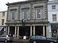 Crickhowell market hall, High Street - geograph.org.uk - 1214242.jpg 640 × 480; 75 KB
-
 Crickhowell post office - geograph.org.uk - 1215184.jpg 640 × 480; 68 KB
-
 Crocknacor Road - geograph.org.uk - 1200329.jpg 640 × 479; 82 KB
-
 Crocknacor Road - geograph.org.uk - 1200332.jpg 640 × 479; 73 KB
-
 Crocknacor Road - geograph.org.uk - 1200345.jpg 640 × 479; 99 KB
-
 Crocknacor Road - geograph.org.uk - 1200362.jpg 640 × 479; 77 KB
-
 Crocknacor Road - geograph.org.uk - 1200428.jpg 640 × 479; 86 KB
-
 Crocknanarroge Townland - geograph.org.uk - 1201402.jpg 640 × 479; 57 KB
-
 Crook o' Moor Farm - geograph.org.uk - 1201020.jpg 640 × 480; 46 KB
-
 Crossroads at Wardley Marsh - geograph.org.uk - 1201026.jpg 640 × 360; 41 KB

_Small_Quaker_(Orthosia_cruda)_(3348061065).jpg)
_Small_Quaker_(Orthosia_cruda)_(3348064323).jpg)
_Small_Quaker_(Orthosia_cruda)_(3348896586).jpg)
_Common_Quaker_(Orthosia_cerasi)_(3348895528).jpg)


.jpg)


