Category:United Kingdom photographs taken on 2007-12-07
Jump to navigation
Jump to search
| ← | Friday 7 December 2007 | → | ||
| ← | December 2007 | → | ||

United Kingdom photographs taken on 7 December 2007.
Image files should be categorized here automatically using {{taken on}} template. Direct categorisation is also possible, if automatic is impossible.
Subcategories
This category has the following 2 subcategories, out of 2 total.
Media in category "United Kingdom photographs taken on 2007-12-07"
The following 200 files are in this category, out of 666 total.
(previous page) (next page)-
 "The Gymnasium", Pancras Road - geograph.org.uk - 721150.jpg 640 × 480; 82 KB
-
 321404 at Euston 1.jpg 3,648 × 2,736; 3.92 MB
-
 321404 at Euston 2.jpg 3,648 × 2,736; 4.05 MB
-
 321404 coupling.jpg 3,648 × 2,736; 4.37 MB
-
 34 Hallstile Bank - geograph.org.uk - 633052.jpg 480 × 640; 64 KB
-
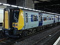
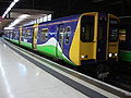
 350114 at Euston.jpg 3,648 × 2,736; 4.66 MB
-
 350115 at Euston 1.jpg 3,648 × 2,736; 4.44 MB
-
 350115 at Euston 2.jpg 3,648 × 2,736; 4.25 MB
-
 365539 at Kings Cross.jpg 3,648 × 2,736; 4.64 MB
-
 43039 at Kings Cross.jpg 3,648 × 2,736; 4.33 MB
-
 43039 number outline.jpg 3,648 × 2,736; 3.9 MB
-
 43039 rear bogie.jpg 3,648 × 2,736; 4.19 MB
-
 508301 at Euston.jpg 3,648 × 2,736; 3.87 MB
-
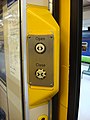 508301 door open button.jpg 2,736 × 3,648; 3.92 MB
-
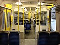 508301 Interior.jpg 3,648 × 2,736; 4.08 MB
-
 508303 at Euston 1.jpg 3,648 × 2,736; 3.88 MB
-
 508303 at Euston 2.jpg 3,648 × 2,736; 3.86 MB
-
 A 4169, the Ironbridge By-Pass - geograph.org.uk - 720408.jpg 640 × 425; 79 KB
-
 A bend in the quarry road. - geograph.org.uk - 630606.jpg 640 × 407; 52 KB
-
 A busy Central Pier, Bangor (1) - geograph.org.uk - 628749.jpg 640 × 391; 64 KB
-
 A busy Central Pier, Bangor (2) - geograph.org.uk - 628754.jpg 640 × 419; 56 KB
-
 A Cottage - geograph.org.uk - 629468.jpg 640 × 492; 82 KB
-
 A Handyside.jpg 3,648 × 2,736; 3.81 MB
-
 A lichen - Ramalina farinacea - geograph.org.uk - 1073623.jpg 640 × 480; 82 KB
-
 Abbey Fell - geograph.org.uk - 629259.jpg 640 × 480; 72 KB
-
 Advertising hoardings by the A66 - geograph.org.uk - 628706.jpg 640 × 480; 103 KB
-

-
 Afon Nant Gwrtheyrn crossing the beach - geograph.org.uk - 630951.jpg 640 × 480; 105 KB
-
 Afon Tal south of Eifl Street - geograph.org.uk - 629228.jpg 640 × 480; 120 KB
-
 Albert Street - geograph.org.uk - 629332.jpg 640 × 480; 62 KB
-
 Annandale Arms Hotel, Moffat - geograph.org.uk - 632690.jpg 640 × 480; 68 KB
-
 Apartments beside the Kennet, Reading - geograph.org.uk - 630982.jpg 480 × 640; 123 KB
-

-

-
 Arable land, Forest of Galtres - geograph.org.uk - 628783.jpg 640 × 480; 68 KB
-
 Ardwall - geograph.org.uk - 629280.jpg 640 × 480; 64 KB
-
 Ascot Lodge - geograph.org.uk - 696950.jpg 640 × 480; 96 KB
-
 At the head of the Glen Burn - geograph.org.uk - 629263.jpg 640 × 480; 80 KB
-
-
 Bank Lane (2) - geograph.org.uk - 629331.jpg 480 × 640; 52 KB
-
 Bank Lane - geograph.org.uk - 629329.jpg 480 × 640; 74 KB
-
 Basingstoke Road, Reading - geograph.org.uk - 630977.jpg 640 × 480; 124 KB
-
 Basketball court, Abbey Estate - geograph.org.uk - 721127.jpg 640 × 480; 73 KB
-
 Belgrove Street - geograph.org.uk - 977066.jpg 640 × 480; 81 KB
-
 Berms exposed at low tide - geograph.org.uk - 720461.jpg 640 × 336; 66 KB
-
 Betjeman Statue in St Pancras - geograph.org.uk - 635234.jpg 480 × 640; 70 KB
-
 Betjeman Statue St Pancras Station.jpg 2,736 × 3,648; 4.02 MB
-
 Birkenhead Street - geograph.org.uk - 977086.jpg 640 × 480; 84 KB
-
 Bolton Road - geograph.org.uk - 696926.jpg 640 × 480; 74 KB
-
 Boot Scraper - geograph.org.uk - 629109.jpg 427 × 640; 102 KB
-
 Boundary Road - geograph.org.uk - 696966.jpg 640 × 480; 101 KB
-
 BP petrol station on Goodsway - geograph.org.uk - 635212.jpg 640 × 480; 74 KB
-
-

-

-

-
 Brewsdale Beck - geograph.org.uk - 630785.jpg 640 × 427; 110 KB
-
 Bridge Street buildings, Chester - geograph.org.uk - 628955.jpg 503 × 640; 86 KB
-
 Temple Church - geograph.org.uk - 896026.jpg 480 × 640; 57 KB
-
 British Rail Mk 3 44045 at Kings Cross.jpg 3,648 × 2,736; 4.2 MB
-
 British Rail Mk 3 Bogie.jpg 3,648 × 2,736; 4.01 MB
-
 St Marys Church Broomfleet.jpg 640 × 480; 61 KB
-
 Broomfleet Main Street - geograph.org.uk - 629594.jpg 640 × 469; 72 KB
-
-
 Butterley co plate.jpg 3,648 × 2,736; 3.67 MB
-
-

-
 Capel Bethania - Bedyddwyr-Baptist - geograph.org.uk - 629227.jpg 640 × 480; 87 KB
-
 Cardiff Bay, from The Senedd.jpg 640 × 480; 72 KB
-
 Carlton Hotel - geograph.org.uk - 977097.jpg 640 × 480; 98 KB
-

-
 Central Fish Hall (2) - geograph.org.uk - 629316.jpg 640 × 480; 93 KB
-
 Chalton Street - geograph.org.uk - 711869.jpg 640 × 480; 77 KB
-
 Chapel on Kilburn Vale - geograph.org.uk - 701805.jpg 640 × 480; 96 KB
-
 Chester Castle - geograph.org.uk - 629121.jpg 640 × 480; 62 KB
-
 Chester Magistrates Court.jpg 640 × 480; 88 KB
-
 Chester Road, Bretton - geograph.org.uk - 628947.jpg 640 × 480; 62 KB
-
 Chester Youth Hostel - geograph.org.uk - 629126.jpg 640 × 480; 74 KB
-
 Chippenham Road and Elgin Avenue Junction - geograph.org.uk - 629317.jpg 635 × 470; 105 KB
-
 Christ Church, Reading - geograph.org.uk - 630976.jpg 480 × 640; 186 KB
-
 Christmas Market, Chester - geograph.org.uk - 628958.jpg 640 × 480; 104 KB
-

-
 Church on Loxley Road - geograph.org.uk - 628713.jpg 640 × 460; 92 KB
-
 Churchway - geograph.org.uk - 711882.jpg 640 × 480; 80 KB
-
 Cledwen Road, Broughton - geograph.org.uk - 628942.jpg 640 × 429; 98 KB
-
 Concord College - geograph.org.uk - 637655.jpg 640 × 480; 125 KB
-
 Concrete embankment - geograph.org.uk - 629113.jpg 640 × 427; 85 KB
-
 Conquest House, Bexhill - geograph.org.uk - 629424.jpg 640 × 480; 71 KB
-

-
 Cotehele House - geograph.org.uk - 1460174.jpg 640 × 427; 75 KB
-
 Cottage at Ardwall - geograph.org.uk - 629289.jpg 640 × 480; 74 KB
-
 Cottage by the green in Crayke. - geograph.org.uk - 629028.jpg 640 × 480; 93 KB
-

-
 Coventry-Saint Mark's Church - geograph.org.uk - 629481.jpg 640 × 480; 92 KB
-
 Coventry- Bayley Lane - geograph.org.uk - 631477.jpg 480 × 640; 76 KB
-
 Coventry- Ford Street - geograph.org.uk - 629065.jpg 640 × 480; 67 KB
-
 Coventry- Spon Street - geograph.org.uk - 631504.jpg 640 × 480; 72 KB
-
 Coventry-Bayley Lane - geograph.org.uk - 631479.jpg 640 × 480; 78 KB
-
 Coventry-Broadgate - geograph.org.uk - 630727.jpg 640 × 480; 79 KB
-
 Coventry-Cook Street Gate - geograph.org.uk - 629482.jpg 640 × 480; 111 KB
-
 Coventry-Eagle Street Mosque - geograph.org.uk - 629467.jpg 640 × 480; 71 KB
-
 Coventry-Hillfields - geograph.org.uk - 630026.jpg 640 × 480; 75 KB
-
 Coventry-Hindu Temple - geograph.org.uk - 630011.jpg 640 × 480; 58 KB
-
 Coventry-Lady Herbert's Homes - geograph.org.uk - 629486.jpg 640 × 480; 72 KB
-
 Coventry-Lower Ford Street - geograph.org.uk - 629488.jpg 640 × 480; 71 KB
-
 Coventry-Lower Holyhead Road - geograph.org.uk - 633397.jpg 640 × 480; 88 KB
-
 Coventry-Lower Holyhead Road - geograph.org.uk - 633400.jpg 640 × 480; 70 KB
-
 Coventry-Queen Victoria Road - geograph.org.uk - 631494.jpg 640 × 439; 72 KB
-
 Coventry-Saint Peter's Church - geograph.org.uk - 630053.jpg 640 × 480; 102 KB
-
 Coventry-Sports and Leisure Centre - geograph.org.uk - 630689.jpg 640 × 480; 82 KB
-
 Coventry-Stoney Stanton Road - geograph.org.uk - 629464.jpg 640 × 480; 64 KB
-
 Coventry-Swanswell Pool - geograph.org.uk - 629048.jpg 640 × 480; 89 KB
-
 Coventry-The Elastic Inn - geograph.org.uk - 629487.jpg 640 × 480; 85 KB
-
 Coventry-The Foresters Public House - geograph.org.uk - 630071.jpg 640 × 480; 59 KB
-
 Coventry-The Golden Cross - geograph.org.uk - 630719.jpg 640 × 480; 75 KB
-
 Coventry-The Phoenix Public House - geograph.org.uk - 630699.jpg 640 × 480; 52 KB
-
 Coventry-The Rose and Woodbine - geograph.org.uk - 629466.jpg 640 × 480; 65 KB
-
 Coventry-The Swanswell Tavern - geograph.org.uk - 629058.jpg 640 × 480; 79 KB
-

-
 Crags above Nant-y-cwm - geograph.org.uk - 630214.jpg 640 × 480; 105 KB
-
 Crestfield Street - geograph.org.uk - 977076.jpg 640 × 480; 90 KB
-
 Criffel Burn - geograph.org.uk - 629283.jpg 640 × 480; 98 KB
-
 Criffel Burn - geograph.org.uk - 629288.jpg 480 × 640; 90 KB
-

-

-

-

-

-

-
 Dingle Bank Bridge - geograph.org.uk - 629123.jpg 640 × 480; 119 KB
-

-

-

-
 Divers at the Eisenhower Pier - geograph.org.uk - 629314.jpg 640 × 534; 100 KB
-
 Don't shoot^ - geograph.org.uk - 631345.jpg 640 × 480; 76 KB
-
 Douglas's Cairn, Criffel - geograph.org.uk - 629270.jpg 640 × 480; 83 KB
-
 Easingwold Library - geograph.org.uk - 629022.jpg 640 × 480; 136 KB
-
 Easingwold Post Office - geograph.org.uk - 629016.jpg 480 × 640; 88 KB
-
 Easingwold War Memorial - geograph.org.uk - 628964.jpg 480 × 640; 66 KB
-
 East Hull Fire Station - geograph.org.uk - 629721.jpg 640 × 477; 74 KB
-
 East of Bilton - geograph.org.uk - 629680.jpg 640 × 480; 92 KB
-
 Eastgate Street, Chester - geograph.org.uk - 628957.jpg 480 × 640; 78 KB
-

-
 Electricity Sub-Station at Bexhill - geograph.org.uk - 629346.jpg 640 × 480; 43 KB
-
 Elgar Road, Reading - geograph.org.uk - 630979.jpg 640 × 480; 136 KB
-
 Elgar Road, Reading - geograph.org.uk - 630981.jpg 640 × 480; 117 KB
-
-
-
-

-
 Euston 1.jpg 3,648 × 2,736; 4.2 MB
-
 Euston 2.jpg 3,648 × 2,736; 4.1 MB
-
 Euston 3.jpg 3,648 × 2,736; 3.8 MB
-
 Euston bus station - geograph.org.uk - 635228.jpg 640 × 480; 106 KB
-
 Euston House, Eversholt Street, NW1 - geograph.org.uk - 701899.jpg 480 × 640; 88 KB
-

-
 Farrar Lane - geograph.org.uk - 628874.jpg 640 × 457; 112 KB
-
 Fence and path at Little Hard Hill - geograph.org.uk - 629258.jpg 640 × 480; 64 KB
-
 Fence posts on Meikle Hard Hill - geograph.org.uk - 629262.jpg 640 × 480; 81 KB
-
 First London Routemaster RM1562 (562 CLT), Euston Road, 7 December 2007.jpg 2,747 × 2,567; 4.01 MB
-
 Flooding in garden, Omagh - geograph.org.uk - 628816.jpg 640 × 299; 60 KB
-
 Floodlight house on Boundary Road - geograph.org.uk - 696891.jpg 640 × 480; 56 KB
-
 Footbridge over the Criffel Burn - geograph.org.uk - 629279.jpg 640 × 480; 86 KB
-

-
 Footpath South of Broomfleet - geograph.org.uk - 629543.jpg 640 × 480; 102 KB
-
 Footpath through the Fields - geograph.org.uk - 629551.jpg 640 × 480; 86 KB
-
 Footpath to Broomfleet - geograph.org.uk - 629561.jpg 640 × 480; 125 KB
-
 Footpath to Broomfleet Dam - geograph.org.uk - 629568.jpg 640 × 480; 111 KB
-
 Forest clearing at Thorter Fell - geograph.org.uk - 629257.jpg 640 × 480; 74 KB
-
 Former quarrymen's houses above Afon Tal - geograph.org.uk - 632043.jpg 640 × 498; 112 KB
-
 Former shops on Belsize Rd - geograph.org.uk - 701783.jpg 640 × 480; 77 KB
-
 Fosse Gill, Starbotton, Upper Wharfedale - geograph.org.uk - 748199.jpg 640 × 426; 114 KB
-

-
 Ganstead Drain - geograph.org.uk - 629703.jpg 477 × 640; 151 KB
-
 Gasometer behind King's Cross station - geograph.org.uk - 635220.jpg 640 × 480; 98 KB
-
 Gilsland village main street - geograph.org.uk - 633042.jpg 640 × 480; 79 KB
-

-
 Grazing in the mist - geograph.org.uk - 685311.jpg 640 × 426; 55 KB
-
 Grazing near Wombourne, Staffordshire - geograph.org.uk - 629003.jpg 640 × 476; 139 KB
-
 Great Asby church - geograph.org.uk - 628839.jpg 640 × 480; 50 KB
-

-
 Grosvenor Museum, Chester - geograph.org.uk - 628954.jpg 640 × 463; 61 KB
-

-
 Hadrian's Wall Path - geograph.org.uk - 631316.jpg 640 × 480; 137 KB
-
 Hagley Road, Reading - geograph.org.uk - 630980.jpg 640 × 480; 125 KB
-
 Hambleton 005.jpg 640 × 480; 77 KB
-
 Harry Potter Platform Kings Cross.jpg 2,608 × 2,922; 2.94 MB
-

-
 Hexham Abbey (from Hallstile Bank) - geograph.org.uk - 633056.jpg 555 × 640; 79 KB
-
 Hexham Auction Mart (2) - geograph.org.uk - 633062.jpg 640 × 486; 100 KB
-
 Hexham Station (2) - geograph.org.uk - 633082.jpg 640 × 480; 103 KB
-
 Hexham Station - geograph.org.uk - 633079.jpg 640 × 480; 98 KB
-
 Hexham Station, Platform 1 - geograph.org.uk - 633074.jpg 640 × 394; 77 KB
-
 Hexham Station, Platform 2 - geograph.org.uk - 633077.jpg 640 × 411; 73 KB
-

-
 Hillsborough Court - geograph.org.uk - 698356.jpg 640 × 480; 95 KB
-
 Holt Park District Centre - geograph.org.uk - 629072.jpg 640 × 486; 75 KB
-
 Holt Park District Centre - geograph.org.uk - 629082.jpg 640 × 480; 79 KB
-
 Hop field from Pedding Lane - geograph.org.uk - 628912.jpg 640 × 480; 70 KB
-
 Horse and Groom, 38 East Street - geograph.org.uk - 750973.jpg 640 × 480; 77 KB


_-_geograph.org.uk_-_628749.jpg)
_-_geograph.org.uk_-_628754.jpg)


_-_geograph.org.uk_-_629331.jpg)


,_Staffordshire_and_Worcestershire_canal_-_geograph.org.uk_-_629353.jpg)
,_Staffordshire_and_Worcestershire_canal_-_geograph.org.uk_-_629354.jpg)
,_Staffordshire_and_Worcestershire_Canal_-_geograph.org.uk_-_629810.jpg)


_-_geograph.org.uk_-_629316.jpg)


,_Garlinge_-_geograph.org.uk_-_837425.jpg)


_-_geograph.org.uk_-_628886.jpg)
_-_geograph.org.uk_-_628895.jpg)
_-_geograph.org.uk_-_628900.jpg)


,_Euston_Road,_7_December_2007.jpg)


_-_geograph.org.uk_-_633056.jpg)
_-_geograph.org.uk_-_633062.jpg)
_-_geograph.org.uk_-_633082.jpg)


