Category:United Kingdom photographs taken on 2007-12-03
Jump to navigation
Jump to search
| ← | Monday 3 December 2007 | → | ||
| ← | December 2007 | → | ||

United Kingdom photographs taken on 3 December 2007.
Image files should be categorized here automatically using {{taken on}} template. Direct categorisation is also possible, if automatic is impossible.
Subcategories
This category has only the following subcategory.
S
Media in category "United Kingdom photographs taken on 2007-12-03"
The following 200 files are in this category, out of 356 total.
(previous page) (next page)-

-
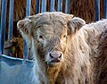 "You're darned right I'm handsome" - geograph.org.uk - 630440.jpg 640 × 500; 108 KB
-
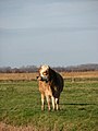 A marsh cow - geograph.org.uk - 626267.jpg 480 × 640; 45 KB
-
 A view over Whitley - geograph.org.uk - 630503.jpg 640 × 480; 135 KB
-
 Abandoned Morris Minor - geograph.org.uk - 1197542.jpg 640 × 480; 159 KB
-
 An obsession with boats^ - geograph.org.uk - 626999.jpg 640 × 545; 96 KB
-
 Andrews Road, Maiden Erlegh - geograph.org.uk - 630486.jpg 640 × 480; 111 KB
-
 Baker Street, Hull - geograph.org.uk - 630354.jpg 640 × 477; 94 KB
-
 Barnharrow farm - geograph.org.uk - 630453.jpg 640 × 480; 99 KB
-
 Barton Haven - geograph.org.uk - 626512.jpg 427 × 640; 73 KB
-
 Beaver Road, Beverley - geograph.org.uk - 627359.jpg 640 × 440; 182 KB
-

-
 Betjeman Statue at St Pancras Station.jpg 1,200 × 1,600; 330 KB
-
 Beverley and Barmston Drain, Grovehill - geograph.org.uk - 626524.jpg 640 × 448; 169 KB
-
 St Nicholas Church Beverley.jpg 480 × 640; 185 KB
-
 Black Lion - Broad Lane - geograph.org.uk - 626794.jpg 640 × 403; 30 KB
-
 Brackley fire station (original section) - geograph.org.uk - 629567.jpg 640 × 427; 245 KB
-
 Brackley fire station - geograph.org.uk - 629559.jpg 640 × 427; 276 KB
-
 Bramley Social Club - Broad Lane - geograph.org.uk - 626788.jpg 640 × 367; 20 KB
-
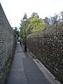
 Broad Walk - geograph.org.uk - 626870.jpg 480 × 640; 130 KB
-
 Cabbage patch - geograph.org.uk - 626549.jpg 640 × 353; 92 KB
-
 Cables Away on Tower No 16 - geograph.org.uk - 626858.jpg 640 × 480; 47 KB
-
 Cairn - geograph.org.uk - 626468.jpg 640 × 480; 60 KB
-
 Cambridge, St Andrew the Great - geograph.org.uk - 626188.jpg 640 × 478; 79 KB
-
 Castle east gate - geograph.org.uk - 626552.jpg 640 × 427; 63 KB
-
 Cattle pens beside a drainage ditch - geograph.org.uk - 626177.jpg 640 × 480; 76 KB
-
 Cherry Tree Lane, Beverley - geograph.org.uk - 626795.jpg 640 × 429; 166 KB
-
 Cherry Tree Terrace, Beverley - geograph.org.uk - 626798.jpg 640 × 474; 181 KB
-
 Cholmondeley Deer Park - geograph.org.uk - 626304.jpg 640 × 480; 117 KB
-
 Church Crescent, Coedkernew - geograph.org.uk - 633253.jpg 640 × 479; 165 KB
-
 City from the roof garden - Flickr - Ed.ward.jpg 718 × 1,077; 218 KB
-
 City from the roof.jpg 1,549 × 1,033; 422 KB
-
 Clencher's Mill Ford - geograph.org.uk - 627543.jpg 640 × 480; 107 KB
-
 Clencher's Mill Ford - geograph.org.uk - 627550.jpg 640 × 480; 105 KB
-
 Cluny Church Centre - geograph.org.uk - 626286.jpg 480 × 640; 64 KB
-
 Cluny Church Centre - geograph.org.uk - 626290.jpg 480 × 640; 54 KB
-
 Ty Eglwys, Coedkernew - geograph.org.uk - 630680.jpg 640 × 480; 161 KB
-
 Coedkernew Footbridge - geograph.org.uk - 633247.jpg 640 × 480; 139 KB
-
 Coltman Avenue, Beverley - geograph.org.uk - 626791.jpg 640 × 480; 166 KB
-
 Connecting the blade hub - geograph.org.uk - 627008.jpg 640 × 480; 39 KB
-
 Dawnay House - Puddletown - geograph.org.uk - 627001.jpg 640 × 418; 189 KB
-

-
 Dovestones Reservoir in the snow - geograph.org.uk - 1111788.jpg 480 × 640; 40 KB
-
 East from Knoll Farm - geograph.org.uk - 626860.jpg 640 × 426; 49 KB
-
 Eastnor Park roadway - geograph.org.uk - 628050.jpg 640 × 480; 80 KB
-
 Elie House - geograph.org.uk - 1144537.jpg 640 × 480; 93 KB
-
 Barton Haven - geograph.org.uk - 626516.jpg 427 × 640; 75 KB
-
 Entrance to Eastnor Castle - geograph.org.uk - 626214.jpg 640 × 480; 75 KB
-
 Entrance to Exeter Central Library - geograph.org.uk - 628087.jpg 476 × 640; 87 KB
-
 Entrance to Sunnyside - geograph.org.uk - 628020.jpg 640 × 480; 84 KB
-
 Exeter Cathedral, the east end - geograph.org.uk - 631979.jpg 480 × 640; 74 KB
-
 Exeter roofscape - geograph.org.uk - 631863.jpg 529 × 640; 112 KB
-
 Farm track by the river Dee, Maryculter - geograph.org.uk - 1027519.jpg 633 × 475; 243 KB
-
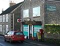 Faulkland Country Stores and Post Office - geograph.org.uk - 626845.jpg 640 × 486; 100 KB
-
 Faulkland Main Road - geograph.org.uk - 626840.jpg 640 × 426; 74 KB
-
 Faversham creek from Bridge Road - geograph.org.uk - 626253.jpg 640 × 480; 49 KB
-
 Fife Coastal Path - geograph.org.uk - 1144516.jpg 640 × 480; 78 KB
-
 Flats, Northumberland Avenue, Whitley - geograph.org.uk - 630513.jpg 640 × 480; 133 KB
-
 Fleet Dike - geograph.org.uk - 626289.jpg 640 × 480; 58 KB
-
 Flood Lane, Faversham - geograph.org.uk - 626285.jpg 480 × 640; 112 KB
-
 Footbridge in Eastnor Park - geograph.org.uk - 628031.jpg 640 × 480; 104 KB
-
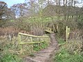 Footbridge on the 'Sandstone Trail'. - geograph.org.uk - 665298.jpg 640 × 480; 94 KB
-
 Footbridge over the Buckler Burn - geograph.org.uk - 628589.jpg 460 × 614; 182 KB
-

-
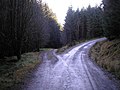 Fork in the forestry tracks - geograph.org.uk - 626577.jpg 640 × 480; 87 KB
-

-
 Freethorpe Village Hall - geograph.org.uk - 626376.jpg 640 × 480; 105 KB
-

-

-
 Gatefield Lane - geograph.org.uk - 626300.jpg 480 × 640; 83 KB
-
 Geese overhead - geograph.org.uk - 626299.jpg 480 × 640; 37 KB
-
 Glenalbert burn - geograph.org.uk - 626572.jpg 640 × 480; 130 KB
-
 Hartland Road, Whitley - geograph.org.uk - 630508.jpg 640 × 480; 127 KB
-
 Hartland Road, Whitley - geograph.org.uk - 630516.jpg 640 × 480; 103 KB
-

-
 Heathery top - geograph.org.uk - 626509.jpg 640 × 480; 83 KB
-
 Heathery Top - geograph.org.uk - 626547.jpg 640 × 480; 99 KB
-
 Highfield Road Beverley.jpg 640 × 440; 169 KB
-
 Holly Hedge Close - geograph.org.uk - 627932.jpg 575 × 640; 169 KB
-
 Holly Hedge Road - geograph.org.uk - 626864.jpg 640 × 514; 133 KB
-
 Homo nivalis - geograph.org.uk - 629930.jpg 419 × 640; 70 KB
-
 Hop Field near Little Scotney Farm - geograph.org.uk - 1197539.jpg 640 × 480; 132 KB
-
 Hounslow Railway Station.jpg 640 × 427; 75 KB
-
 Hounslow station (2) - geograph.org.uk - 626433.jpg 640 × 427; 83 KB
-
 Hounslow station (4) - geograph.org.uk - 626456.jpg 640 × 427; 79 KB
-
 Houses on Leighton Terrace - geograph.org.uk - 631930.jpg 640 × 376; 52 KB
-
 Hull Bridge Road - geograph.org.uk - 626534.jpg 640 × 509; 190 KB
-
 Isla Ericht confluence.jpg 640 × 480; 79 KB
-
 King William Street Car Park, Exeter - geograph.org.uk - 631878.jpg 640 × 464; 71 KB
-

-
 Kinlet Hall - geograph.org.uk - 626133.jpg 640 × 480; 69 KB
-
 Kinlet, cross and churchyard - geograph.org.uk - 626379.jpg 640 × 480; 87 KB
-
 Knighton Manor - Durweston - geograph.org.uk - 626887.jpg 640 × 422; 176 KB
-
 Knocknamoe Road, Omagh - geograph.org.uk - 626903.jpg 640 × 480; 58 KB
-
 Knocknamoe Road, Omagh - geograph.org.uk - 626908.jpg 640 × 480; 57 KB
-
 Lakeside Plaza, Cannock - geograph.org.uk - 627263.jpg 640 × 480; 59 KB
-
 Lakeside, Maiden Erlegh - geograph.org.uk - 630488.jpg 640 × 480; 130 KB
-
 Lamb's House - geograph.org.uk - 626332.jpg 640 × 480; 72 KB
-
 Lamb's House - geograph.org.uk - 626339.jpg 640 × 480; 87 KB
-
 Lamb's House information plaque - geograph.org.uk - 626342.jpg 600 × 640; 101 KB
-
 Latham Avenue - geograph.org.uk - 626605.jpg 640 × 464; 83 KB
-

-
 Linksview House - geograph.org.uk - 626440.jpg 640 × 480; 96 KB
-
 Llamas on Howler's Heath - geograph.org.uk - 627956.jpg 640 × 480; 60 KB
-
 Long view to Ashwood Covert - geograph.org.uk - 626323.jpg 640 × 480; 86 KB
-
 Looking towards Frimley Park Hospital - geograph.org.uk - 626527.jpg 592 × 640; 177 KB
-
 Looking up Meadway from Farm Road - geograph.org.uk - 626882.jpg 640 × 511; 103 KB
-
 Lower North Street, Exeter - geograph.org.uk - 628015.jpg 640 × 524; 71 KB
-
 Lower North Street, Exeter - geograph.org.uk - 628028.jpg 480 × 640; 71 KB
-
 Lower North Street, Exeter - geograph.org.uk - 628045.jpg 483 × 640; 64 KB
-
 Manor Road Beverley.jpg 480 × 640; 199 KB
-
 Martins Lane, Exeter - geograph.org.uk - 631996.jpg 480 × 640; 86 KB
-
 Maryculter House Hotel - geograph.org.uk - 783664.jpg 600 × 450; 216 KB
-
 Maryculter House Hotel.jpg 600 × 450; 108 KB
-
 Melrose Avenue, Reading - geograph.org.uk - 630337.jpg 640 × 640; 163 KB
-
 Memorials in South Leith Parish Churchyard.jpg 640 × 480; 108 KB
-
 Mercedes dealership - ng2 - geograph.org.uk - 626613.jpg 640 × 326; 53 KB
-
 Merton Road, Whitley - geograph.org.uk - 630515.jpg 640 × 480; 111 KB
-
 Middle Row, Faversham - geograph.org.uk - 626305.jpg 480 × 640; 50 KB
-
 Mill Lane Beverley.jpg 640 × 471; 184 KB
-

-

-
 Mutton's Mill, Halvergate.jpg 480 × 640; 45 KB
-
 National Westminster Bank, Exeter - geograph.org.uk - 628056.jpg 483 × 640; 70 KB
-
 Norwood House Beverley.jpg 537 × 640; 200 KB
-
 Norwood Methodist Church Beverley.jpg 640 × 480; 192 KB
-
 Numbers 2-5 Cathedral Close, Exeter - geograph.org.uk - 628062.jpg 640 × 480; 72 KB
-
 Oakland Road, Omagh - geograph.org.uk - 626906.jpg 640 × 480; 73 KB
-
 Oakland Road, Omagh - geograph.org.uk - 626910.jpg 640 × 295; 35 KB
-
-

-
 Oxford old fire station - geograph.org.uk - 629546.jpg 640 × 427; 284 KB
-
 Oxford old fire station.jpg 385 × 427; 164 KB
-
 P.J. O'Callaghan plaque, Omagh - geograph.org.uk - 626919.jpg 481 × 640; 109 KB
-
 Parish boundary marks, Fair Street - geograph.org.uk - 626203.jpg 640 × 475; 110 KB
-

-
 Pastures by Chorley Hall Farm - geograph.org.uk - 626314.jpg 640 × 337; 47 KB
-
 Peterculter graveyard - geograph.org.uk - 1027479.jpg 633 × 475; 229 KB
-
 Petrol and tyres - geograph.org.uk - 626657.jpg 640 × 480; 70 KB
-
 Playground, park and office building - geograph.org.uk - 626559.jpg 640 × 545; 147 KB
-
 Priory Park gates, Orpington - geograph.org.uk - 626632.jpg 640 × 480; 130 KB
-

-

-
 Pulford Brook in England - geograph.org.uk - 1465681.jpg 640 × 480; 192 KB
-
 Radegund Buildings, Jesus Lane - geograph.org.uk - 626211.jpg 640 × 480; 102 KB
-
 Railway footbridge, Welshpool - geograph.org.uk - 634140.jpg 640 × 480; 66 KB
-
 Reading Buses Number 17.jpg 640 × 426; 115 KB
-
 Remnants of a tree house Omagh - geograph.org.uk - 626913.jpg 640 × 566; 93 KB
-
 Rhubarb field in Winter - geograph.org.uk - 626541.jpg 640 × 480; 76 KB
-
 Rhubarb Shed.jpg 640 × 480; 106 KB
-
 Richmond Court, Exeter - geograph.org.uk - 632068.jpg 476 × 640; 54 KB
-
 Richmond station (2) - geograph.org.uk - 626480.jpg 640 × 427; 78 KB
-
 Richmond station - geograph.org.uk - 626471.jpg 640 × 427; 76 KB
-

-

-
 River Hull moorings.jpg 537 × 640; 176 KB
-
 Road and Rail - geograph.org.uk - 626531.jpg 640 × 480; 103 KB
-
 Road Mending, Mill Street, Hull - geograph.org.uk - 630809.jpg 640 × 497; 113 KB
-
 Road near Killyclogher, Omagh - geograph.org.uk - 626917.jpg 640 × 310; 48 KB
-
-
 Sandford Arms - Broad Lane - geograph.org.uk - 626800.jpg 640 × 480; 33 KB
-
 Sandford Arms - Broad Lane - geograph.org.uk - 626802.jpg 640 × 453; 43 KB
-
 Sculcoates Gasworks, Hull - geograph.org.uk - 627513.jpg 459 × 640; 64 KB
-
 Seventh-day Adventist Church, Exeter - geograph.org.uk - 631894.jpg 640 × 439; 51 KB
-
 Sheep on Howler's Heath - geograph.org.uk - 627966.jpg 640 × 480; 107 KB
-
 Shinfield Road, Reading - geograph.org.uk - 630499.jpg 640 × 480; 119 KB
-
 Shops on Cathedral Close, Exeter - geograph.org.uk - 628072.jpg 447 × 640; 76 KB
-
 Shops on Cathedral Close, Exeter - geograph.org.uk - 628080.jpg 479 × 640; 82 KB
-

-
 Silvester Street, Hull - geograph.org.uk - 626502.jpg 640 × 426; 80 KB
-

-
 Site of McGahey's Row, Omagh - geograph.org.uk - 626166.jpg 640 × 479; 48 KB
-
 South Leith Parish Church (geograph 626353).jpg 640 × 480; 115 KB
-
 South side of St Mary's, Pulford - geograph.org.uk - 1465393.jpg 480 × 640; 92 KB
-
 St Wilfrid's School, Exeter - geograph.org.uk - 632088.jpg 471 × 640; 69 KB
-

-

-

-
 Starlings at Coedkernew - geograph.org.uk - 635981.jpg 640 × 480; 139 KB
-

-
 Stop valve markers by Pulford Bridge - geograph.org.uk - 1465670.jpg 640 × 480; 246 KB
-
 Subscription Mill - geograph.org.uk - 630086.jpg 640 × 427; 48 KB
-
 Sunrise on Scout Moor - geograph.org.uk - 626849.jpg 640 × 480; 38 KB
-
 Sutton Road, Hull - geograph.org.uk - 628187.jpg 640 × 473; 108 KB
-
 Swine Moor tree, Beverley - geograph.org.uk - 626401.jpg 480 × 640; 207 KB
-
 Swine Moor, Beverley - geograph.org.uk - 626399.jpg 640 × 480; 177 KB
-
 Talland Bay - geograph.org.uk - 1471029.jpg 640 × 426; 70 KB
-
 Tanpit Woods, Abbots Leigh - panoramio.jpg 2,304 × 1,728; 1.79 MB
-

-
 Telephone Exchange, Exeter - geograph.org.uk - 631956.jpg 480 × 640; 95 KB
-
 The Arc - ng2 - geograph.org.uk - 626455.jpg 640 × 355; 61 KB
-
 The back side of The Faulkland Inn - geograph.org.uk - 626829.jpg 640 × 432; 85 KB
-
 The Bath House, Bene't Street - geograph.org.uk - 797016.jpg 640 × 480; 81 KB
-
 The Beacon - Broad Lane - geograph.org.uk - 626784.jpg 640 × 402; 23 KB
-
 The Church of Christ the King, Whitley - geograph.org.uk - 630511.jpg 640 × 480; 130 KB
-
 The Experian building - ng2 - geograph.org.uk - 626445.jpg 640 × 427; 71 KB
-
 The Faulkland Inn - geograph.org.uk - 626833.jpg 640 × 511; 73 KB
-
 The Gillette factory, Reading - geograph.org.uk - 630519.jpg 640 × 480; 134 KB
-

-


_-_geograph.org.uk_-_629567.jpg)


_-_geograph.org.uk_-_626433.jpg)
_-_geograph.org.uk_-_626456.jpg)


_on_junction_41_slip_road_north_M1_motorway_-_geograph.org.uk_-_626510.jpg)


_-_geograph.org.uk_-_626480.jpg)


.jpg)


